246 Sullivan Pl, Brooklyn, NY 11225 Kings County Last Updated: March 13, 2024
Auction: Estimated Market Value $2,148,000
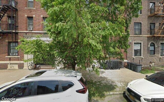
Description: 246 Sullivan Pl, Brooklyn, NY 11225 is a Multi Family Home built in 1920. This property was last sold for $426,000 in 2009 and currently has an estimated value of $2,148,000. According to the Brooklyn public records, the property at 246 Sullivan Pl, Brooklyn, NY 11225 has approximately 2,424 square feet, with a lot size of 2,450 square feet. Nearby schools include Success Academy Crown Heights, Ps 161 The Crown and Ps 375 Jackie Robinson School.
2,424 sqft
2,450 lot size
Year Built: 1920
Auction
246 Sullivan Pl, Brooklyn, NY 11225
Last Updated: March 13, 2024
1
Multi Family Home
Estimated Market Value EMV $ 2,148,000
246 Sullivan Pl
bool(false)

bool(true)

bool(true)

int(0)
Estimated Market Value EMV $ 2,148,000
for 246 Sullivan Pl
Thursday
30
November
2023
2:30 PM
Auction Date
Nov 30, 2023
Auction Time
2:30 PM
Auction Location
360 ADAMS STREET
for 246 Sullivan Pl
246 Sullivan Pl, Brooklyn, NY 11225 is a Multi Family Home built in 1920. This property was last sold for $426,000 in 2009 and currently has an estimated value of $2,148,000. According to the Brooklyn public records, the property at 246 Sullivan Pl, Brooklyn, NY 11225 has approximately 2,424 square feet, with a lot size of 2,450 square feet. Nearby schools include Success Academy Crown Heights, Ps 161 The Crown and Ps 375 Jackie Robinson School.
Property features
Year Built:
Year Built:
1920
1920
Zoning:
Zoning:
R7-1
R7-1
Living Area:
Living Area:
2424
2424
Building Class:
B1
Two Family Dwellings: Brick
Floors on Main Building:
2
Building Dimensions:
20'
Actual Square Footage:
2,424
Calculated Square Footage:
2,280
Residential Floor Area:
2,424
Basement:
Below grade full basement
Address:
246 SULLIVAN PLACE
BIN
Name 246 SULLIVAN PLACE
Land Use:
01
One & Two Family Buildings
Lot Dimensions:
24.50'
Calculated Lot Perimeter:
250.39 ft
Zoning Districts:
R7-1
Moderate-density residence district
Max Residential FAR:
3.44
Max Residential Sqft:
8,428
Buildable Residential Sqft:
6,004
Residential Area Distribution:
Assessed Land Value:
$23,040
Assessed Total Value:
$78,780
Last Recording Date:
Jan 8, 2024
Property Assessment Data:
Tax Class:
1
One- to three-unit residential properties
Taxable Assessed Value:
$32,724
Estimated Market Value by NYC DOF :
$1,494,000
Community District (CD):
309
City Council District:
35
Document DateDocument Type Unit Amount
Date
Event
Price
Price/Sqft
Source
Nov 6, 2009
Sold
$426,000
$176
Public Record
Year
Taxes
Land
Additions
Total Assessment
2022
$5,688
$23,040
$44,160
$67,200
2021
$6,082
$23,040
$50,640
$73,680
2020
$5,772
$23,040
$54,180
$77,220
2019
$5,704
$23,040
$38,640
$61,680
2018
$5,553
$9,984
$16,563
$26,547
2017
$5,106
$10,771
$14,277
$25,048
2016
$4,815
$11,605
$12,482
$24,087
2015
$4,443
$10,600
$12,125
$22,725
2014
$4,353
$12,284
$10,441
$22,725
2013
$4,245
$14,360
$7,763
$22,123
2012
$3,800
$15,216
$5,658
$20,874
2010
$3,236
$12,546
$7,527
$20,073
2009
$3,236
$11,883
$7,055
$18,938
2007
$2,684
$2,522
$14,873
$17,395
Address
Price
Built
Beds
Baths
Sqft
Lot Size
Distance
104 Brooklyn Ave
Brooklyn, NY 11216MF
$1,190,000
03/04/2024
1899
3
3
2,592
+168difference
1,160
0.93 mi
1006 Bergen St Unit A
Brooklyn, NY 11216MF
$1,310,000
12/18/2023
1899
2
2
2,250
-174
2,142
0.82 mi
1006 Bergen St Unit B
Brooklyn, NY 11216MF
$839,000
12/18/2023
1899
1
1
2,250
-174
2,142
0.82 mi
1006 Bergen St Unit C
Brooklyn, NY 11216MF
$903,000
12/19/2023
1899
2
1
2,250
-174
2,142
0.82 mi
1006 Bergen St Unit D
Brooklyn, NY 11216MF
$985,000
03/06/2024
1899
2
1
2,250
-174
2,142
0.82 mi
203 Sterling St
Brooklyn, NY 11225MF
$1,300,000
02/27/2024
1910
5
2
2,128
-296
2,000
0.12 mi
293 Lefferts Ave
Brooklyn, NY 11225MF
$1,400,000
12/26/2023
1905
5
3
2,108
-316
2,000
0.14 mi
217 Lincoln Rd
Brooklyn, NY 11225MF
$1,900,000
02/21/2024
1905
5
3
2,704
+280
2,050
0.24 mi
158 Martense St
Brooklyn, NY 11226MF
$1,262,500
11/16/2023
—
6
5
3,219
+795
2,380
0.90 mi
156 Martense St
Brooklyn, NY 11226MF
$1,262,500
11/16/2023
—
8
3
3,282
+858
2,400
0.91 mi
Address
Price
Built
Beds
Baths
Sqft
Lot Size
Distance
90 Putnam Ave
Brooklyn, NY 11238MF
$1,549,000
28 days ago
1901
5
3
2,432
+8difference
1,360
1.31 mi
604 Sterling Pl
Brooklyn, NY 11238MF
$1,899,999
41 days ago
1910
4
4
2,400
-24
2,620
0.69 mi
1073 Clarkson Ave
Brooklyn, NY 11212MF
$798,000
84 days ago
1940
5
2
2,392
-32
2,300
1.61 mi
1073 Clarkson Ave
Brooklyn, NY 11212MF
$798,000
84 days ago
1940
5
2
2,392
-32
2,300
1.61 mi
444 Quincy St
Bedford Stuyvesant, NY 11221MF
$1,600,000
50 days ago
1899
5
2
2,475
+51
1,875
1.68 mi
881 Linden Blvd
Brooklyn, NY 11203MF
$1,275,000
32 days ago
1920
6
3
2,508
+84
3,001
1.60 mi
403 8th St
Brooklyn, NY 11215MF
$2,999,999
141 days ago
1899
—
3
2,511
+87
1,875
1.53 mi
230 7th St
Brooklyn, NY 11215MF
$2,699,888
21 days ago
1901
4
4
2,334
-90
1,667
1.97 mi
635 E 38th St
Brooklyn, NY 11203MF
$1,200,000
173 days ago
1920
7
4
2,523
+99
5,000
1.81 mi
524 11th St
Brooklyn, NY 11215MF
$3,000,000
21 days ago
1901
5
3
2,322
-102
—
1.51 mi
Estimated values are not a substitute for professional expertise. Contact your RE agent for a market assessment.
School Name
Rating
Grades
Parent Rating
Distance
Educational Inst Oholei Torah
, Brooklyn , NY 11225
—
PK−12
—
0.20 mi
Associated Beth Rivkah Schools
, Brooklyn , NY 11225
—
PK−12
—
0.19 mi
Beth Rivka High School
, Brooklyn , NY 11225
—
9−12
0.19 mi
Success Academy Crown Heights
, Brooklyn , NY 11225
7 / 10
K−8
0.22 mi
Ps 161 The Crown
, Brooklyn , NY 11225
5 / 10
K−5
0.22 mi
Medgar Evers College Preparatory School
, Brooklyn , NY 11225
5 / 10
6−12
0.19 mi
W E B Dubois Academic High School
, Brooklyn , NY 11225
—
9−12
0.38 mi
Ps 375 Jackie Robinson School
, Brooklyn , NY 11225
2 / 10
K−5
0.35 mi
Clara Barton High School
, Brooklyn , NY 11225
2 / 10
9−12
0.57 mi
Ms 61 Gladstone H Atwell
, Brooklyn , NY 11225
5 / 10
6−8
0.21 mi
FEMA Zone (Est.)
X (unshaded)
Flood insurance:
Recommended
Flood risks are increasing as sea levels rise and weather patterns change.
This property has a
Minimal Flood Factor
.
Please Log In
Please wait... If this message is not eventually replaced by the proper contents of the document, your PDF viewer may not be able to display this type of document.
You can upgrade to the latest version of Adobe Reader for Windows®, Mac, or Linux® by visiting
https://get.adobe.com/reader/ this link .
For more assistance with Adobe Reader visit
http://get.adobe.com/reader/ this link .
You can download this PDF-document from
here .