")

bool(false)

bool(true)

bool(true)

int(0)
bool(false)
bool(true)
bool(true)
int(0)
Staten Island, NY 10312
Foreclosure History
Lis Pendens
Property details
The description and property data below may have been provided by a third party, the homeowner or public records.
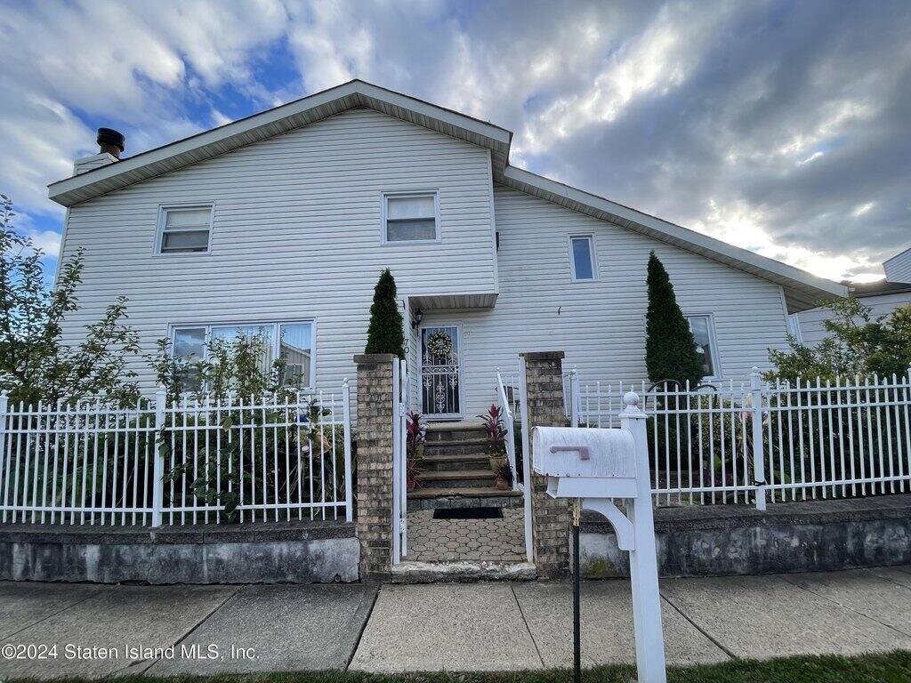
Seller packed and ready to close. Looking for a buyer ready to perform. Cash Preferred. Level 1: L-SHAPED LIVING ROOM/DINING ROOM, WOOD BURNING FIRE PLACE, LARGE EAT IN KITCHEN, YARD ACCESS, DEN WITH BALCONY, COAT CLOSET, 1/2 BATH Level 2: LOFT OVERLOOKS DEN, FULL BATH, BEDROOM, LINEN CLOSET, BEDROOM, MASTER BEDROOM W WALK IN CLOSET, 1/2 BATH Level 3: FINISHED WALK UP ATTIC. Basement: FULL FINISHED , 3/4 BATH, LAUNDRY, electric
Primary Land Use and Tax Lot Information
for 70 Manchester Dr

Property Price History
for 70 Manchester Dr
| Date | Event | Price | ||
|---|---|---|---|---|
| Jul 16, 2025 | Sold | $680,000 | $281 | StatenIsland |
| Oct 16, 2024 | Listed | $699,999 | $289 | StatenIsland |
Property Tax History
for 70 Manchester Dr
| Year | Taxes | |
|---|---|---|
| 2024 | $7,123 | $44,460 |
| 2023 | $7,190 | $42,420 |
Sold Homes
near 70 Manchester Dr
| Address | Price | Beds | Baths |
|---|---|---|---|
|
Staten Island, NY 10312MF
|
$2,465,000
04/24/2025
|
3
|
1
|
|
Staten Island, NY 10312MF
|
$825,000
07/15/2025
|
4
|
3
|
|
Staten Island, NY 10309MF
|
$860,000
03/03/2025
|
4
|
4
|
|
Staten Island, NY 10312MF
|
$930,000
04/23/2025
|
5
|
2
|
|
Staten Island, NY 10312MF
|
$720,000
02/28/2025
|
4
|
3
|
Homes For Sale
near 70 Manchester Dr
| Address | Price | Beds | Baths |
|---|---|---|---|
|
Staten Island, NY 10309MF
|
$849,999
48 days ago
|
4
|
3
|
|
Staten Island, NY 10312MF
|
$899,999
56 days ago
|
4
|
4
|
|
Staten Island, NY 10309MF
|
$939,999
22 days ago
|
3
|
4
|
|
Staten Island, NY 10312MF
|
$774,900
109 days ago
|
4
|
2
|
Home Value
for 70 Manchester Dr
Estimated values are not a substitute for professional expertise. Contact your RE agent for a market assessment.
Schools
serving 70 Manchester Dr
| School Name | Rating |
|---|---|
|
300 Genesee Avenue, Staten Island, NY 10312
|
— |
|
5411 Amboy Road, Staten Island, NY 10312
|
— |
|
100 Luten Avenue, Staten Island, NY 10312
|
7 / 10 |
Data provided by
GreatSchools.org © 2025. All Rights Reserved.
School service boundaries are intended to be used as reference only.
To verify enrollment eligibility for a property, contact the school directly.
Flood Factor
for 70 Manchester Dr
1
|10
Minimal

FEMA Zone (Est.)
X (unshaded)
Flood insurance:
Recommended
Flood risks are increasing as sea levels rise and weather patterns change.
This property has a
Minimal Flood Factor
.
Although flood risks across the country are changing because of the environment, this property is unlikely to flood over the next 30 years.
Although flood risks across the country are changing because of the environment, this property is unlikely to flood over the next 30 years.
Flood Factor data provided by FloodFactor.