

bool(false)

bool(true)

bool(true)

int(0)
Bronx, NY 10469
Foreclosure History
Property details
The description and property data below may have been provided by a third party, the homeowner or public records.
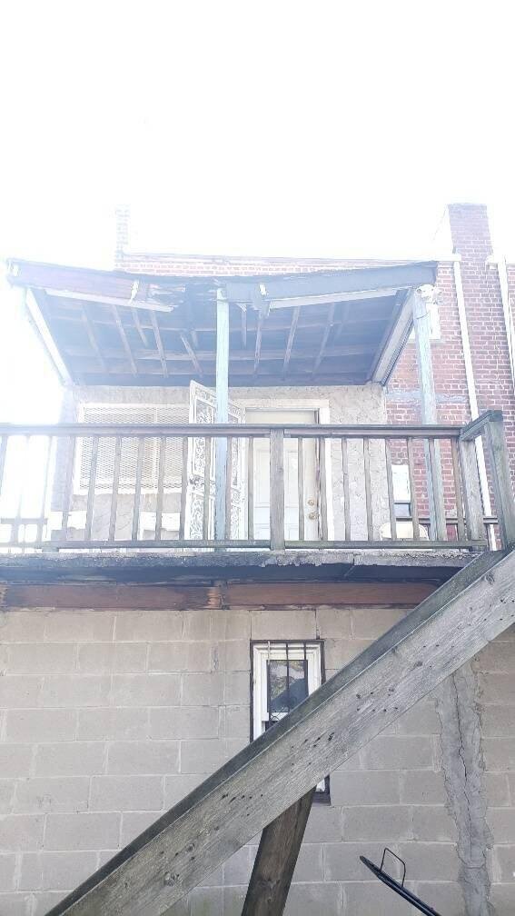
1037 E 219th St, Bronx, NY 10469 is a Single Family Home built in 1955. This property was last sold for $410,000 in 2006 and currently has an estimated value of $883,300. According to the Bronx public records, the property at 1037 E 219th St, Bronx, NY 10469 has approximately 1,782 square feet, with a lot size of 2,884 square feet. Nearby schools include Ps 78 Anne Hutchinson, Ps 112 Bronxwood and Ps 21 Philip H Sheridan.
Primary Land Use and Tax Lot Information
for 1037 E 219th St

Property Price History
for 1037 E 219th St
| Date | Event | Price | ||
|---|---|---|---|---|
| Feb 13, 2021 | Listing removed | $450,000 | $253 | MyStateMLS |
| Aug 31, 2006 | Sold | $410,000 | $230 | Public Record |
Property Tax History
for 1037 E 219th St
| Year | Taxes | |
|---|---|---|
| 2023 | $5,189 | $36,660 |
| 2022 | $4,812 | $33,840 |
Sold Homes
near 1037 E 219th St
| Address | Price | Beds | Baths |
|---|---|---|---|
|
Bronx, NY 10467SF
|
$620,000
02/04/2025
|
3
|
2
|
|
Bronx, NY 10469SF
|
$620,000
01/03/2025
|
3
|
3
|
|
Bronx, NY 10469SF
|
$570,000
05/06/2025
|
3
|
3
|
|
Bronx, NY 10467SF
|
$580,000
05/21/2025
|
3
|
2
|
|
Bronx, NY 10469SF
|
$618,000
12/23/2024
|
4
|
2
|
Homes For Sale
near 1037 E 219th St
| Address | Price | Beds | Baths |
|---|---|---|---|
|
Bronx, NY 10469SF
|
$549,000
145 days ago
|
3
|
2
|
|
Bronx, NY 10469SF
|
$659,999
133 days ago
|
3
|
3
|
|
Bronx, NY 10466SF
|
$525,000
195 days ago
|
3
|
3
|
|
Bronx, NY 10469SF
|
$574,999
160 days ago
|
2
|
2
|
|
Mount Vernon, NY 10550SF
|
$547,500
141 days ago
|
3
|
2
|
Home Value
for 1037 E 219th St
Estimated values are not a substitute for professional expertise. Contact your RE agent for a market assessment.
Schools
serving 1037 E 219th St
| School Name | Rating |
|---|---|
|
1137 East 223rd Street, Bronx, NY 10466
|
— |
|
1160 East 213th Street, Bronx, NY 10469
|
— |
|
1400 NEEDHAM AVE, The Bronx, NY 10469
|
3 / 10 |
Data provided by
GreatSchools.org © 2025. All Rights Reserved.
School service boundaries are intended to be used as reference only.
To verify enrollment eligibility for a property, contact the school directly.
Flood Factor
for 1037 E 219th St
1
|10
Minimal

FEMA Zone (Est.)
X (unshaded)
Flood insurance:
Recommended
Flood risks are increasing as sea levels rise and weather patterns change.
This property has a
Minimal Flood Factor
.
Although flood risks across the country are changing because of the environment, this property is unlikely to flood over the next 30 years.
Although flood risks across the country are changing because of the environment, this property is unlikely to flood over the next 30 years.
Flood Factor data provided by FloodFactor.