1097 E 42nd St, Brooklyn, NY 11210 Kings County Last Updated: March 13, 2024
Pre-Foreclosure: Lis Pendens, Estimated Market Value $945,200
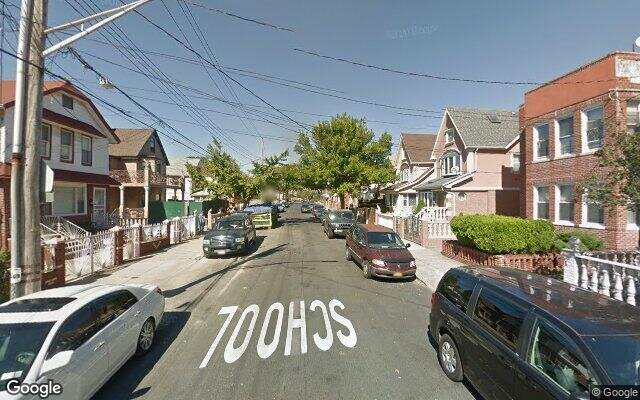
Description: 1097 E 42nd St, Brooklyn, NY 11210 is a Multi Family Home built in 1930. This property was last sold for $214,500 in 1999 and currently has an estimated value of $945,200. According to the Brooklyn public records, the property at 1097 E 42nd St, Brooklyn, NY 11210 has approximately 2,040 square feet, with a lot size of 2,400 square feet. Nearby schools include Kings Collegiate Charter School, Ps 326 and Ps 119 Amersfort.
2,040 sqft
2,400 lot size
Year Built: 1930
Pre-foreclosure
1097 E 42nd St, Brooklyn, NY 11210
Last Updated: March 13, 2024
1
Multi Family Home
Estimated Market Value EMV $ 945,200
1097 E 42nd St
bool(false)

bool(true)

bool(true)

int(0)
Estimated Market Value EMV $ 945,200
Foreclosure History
for 1097 E 42nd St
for 1097 E 42nd St
Last Sold
$214.5K in 1999
1097 E 42nd St, Brooklyn, NY 11210 is a Multi Family Home built in 1930. This property was last sold for $214,500 in 1999 and currently has an estimated value of $945,200. According to the Brooklyn public records, the property at 1097 E 42nd St, Brooklyn, NY 11210 has approximately 2,040 square feet, with a lot size of 2,400 square feet. Nearby schools include Kings Collegiate Charter School, Ps 326 and Ps 119 Amersfort.
Property features
Year Built:
Year Built:
1930
1930
Living Area:
Living Area:
2040
2040
Building Class:
B1
Two Family Dwellings: Brick
Floors on Main Building:
2
Building Dimensions:
20'
Actual Square Footage:
2,040
Calculated Square Footage:
1,800
Residential Floor Area:
2,040
Basement:
Below grade full basement
Address:
1097 EAST 42 STREET
BIN
Name 1097 EAST 42 STREET
Land Use:
01
One & Two Family Buildings
Calculated Lot Perimeter:
250.92 ft
Zoning Districts:
R4
Lower-density residence district
Commercial Overlays:
C1-2
Commercial districts that are predominantly residential in character
Max Residential FAR:
0.75
Max Residential Sqft:
1,800
Buildable Residential Sqft:
0
Residential Area Distribution:
Assessed Land Value:
$9,960
Assessed Total Value:
$46,380
Exempt Total Value:
$1,400
Last Recording Date:
Jan 8, 2024
Property Assessment Data:
Tax Class:
1
One- to three-unit residential properties
Taxable Assessed Value:
$37,480
Estimated Market Value by NYC DOF :
$773,000
Community District (CD):
318
City Council District:
45
Document DateDocument Type Unit Amount
Date
Event
Price
Price/Sqft
Source
Aug 11, 1999
Sold
$214,500
$105
Public Record
Apr 16, 1999
Sold
$208,000
$231
Brooklyn
Nov 13, 1996
Sold
$210,000
$103
Public Record
Year
Taxes
Land
Additions
Total Assessment
2022
$6,865
$9,960
$30,900
$40,860
2021
$7,244
$9,960
$32,700
$42,660
2020
$6,973
$9,960
$29,340
$39,300
2019
$6,484
$9,960
$26,400
$36,360
2018
$6,252
$7,687
$23,664
$31,351
2017
$5,787
$8,275
$21,584
$29,859
2016
$5,659
$9,196
$20,663
$29,859
2015
$5,287
$9,899
$18,721
$28,620
2014
$4,867
$11,040
$15,960
$27,000
2013
$4,714
$10,360
$15,766
$26,126
2012
$4,236
$15,805
$9,078
$24,883
2010
$3,903
$17,089
$7,794
$24,883
2009
$3,707
$13,434
$11,028
$24,462
2007
$3,001
$3,097
$17,639
$20,736
Address
Price
Built
Beds
Baths
Sqft
Lot Size
Distance
941 E 46th St
Brooklyn, NY 11203MF
$789,000
04/03/2024
1945
4
2
2,096
+56difference
3,000
0.71 mi
107 Kenilworth Pl
Brooklyn, NY 11210MF
$775,000
01/09/2024
1915
—
3
2,120
+80
2,000
0.82 mi
3812 Quentin Rd
Brooklyn, NY 11234MF
$1,050,000
12/27/2023
1955
5
4
2,148
+108
2,658
0.87 mi
1597 E 53rd St
Brooklyn, NY 11234MF
$610,000
01/03/2024
1910
—
3
1,920
-120
2,000
0.85 mi
1663 E 48th St
Brooklyn, NY 11234MF
$970,000
01/09/2024
1920
5
4
2,175
+135
2,500
0.67 mi
3904 Avenue J
Brooklyn, NY 11210MF
$875,000
04/10/2024
1910
6
2
2,280
+240
2,400
0.16 mi
1288 E 39th St
Brooklyn, NY 11210MF
$760,000
02/12/2024
1925
—
3
1,513
-527
2,912
0.27 mi
1403 E 48th St
Brooklyn, NY 11234MF
$760,000
01/29/2024
1930
3
3
1,702
-338
1,633
0.33 mi
1741 Flatbush Ave
Brooklyn, NY 11210MF
$830,000
01/05/2024
1930
5
2
3,900
+1,860
2,415
0.34 mi
1290 E 37th St
Brooklyn, NY 11210MF
$930,000
03/13/2024
—
6
3
1,075
-965
2,000
0.35 mi
Address
Price
Built
Beds
Baths
Sqft
Lot Size
Distance
2053 Coyle St
Brooklyn, NY 11229MF
$999,000
40 days ago
1930
5
3
2,040
1,800
1.82 mi
2053 Coyle St
Marine Park, NY 11234MF
$999,000
23 days ago
1930
5
3
2,040
1,800
1.82 mi
2029 Coyle St
Brooklyn, NY 11229MF
$999,000
68 days ago
1930
5
3
2,040
1,800
1.78 mi
1121 E 55th St
Brooklyn, NY 11234MF
$880,000
11 days ago
1950
4
3
2,040
2,000
0.66 mi
1263 Ryder St
Brooklyn, NY 11234MF
$950,000
96 days ago
1940
—
3
2,036
-4difference
2,117
0.48 mi
1462 New York Ave
Brooklyn, NY 11210MF
$949,000
24 days ago
—
4
3
2,028
-12
2,050
0.82 mi
8 Raleigh Pl
Brooklyn, NY 11226MF
$1,099,999
27 days ago
1910
5
3
2,060
+20
2,000
1.74 mi
932 E 79th St
Brooklyn, NY 11236MF
$1,150,000
73 days ago
1960
6
3
2,000
-40
2,000
1.21 mi
3810 Flatlands Ave
Brooklyn, NY 11234MF
$999,000
143 days ago
1925
—
2
2,080
+40
2,500
0.67 mi
1759 E 48th St
Brooklyn, NY 11234MF
$1,000,000
100 days ago
1930
5
4
2,000
-40
2,000
0.82 mi
Estimated values are not a substitute for professional expertise. Contact your RE agent for a market assessment.
School Name
Rating
Grades
Parent Rating
Distance
Kings Collegiate Charter School
, Brooklyn , NY 11203
7 / 10
K−12
2.21 mi
St. Vincent Ferrer School
, Brooklyn , NY 11210
—
K−8
—
0.53 mi
Christian Heritage Academy
, Brooklyn , NY 11210
—
K−12
0.03 mi
Midwood High School
, Brooklyn , NY 11210
7 / 10
9−12
0.95 mi
Mesivta Tiferes Yisroel
, Brooklyn , NY 11210
—
K−12
—
0.48 mi
Ps 326
, Brooklyn , NY 11234
—
K−2
0.38 mi
Ps 119 Amersfort
, Brooklyn , NY 11210
5 / 10
K−5
0.24 mi
James Madison High School
, Brooklyn , NY 11229
4 / 10
9−12
1.43 mi
Is 381
, Brooklyn , NY 11210
8 / 10
6−8
0.68 mi
Andries Hudde School
, Brooklyn , NY 11210
5 / 10
6−8
0.68 mi
FEMA Zone (Est.)
X (unshaded)
Flood insurance:
Recommended
Flood risks are increasing as sea levels rise and weather patterns change.
This property has a
Minimal Flood Factor
.
Please Log In
Please wait... If this message is not eventually replaced by the proper contents of the document, your PDF viewer may not be able to display this type of document.
You can upgrade to the latest version of Adobe Reader for Windows®, Mac, or Linux® by visiting
https://get.adobe.com/reader/ this link .
For more assistance with Adobe Reader visit
http://get.adobe.com/reader/ this link .
You can download this PDF-document from
here .