11-25 Mcbride St, Far Rockaway, NY 11691 Queens County Last Updated: June 23, 2023
Pre-Foreclosure: Lis Pendens, Estimated Market Value $1,047,800
Description: 11-25 Mcbride St, Far Rockaway, NY 11691 is a Multi Family Home built in 2006. This property was last sold for $499,900 in 2012 and currently has an estimated value of $1,047,800. According to the Far Rockaway public records, the property at 11-25 Mcbride St, Far Rockaway, NY 11691 has approximately 3,240 square feet, with a lot size of 2,260 square feet. Nearby schools include Ps 104 The Bays Water, Wave Preparatory Elementary School and Peninsula Preparatory Academy Charter School.
3,240 sqft
2,260 lot size
8 beds
4 baths
Year Built: 2006
Pre-foreclosure
11-25 Mcbride St, Far Rockaway, NY 11691
Last Updated: June 23, 2023
1
Multi Family Home
Estimated Market Value EMV $ 1,047,800
11-25 Mcbride St
bool(false)

bool(true)

bool(true)

int(0)
Estimated Market Value EMV $ 1,047,800
Foreclosure History
for 11-25 Mcbride St
for 11-25 Mcbride St
Last Sold
$499.9K in 2012
11-25 Mcbride St, Far Rockaway, NY 11691 is a Multi Family Home built in 2006. This property was last sold for $499,900 in 2012 and currently has an estimated value of $1,047,800. According to the Far Rockaway public records, the property at 11-25 Mcbride St, Far Rockaway, NY 11691 has approximately 3,240 square feet, with a lot size of 2,260 square feet. Nearby schools include Ps 104 The Bays Water, Wave Preparatory Elementary School and Peninsula Preparatory Academy Charter School.
Property features
Full Bathrooms:
Full Bathrooms:
4
4
House Style:
House Style:
Townhouse
Townhouse
Lot Size:
Lot Size:
20x113
20x113
School District:
School District:
Community District 28
Community District 28
Mbr 1st Floor:
Mbr 1st Floor:
Yes
Yes
Dining Room:
Dining Room:
Lr/Dr
Lr/Dr
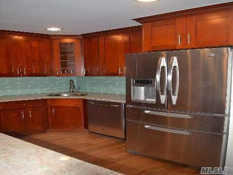
Eat in Kitchen:
Eat in Kitchen:
Yes
Yes
Area:
Area:
Bayswater
Bayswater
School District Number:
School District Number:
28
28
Township:
Township:
Queens
Queens
Basement:
Basement:
Full
Full
Den Family room:
Den Family room:
Yes
Yes
Finished Basement:
Finished Basement:
Yes
Yes
Dishwasher:
Dishwasher:
3
3
Refrigerator:
Refrigerator:
4
4
Building Class:
C0
Walk Up Apartments: Three Families
Floors on Main Building:
3
Building Dimensions:
20'
Actual Square Footage:
3,240
Calculated Square Footage:
3,240
Residential Floor Area:
3,240
Basement:
Below grade full basement
Address:
11-25 MCBRIDE STREET
BIN
Name 11-25 MCBRIDE STREET
Land Use:
02
Multi-Family Walk-Up Buildings
Calculated Lot Perimeter:
266.11 ft
Zoning Districts:
R5
Lower-density residence district
Max Residential FAR:
1.25
Max Residential Sqft:
2,825
Buildable Residential Sqft:
0
Residential Area Distribution:
Assessed Land Value:
$8,880
Assessed Total Value:
$48,120
Exempt Total Value:
$1,400
Last Recording Date:
Jan 8, 2024
Property Assessment Data:
Tax Class:
1
One- to three-unit residential properties
Taxable Assessed Value:
$29,877
Estimated Market Value by NYC DOF :
$802,000
Community District (CD):
414
City Council District:
31
Document DateDocument Type Unit Amount
Recorded DateDocument Type Unit Amount
Date
Event
Price
Price/Sqft
Source
Oct 24, 2012
Sold
$499,900
$154
OneKeyMLS
Jun 8, 2012
Listed
$499,900
$154
OneKeyMLS
Jun 6, 2012
Listing removed
$524,000
$162
OneKeyMLS
May 9, 2012
Price Changed
$524,000
$162
OneKeyMLS
Apr 25, 2012
Listing removed
$524,900
$162
OneKeyMLS
Apr 12, 2012
Price Changed
$524,900
$162
OneKeyMLS
Apr 12, 2012
Price Changed
$524,900
$162
OneKeyMLS
Mar 5, 2012
Listed
$549,000
$169
OneKeyMLS
Mar 5, 2012
Listed
$549,000
$169
OneKeyMLS
Aug 31, 2011
Sold
$268,000
—
OneKeyMLS
Jul 20, 2011
Listed
$272,250
—
OneKeyMLS
Apr 2, 2007
Sold
$689,000
$213
Public Record
Year
Taxes
Land
Additions
Total Assessment
2022
$5,559
$8,880
$37,080
$45,960
2021
$5,518
$8,880
$29,220
$38,100
2020
$5,221
$8,880
$23,880
$32,760
2019
$5,159
$8,880
$23,220
$32,100
2018
$5,105
$7,334
$18,534
$25,868
2017
$4,675
$7,572
$16,832
$24,404
2016
$4,293
$6,968
$16,055
$23,023
2015
$3,938
$7,380
$14,340
$21,720
2014
$3,856
$7,380
$14,340
$21,720
2013
$3,869
$7,380
$14,340
$21,720
2011
$5,125
$19,320
$10,020
$29,340
2010
$5,003
$19,320
$11,940
$31,260
2009
$5,392
$19,320
$11,580
$30,900
2007
$5,501
$7,446
$28,198
$35,644
Address
Price
Built
Beds
Baths
Sqft
Lot Size
Distance
561 Beach 43rd St
Far Rockaway, NY 11691MF
$760,000
11/08/2023
2005
3
1
2,312
-928difference
3,305
0.97 mi
1470 Egmont Pl
Far Rockaway, NY 11691MF
$950,000
02/20/2024
1960
6
4
2,052
-1,188
13,499
0.62 mi
152 Beach 26th St
Far Rockaway, NY 11691MF
$866,250
03/14/2024
2023
5
2
1,959
-1,281
3,268
0.77 mi
23-02 Cornaga Ave
Far Rockaway, NY 11691MF
$705,000
12/07/2023
1930
5
2
1,890
-1,350
6,059
0.17 mi
2225 Brookhaven Ave
Far Rockaway, NY 11691MF
$635,000
11/21/2023
1935
4
2
1,600
-1,640
3,352
0.35 mi
Estimated values are not a substitute for professional expertise. Contact your RE agent for a market assessment.
School Name
Rating
Grades
Parent Rating
Distance
Ps 104 The Bays Water
, Queens , NY 11691
6 / 10
K−5
0.41 mi
Wave Preparatory Elementary School
, Queens , NY 11691
9 / 10
K−5
—
0.36 mi
Peninsula Preparatory Academy Charter School
, Queens , NY 11691
8 / 10
K−5
0.40 mi
Knowledge and Power Preparatory Academy VI
, Queens , NY 11691
8 / 10
6−8
0.35 mi
Acadey of Medical Technology - A College Board School
, Queens , NY 11691
4 / 10
6−12
0.35 mi
Frederick Douglas Academy Vi High School
, Queens , NY 11691
1 / 10
9−12
—
0.35 mi
Queens High School For Information Research And T
, Queens , NY 11691
4 / 10
9−12
—
0.36 mi
Mesivta Yam Hatorah
, Queens , NY 11691
—
9−12
—
0.29 mi
Village Academy
, Queens , NY 11691
6 / 10
6−8
0.45 mi
Ms 53 Brian Piccolo
, Queens , NY 11691
3 / 10
6−8
0.46 mi
FEMA Zone (Est.)
X (shaded)
Flood insurance:
Recommended
Flood risks are increasing as sea levels rise and weather patterns change.
This property has a
Major Flood Factor
.
Please Log In
Please wait... If this message is not eventually replaced by the proper contents of the document, your PDF viewer may not be able to display this type of document.
You can upgrade to the latest version of Adobe Reader for Windows®, Mac, or Linux® by visiting
https://get.adobe.com/reader/ this link .
For more assistance with Adobe Reader visit
http://get.adobe.com/reader/ this link .
You can download this PDF-document from
here .