11 Holmes Ln, Brooklyn, NY 11236 Kings County Last Updated: March 13, 2024
Pre-Foreclosure: Lis Pendens, Estimated Market Value $927,600
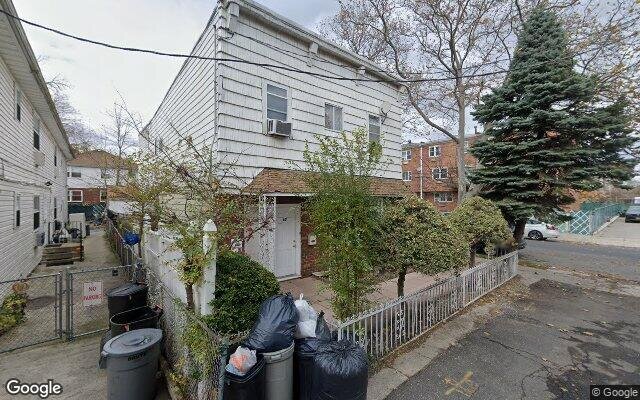
Description: 11 Holmes Ln, Brooklyn, NY 11236 is a Multi Family Home built in 2005. This property was last sold for $590,000 in 2006 and currently has an estimated value of $927,600. According to the Brooklyn public records, the property at 11 Holmes Ln, Brooklyn, NY 11236 has approximately 2,122 square feet, with a lot size of 2,524 square feet. Nearby schools include Ps 279 Herman Schreiber, Ps 115 Daniel Mucatel School and Canarsie Ascend Charter School.
2,122 sqft
2,524 lot size
Year Built: 2005
Pre-foreclosure
11 Holmes Ln, Brooklyn, NY 11236
Last Updated: March 13, 2024
1
Multi Family Home
Estimated Market Value EMV $ 927,600
11 Holmes Ln
bool(false)

bool(true)

bool(true)

int(0)
Estimated Market Value EMV $ 927,600
Foreclosure History
for 11 Holmes Ln
for 11 Holmes Ln
11 Holmes Ln, Brooklyn, NY 11236 is a Multi Family Home built in 2005. This property was last sold for $590,000 in 2006 and currently has an estimated value of $927,600. According to the Brooklyn public records, the property at 11 Holmes Ln, Brooklyn, NY 11236 has approximately 2,122 square feet, with a lot size of 2,524 square feet. Nearby schools include Ps 279 Herman Schreiber, Ps 115 Daniel Mucatel School and Canarsie Ascend Charter School.
Property features
Year Built:
Year Built:
2005
2005
Zoning:
Zoning:
R4-1
R4-1
Living Area:
Living Area:
2122
2122
Building Class:
B2
Two Family Dwellings: Frame
Floors on Main Building:
2.00
Building Dimensions:
17.70'
Actual Square Footage:
2,122
Calculated Square Footage:
2,124
Residential Floor Area:
2,122
Basement:
Below grade full basement
Land Use:
01
One & Two Family Buildings
Lot Dimensions:
22.50'
Calculated Lot Perimeter:
270.87 ft
Zoning Districts:
R4-1
Lower-density residence district
Max Residential FAR:
0.75
Max Residential Sqft:
1,893
Buildable Residential Sqft:
0
Residential Area Distribution:
Assessed Land Value:
$11,760
Assessed Total Value:
$65,880
Last Recording Date:
Jan 8, 2024
Property Assessment Data:
Tax Class:
1
One- to three-unit residential properties
Taxable Assessed Value:
$41,040
Estimated Market Value by NYC DOF :
$1,005,000
Community District (CD):
318
City Council District:
46
Document DateDocument Type Unit Amount
Date
Event
Price
Price/Sqft
Source
Jun 7, 2006
Sold
$590,000
$278
Public Record
Year
Taxes
Land
Additions
Total Assessment
2022
$7,517
$11,760
$41,640
$53,400
2021
$7,682
$11,760
$29,460
$41,220
2020
$7,289
$11,760
$22,680
$34,440
2019
$7,154
$11,760
$22,440
$34,200
2018
$6,958
$8,980
$24,282
$33,262
2017
$6,396
$11,760
$19,620
$31,380
2016
$6,537
$11,760
$20,940
$32,700
2015
$6,976
$12,134
$23,545
$35,679
2014
$6,448
$13,080
$20,580
$33,660
2013
$4,558
$13,080
$19,800
$32,880
2012
$5,823
$21,300
$12,300
$33,600
2010
$5,721
$21,300
$12,060
$33,360
2009
$5,703
$19,319
$15,781
$35,100
2007
$5,145
$6,051
$28,580
$34,631
Address
Price
Built
Beds
Baths
Sqft
Lot Size
Distance
615 E 102nd St
Brooklyn, NY 11236MF
$940,000
12/22/2023
1999
6
4
2,140
+18difference
2,058
0.67 mi
969 E 101st St
Brooklyn, NY 11236MF
$600,000
02/02/2024
1960
3
3
2,160
+38
2,000
0.37 mi
1420 E 103rd St
Brooklyn, NY 11236MF
$880,000
11/27/2023
1955
—
3
2,258
+136
2,000
0.57 mi
1139 E 86th St
Brooklyn, NY 11236MF
$875,000
03/11/2024
1950
4
3
1,892
-230
2,150
0.48 mi
8424 Glenwood Rd
Brooklyn, NY 11236MF
$680,000
03/06/2024
1920
3
3
1,800
-322
2,000
0.72 mi
1270 E 98th St
Brooklyn, NY 11236MF
$975,000
12/05/2023
1960
4
4
2,522
+400
8,999
0.13 mi
1379 E 93rd St
Brooklyn, NY 11236MF
$394,800
02/02/2024
1925
4
4
1,619
-503
3,200
0.14 mi
1367 E 91st St
Brooklyn, NY 11236MF
$1,275,000
01/05/2024
2023
6
5
2,750
+628
3,249
0.23 mi
1373 E 91st St
Brooklyn, NY 11236MF
$1,200,000
11/15/2023
2023
6
5
2,750
+628
3,310
0.23 mi
1214 E 93rd St
Brooklyn, NY 11236MF
$860,000
04/30/2024
1920
4
4
1,584
-538
1,908
0.30 mi
Address
Price
Built
Beds
Baths
Sqft
Lot Size
Distance
100 Louisiana Ave
Brooklyn, NY 11207MF
$799,000
86 days ago
1925
—
3
2,124
+2difference
2,000
1.22 mi
729 E 81st St
Brooklyn, NY 11236MF
$1,250,000
22 days ago
1960
4
4
2,109
-13
1,992
0.84 mi
1419 E 98th St
Brooklyn, NY 11236MF
$699,000
114 days ago
1925
4
2
2,100
-22
2,167
0.24 mi
2077 E 60th St
Brooklyn, NY 11234MF
$899,000
69 days ago
1960
5
3
2,100
-22
2,000
1.94 mi
1391 Remsen Ave
Brooklyn, NY 11236MF
$996,000
44 days ago
2012
6
4
2,146
+24
2,794
0.28 mi
964 E 102nd St
Brooklyn, NY 11236MF
$999,000
81 days ago
1960
5
4
2,160
+38
2,000
0.39 mi
544 Hinsdale St
Brooklyn, NY 11207MF
$848,000
118 days ago
1910
5
4
2,080
-42
2,233
1.54 mi
544 Hinsdale St
Brooklyn, NY 11207MF
$848,000
118 days ago
1910
5
4
2,080
-42
2,233
1.54 mi
1305 E 59th St
Brooklyn, NY 11234MF
$949,000
97 days ago
1955
5
3
2,178
+56
2,383
1.63 mi
1262 E 83rd St
Brooklyn, NY 11236MF
$799,000
148 days ago
1955
5
3
2,058
-64
2,200
0.70 mi
Estimated values are not a substitute for professional expertise. Contact your RE agent for a market assessment.
School Name
Rating
Grades
Parent Rating
Distance
Great Commission Christian School
, Brooklyn , NY 11236
—
K−7
0.35 mi
Ps 279 Herman Schreiber
, Brooklyn , NY 11236
9 / 10
K−5
0.42 mi
Ps 115 Daniel Mucatel School
, Brooklyn , NY 11236
6 / 10
K−5
0.31 mi
Is 211 John Wilson
, Brooklyn , NY 11236
7 / 10
6−8
0.29 mi
High School For Medical Professions
, Brooklyn , NY 11236
4 / 10
9−12
0.10 mi
High School For Innovation In Advertising And Medi
, Brooklyn , NY 11236
2 / 10
9−12
0.10 mi
Urban Action Academy
, Brooklyn , NY 11236
1 / 10
9−12
—
0.10 mi
Bais Meir
, Brooklyn , NY 11236
—
8−12
—
0.19 mi
Canarsie Ascend Charter School
, Brooklyn , NY 11236
9 / 10
K−8
0.38 mi
Mesivta Lev Bonim
, Brooklyn , NY 11236
—
9−12
—
0.45 mi
FEMA Zone (Est.)
X (unshaded)
Flood insurance:
Recommended
Flood risks are increasing as sea levels rise and weather patterns change.
This property has a
Minimal Flood Factor
.
Please Log In
Please wait... If this message is not eventually replaced by the proper contents of the document, your PDF viewer may not be able to display this type of document.
You can upgrade to the latest version of Adobe Reader for Windows®, Mac, or Linux® by visiting
https://get.adobe.com/reader/ this link .
For more assistance with Adobe Reader visit
http://get.adobe.com/reader/ this link .
You can download this PDF-document from
here .