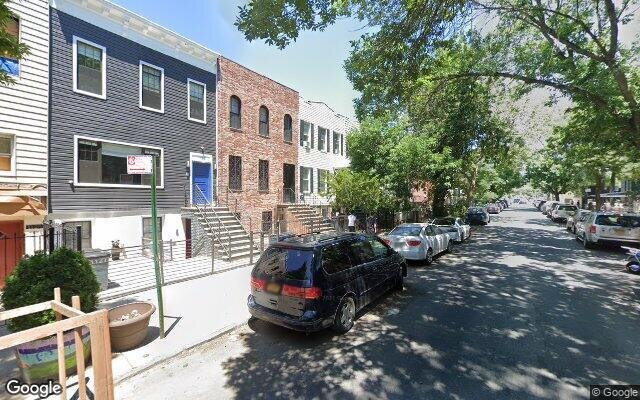
1125 Decatur St, Brooklyn, NY 11207 Kings County Last Updated: April 18, 2024
Pre-Foreclosure: Lis Pendens, Estimated Market Value $1,565,300
Description: 1125 Decatur St, Brooklyn, NY 11207 is a Multi Family Home built in 1925. This property currently has an estimated value of $1,565,300. According to the Brooklyn public records, the property at 1125 Decatur St, Brooklyn, NY 11207 has approximately 2,700 square feet, with a lot size of 2,000 square feet. Nearby schools include Ps 45 Horace E Greene, Ps Is 384 Frances E Carter and Ps 151 Lyndon B Johnson.
2,700 sqft
2,000 lot size
Year Built: 1925
Pre-foreclosure
1125 Decatur St, Brooklyn, NY 11207
Last Updated: April 18, 2024
1
Multi Family Home
Estimated Market Value EMV $ 1,565,300
1125 Decatur St
bool(false)

bool(true)

bool(true)

int(0)
Estimated Market Value EMV $ 1,565,300
Foreclosure History
for 1125 Decatur St
for 1125 Decatur St
1125 Decatur St, Brooklyn, NY 11207 is a Multi Family Home built in 1925. This property currently has an estimated value of $1,565,300. According to the Brooklyn public records, the property at 1125 Decatur St, Brooklyn, NY 11207 has approximately 2,700 square feet, with a lot size of 2,000 square feet. Nearby schools include Ps 45 Horace E Greene, Ps Is 384 Frances E Carter and Ps 151 Lyndon B Johnson.
Property features
Year Built:
Year Built:
1925
1925
Living Area:
Living Area:
2700
2700
Building Class:
B2
Two Family Dwellings: Frame
Floors on Main Building:
2
Building Dimensions:
20'
Actual Square Footage:
2,700
Calculated Square Footage:
1,800
Residential Floor Area:
1,800
Basement:
Above grade full basement
Address:
1125 DECATUR STREET
BIN
Name 1125 DECATUR STREET
Land Use:
01
One & Two Family Buildings
Calculated Lot Perimeter:
243.80 ft
Zoning Districts:
R6
Moderate-density residence district
Max Residential FAR:
2.43
Max Residential Sqft:
4,860
Buildable Residential Sqft:
2,160
Residential Area Distribution:
Assessed Land Value:
$12,900
Assessed Total Value:
$86,700
Last Recording Date:
Jan 8, 2024
Property Assessment Data:
Tax Class:
1
One- to three-unit residential properties
Taxable Assessed Value:
$17,338
Estimated Market Value by NYC DOF :
$1,445,000
Community District (CD):
304
City Council District:
37
Document DateDocument Type Unit Amount
Recorded DateDocument Type Unit Amount
Year
Taxes
Land
Additions
Total Assessment
2022
$3,089
$12,900
$63,480
$76,380
2021
$3,076
$12,900
$46,080
$58,980
2020
$3,089
$12,900
$40,800
$53,700
2019
$3,022
$12,900
$38,820
$51,720
2018
$2,854
$3,015
$10,629
$13,644
2017
$2,628
$2,621
$10,275
$12,896
2016
$2,435
$3,341
$8,841
$12,182
2015
$2,378
$3,748
$8,417
$12,165
2014
$2,307
$4,453
$7,587
$12,040
2013
$2,182
$4,303
$7,067
$11,370
2012
$1,956
$6,863
$3,884
$10,747
2010
$1,732
$5,510
$4,642
$10,152
2009
$1,714
$5,764
$4,374
$10,138
2007
$1,363
$1,363
$7,593
$8,956
Address
Price
Built
Beds
Baths
Sqft
Lot Size
Distance
268 Eldert St
Brooklyn, NY 11207MF
$1,975,000
01/16/2024
1910
6
4
2,700
2,000
0.30 mi
687 Decatur St
Brooklyn, NY 11233MF
$1,200,000
11/27/2023
—
—
3
2,700
2,000
0.44 mi
972 Madison St
Brooklyn, NY 11221MF
$1,245,000
11/08/2023
1910
8
4
2,814
+114difference
1,875
0.52 mi
875 Hancock St
Brooklyn, NY 11233MF
$1,220,000
11/09/2023
1992
5
3
2,856
+156
2,025
0.60 mi
875 Hancock St Unit Townhouse
Brooklyn, NY 11233MF
$1,220,000
11/09/2023
1992
5
3
2,856
+156
2,025
0.60 mi
20 Weirfield St
Brooklyn, NY 11221MF
$1,085,000
11/30/2023
1915
5
3
3,300
+600
2,000
0.34 mi
989 Hancock St
Brooklyn, NY 11221MF
$802,400
12/13/2023
1910
10
4
3,420
+720
1,900
0.39 mi
1583 Bushwick Ave
Brooklyn, NY 11207MF
$744,000
01/16/2024
1920
—
2
1,700
-1,000
1,590
0.50 mi
924 Jefferson Ave
Brooklyn, NY 11221MF
$1,150,000
04/26/2024
1992
—
3
2,856
+156
2,025
0.60 mi
385 Cornelia St
Brooklyn, NY 11237MF
$1,150,000
03/04/2024
1901
5
2
2,200
-500
2,000
0.66 mi
Address
Price
Built
Beds
Baths
Sqft
Lot Size
Distance
26 Weirfield St
Brooklyn, NY 11221MF
$820,000
38 days ago
1915
5
2
2,700
2,178
0.33 mi
605 Georgia Ave
Brooklyn, NY 11207MF
$1,100,000
33 days ago
1899
—
3
2,700
2,438
1.94 mi
356 Miller Ave
Brooklyn, NY 11207MF
$1,150,000
49 days ago
1930
8
3
2,700
2,000
1.42 mi
1719 E New York Ave
Brownville, NY 11212MF
$749,900
10 days ago
1901
6
4
2,664
-36difference
1,065
0.90 mi
78-20 61st St
Glendale, NY 11385MF
$1,288,000
22 days ago
1970
5
5
2,750
+50
2,334
1.01 mi
698 Lexington Ave
Brooklyn, NY 11221MF
$2,995,000
80 days ago
1899
6
6
2,760
+60
850
1.19 mi
758 Livonia Ave
Brooklyn, NY 11207MF
$999,000
29 days ago
—
—
4
2,775
+75
1,976
1.87 mi
16-64 Cornelia St
Ridgewood, NY 11385MF
$1,099,000
24 days ago
1910
6
3
2,790
+90
1,604
0.81 mi
60-71 60th Ln
Maspeth, NY 11378MF
$1,179,000
34 days ago
2002
6
6
2,805
+105
2,500
1.91 mi
114 Shepherd Ave
Brooklyn, NY 11208MF
$899,000
10 days ago
1910
6
3
2,810
+110
2,000
1.44 mi
Estimated values are not a substitute for professional expertise. Contact your RE agent for a market assessment.
School Name
Rating
Grades
Parent Rating
Distance
St. Marks Lutheran Schools
, Brooklyn , NY 11221
—
K−8
0.28 mi
Ps 45 Horace E Greene
, Brooklyn , NY 11207
5 / 10
K−8
0.08 mi
Ps Is 384 Frances E Carter
, Brooklyn , NY 11207
5 / 10
K−8
0.28 mi
Evergreen Middle School-Urban Exploration
, Brooklyn , NY 11207
5 / 10
6−8
—
0.10 mi
Ps 151 Lyndon B Johnson
, Brooklyn , NY 11237
6 / 10
K−5
0.40 mi
Our Lady of Lourdes School
, Brooklyn , NY 11207
—
K−8
0.46 mi
Brooklyn School For Math And Researc
, Brooklyn , NY 11237
5 / 10
9−12
0.65 mi
New York Christian Center Academy
, Westbury , NY 11590
—
K−12
—
0.74 mi
Bushwick Community High School
, Brooklyn , NY 11221
1 / 10
9−12
0.65 mi
Math, Eng, Science Academy Charter High
, Brooklyn , NY 11221
5 / 10
9−12
0.64 mi
FEMA Zone (Est.)
X (unshaded)
Flood insurance:
Recommended
Flood risks are increasing as sea levels rise and weather patterns change.
This property has a
Major Flood Factor
.
Please Log In
Please wait... If this message is not eventually replaced by the proper contents of the document, your PDF viewer may not be able to display this type of document.
You can upgrade to the latest version of Adobe Reader for Windows®, Mac, or Linux® by visiting
https://get.adobe.com/reader/ this link .
For more assistance with Adobe Reader visit
http://get.adobe.com/reader/ this link .
You can download this PDF-document from
here .