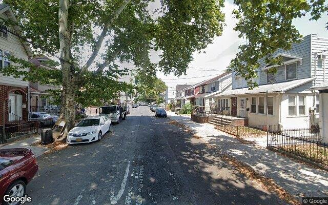
1232 E 34th St, Brooklyn, NY 11210 Kings County Last Updated: March 13, 2024
Pre-Foreclosure: Lis Pendens, Estimated Market Value $899,600
Description: 1232 E 34th St, Brooklyn, NY 11210 is a Single Family Home built in 1935. This property was last sold for $363,500 in 2002 and currently has an estimated value of $899,600. According to the Brooklyn public records, the property at 1232 E 34th St, Brooklyn, NY 11210 has approximately 1,261 square feet, with a lot size of 2,000 square feet. Nearby schools include School Of Science And Technology, Ps 193 Gil Hodges and Ps 119 Amersfort.
1,261 sqft
2,000 lot size
Year Built: 1935
Pre-foreclosure
1232 E 34th St, Brooklyn, NY 11210
Last Updated: March 13, 2024
1
Single Family Home
Town House
Estimated Market Value EMV $ 899,600
1232 E 34th St
bool(false)

bool(true)

bool(true)

int(0)
Estimated Market Value EMV $ 899,600
Foreclosure History
for 1232 E 34th St
for 1232 E 34th St
Type
Single Family Home
Town House
Last Sold
$363.5K in 2002
1232 E 34th St, Brooklyn, NY 11210 is a Single Family Home built in 1935. This property was last sold for $363,500 in 2002 and currently has an estimated value of $899,600. According to the Brooklyn public records, the property at 1232 E 34th St, Brooklyn, NY 11210 has approximately 1,261 square feet, with a lot size of 2,000 square feet. Nearby schools include School Of Science And Technology, Ps 193 Gil Hodges and Ps 119 Amersfort.
Property features
Year Built:
Year Built:
1935
1935
Living Area:
Living Area:
1261
1261
Building Class:
A5
One Family Dwellings: Attached Or Semi-detached
Floors on Main Building:
2
Building Dimensions:
13'
Actual Square Footage:
1,261
Calculated Square Footage:
1,248
Residential Floor Area:
1,261
Basement:
Below grade full basement
Address:
1232 EAST 34 STREET
BIN
Name 1232 EAST 34 STREET
Land Use:
01
One & Two Family Buildings
Calculated Lot Perimeter:
240.81 ft
Zoning Districts:
R4
Lower-density residence district
Max Residential FAR:
0.75
Max Residential Sqft:
1,500
Buildable Residential Sqft:
239
Residential Area Distribution:
Assessed Land Value:
$9,420
Assessed Total Value:
$41,880
Exempt Total Value:
$1,400
Last Recording Date:
Jan 8, 2024
Property Assessment Data:
Tax Class:
1
One- to three-unit residential properties
Taxable Assessed Value:
$32,134
Estimated Market Value by NYC DOF :
$701,000
Community District (CD):
318
City Council District:
45
Document DateDocument Type Unit Amount
Recorded DateDocument Type Unit Amount
Date
Event
Price
Price/Sqft
Source
Aug 31, 2016
Listing removed
$165,000
$264
Brooklyn
Jul 29, 2011
Listing removed
$169,900
$272
Brooklyn
Oct 11, 2010
Listed
$169,900
$272
Brooklyn
Dec 30, 2002
Sold
$363,500
$288
Public Record
Nov 4, 2002
Sold
$219,000
$174
Public Record
Jul 29, 2002
Sold
$230,500
$369
Brooklyn
Jun 9, 1993
Sold
$153,000
$121
Public Record
Year
Taxes
Land
Additions
Total Assessment
2022
$5,721
$9,420
$33,720
$43,140
2021
$5,904
$9,420
$28,860
$38,280
2020
$5,940
$9,420
$33,360
$42,780
2019
$5,552
$9,420
$31,500
$40,920
2018
$5,240
$6,972
$19,540
$26,512
2017
$4,813
$6,896
$18,185
$25,081
2016
$4,598
$7,899
$16,653
$24,552
2015
$4,491
$9,798
$14,754
$24,552
2014
$4,156
$9,294
$13,994
$23,288
2013
$3,941
$9,635
$12,459
$22,094
2012
$3,512
$14,636
$6,265
$20,901
2010
$3,234
$16,680
$3,780
$20,460
2009
$3,080
$13,601
$6,947
$20,548
2007
$2,688
$2,624
$14,794
$17,418
Address
Price
Built
Beds
Baths
Sqft
Lot Size
Distance
1670 E 51st St
Brooklyn, NY 11234SF
$810,000
04/19/2024
1920
4
3
1,260
-1difference
3,000
0.97 mi
1060 E 39th St
Brooklyn, NY 11210SF
$689,000
03/26/2024
1920
3
4
1,284
+23
2,000
0.43 mi
1639 Ryder St
Brooklyn, NY 11234SF
$783,500
01/11/2024
1930
3
3
1,288
+27
2,380
0.72 mi
1510 E 22nd St
Brooklyn, NY 11210SF
$800,000
11/07/2023
1930
3
2
1,290
+29
3,303
0.88 mi
3621 Avenue R
Brooklyn, NY 11234SF
$820,000
11/24/2023
1935
3
2
1,224
-37
1,573
0.94 mi
1922 New York Ave
Brooklyn, NY 11210SF
$670,000
01/23/2024
1925
3
1
1,428
+167
2,000
0.05 mi
1074 E 37th St
Brooklyn, NY 11210SF
$475,000
03/29/2024
1925
3
2
1,344
+83
2,000
0.36 mi
4101 Kings Hwy
Brooklyn, NY 11234SF
$675,000
04/19/2024
1935
3
2
1,708
+447
1,760
0.42 mi
3522 Avenue H
Brooklyn, NY 11210SF
$795,000
12/28/2023
1920
4
3
1,472
+211
1,950
0.43 mi
3410 Kings Hwy
Brooklyn, NY 11234SF
$740,000
12/13/2023
1945
3
3
2,065
+804
2,032
0.44 mi
Address
Price
Built
Beds
Baths
Sqft
Lot Size
Distance
1358 E 56th St
Brooklyn, NY 11234SF
$649,000
64 days ago
1920
3
2
1,260
-1difference
1,800
1.14 mi
2030 E 67th St
Brooklyn, NY 11234SF
$725,000
24 days ago
1930
3
2
1,260
-1
2,000
1.72 mi
1624 E 36th St
Brooklyn, NY 11234SF
$839,000
42 days ago
1925
3
3
1,260
-1
1,800
0.73 mi
2962 Avenue R
Brooklyn, NY 11229SF
$774,999
42 days ago
1940
2
2
1,258
-3
1,730
1.26 mi
1534 E 66th St
Brooklyn, NY 11234SF
$705,000
43 days ago
1930
3
2
1,244
-17
2,000
1.69 mi
6916 Avenue T
Brooklyn, NY 11234SF
$649,000
29 days ago
1962
3
2
1,296
+35
2,400
1.78 mi
1494 E 58th St
Brooklyn, NY 11234SF
$639,000
58 days ago
1925
3
2
1,296
+35
2,100
1.35 mi
1494 E 58th St
Brooklyn, NY 11234SF
$639,000
58 days ago
1925
3
2
1,296
+35
2,100
1.35 mi
1335 E 65th St
Brooklyn, NY 11234SF
$899,000
39 days ago
1925
3
2
1,226
-35
7,200
1.45 mi
1494 E 58th St
Brooklyn, NY 11234SF
$639,000
58 days ago
1925
3
2
1,296
+35
2,100
1.35 mi
Estimated values are not a substitute for professional expertise. Contact your RE agent for a market assessment.
School Name
Rating
Grades
Parent Rating
Distance
School Of Science And Technology
, Brooklyn , NY 11210
4 / 10
K−5
0.76 mi
Yad Yisroel
, Brooklyn , NY 11210
—
—
—
0.26 mi
Ps 193 Gil Hodges
, Brooklyn , NY 11210
8 / 10
K−5
0.46 mi
Step-Special Torah Education Program
, Brooklyn , NY 11204
—
—
0.27 mi
Ps 119 Amersfort
, Brooklyn , NY 11210
5 / 10
K−5
0.23 mi
Mesivta Tiferes Yisroel
, Brooklyn , NY 11210
—
K−12
—
0.20 mi
Midwood High School
, Brooklyn , NY 11210
7 / 10
9−12
0.70 mi
Is 381
, Brooklyn , NY 11210
8 / 10
6−8
0.24 mi
Andries Hudde School
, Brooklyn , NY 11210
5 / 10
6−8
0.24 mi
James Madison High School
, Brooklyn , NY 11229
4 / 10
9−12
1.11 mi
FEMA Zone (Est.)
X (unshaded)
Flood insurance:
Recommended
Flood risks are increasing as sea levels rise and weather patterns change.
This property has a
Moderate Flood Factor
.
Please Log In
Please wait... If this message is not eventually replaced by the proper contents of the document, your PDF viewer may not be able to display this type of document.
You can upgrade to the latest version of Adobe Reader for Windows®, Mac, or Linux® by visiting
https://get.adobe.com/reader/ this link .
For more assistance with Adobe Reader visit
http://get.adobe.com/reader/ this link .
You can download this PDF-document from
here .