135-01 Francis Lewis Blvd, Springfield Gardens, NY 11413 Queens County Last Updated: March 6, 2024
Pre-Foreclosure: Lis Pendens, Estimated Market Value $766,900
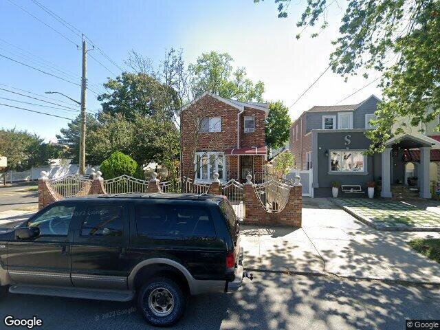
Description: 135-01 Francis Lewis Blvd, Springfield Gardens, NY 11413 is a Single Family Home built in 1920. This property currently has an estimated value of $766,900. According to the Springfield Gardens public records, the property at 135-01 Francis Lewis Blvd, Springfield Gardens, NY 11413 has approximately 1,344 square feet, with a lot size of 3,217 square feet. Nearby schools include The Gordon Parks School, Ps 156 Laurelton and Ps 38 Rosedale.
1,344 sqft
3,217 lot size
Year Built: 1920
Pre-foreclosure
135-01 Francis Lewis Blvd, Springfield Gardens, NY 11413
Last Updated: March 6, 2024
1
Single Family Home
Town House
Estimated Market Value EMV $ 766,900
135-01 Francis Lewis Blvd
bool(false)

bool(true)

bool(true)

int(0)
Estimated Market Value EMV $ 766,900
Springfield Gardens, NY 11413
Foreclosure History
for 135-01 Francis Lewis Blvd
for 135-01 Francis Lewis Blvd
Type
Single Family Home
Town House
135-01 Francis Lewis Blvd, Springfield Gardens, NY 11413 is a Single Family Home built in 1920. This property currently has an estimated value of $766,900. According to the Springfield Gardens public records, the property at 135-01 Francis Lewis Blvd, Springfield Gardens, NY 11413 has approximately 1,344 square feet, with a lot size of 3,217 square feet. Nearby schools include The Gordon Parks School, Ps 156 Laurelton and Ps 38 Rosedale.
Property features
Year Built:
Year Built:
1920
1920
Living Area:
Living Area:
1344
1344
Building Class:
A1
One Family Dwellings: Two Stories Detached (Small Or Moderate Size, With Or Without Attic)
Floors on Main Building:
2
Building Dimensions:
20'
Actual Square Footage:
1,344
Calculated Square Footage:
1,120
Residential Floor Area:
1,344
Basement:
Below grade full basement
Address:
135-01 FRANCIS LEWIS BOULEVARD
BIN
Name 135-01 FRANCIS LEWIS BOULEVARD
Land Use:
01
One & Two Family Buildings
Lot Dimensions:
32.17'
Calculated Lot Perimeter:
267.72 ft
Zoning Districts:
R3A
Lower-density residence district
Max Residential FAR:
0.50
Max Residential Sqft:
1,609
Buildable Residential Sqft:
265
Residential Area Distribution:
Assessed Land Value:
$12,060
Assessed Total Value:
$34,920
Last Recording Date:
Jan 8, 2024
Property Assessment Data:
Tax Class:
1
One- to three-unit residential properties
Taxable Assessed Value:
$31,385
Estimated Market Value by NYC DOF :
$582,000
Community District (CD):
413
City Council District:
31
Document DateDocument Type Unit Amount
Year
Taxes
Land
Additions
Total Assessment
2022
$5,896
$12,060
$25,260
$37,320
2021
$5,864
$12,060
$22,680
$34,740
2020
$5,858
$12,060
$20,880
$32,940
2019
$5,471
$12,060
$17,340
$29,400
2018
$5,196
$10,423
$14,417
$24,840
2017
$5,017
$10,733
$13,883
$24,616
2016
$4,642
$10,259
$12,964
$23,223
2015
$4,510
$11,906
$11,158
$23,064
2014
$4,175
$11,740
$10,055
$21,795
2013
$3,972
$13,380
$7,320
$20,700
2011
$3,360
$13,337
$7,177
$20,514
2010
$3,284
$10,682
$8,671
$19,353
2009
$3,103
$10,557
$8,663
$19,220
2007
$2,638
$2,605
$14,490
$17,095
Address
Price
Built
Beds
Baths
Sqft
Lot Size
Distance
137-01 232nd St
Laurelton, NY 11413SF
$775,000
01/22/2024
1920
4
3
1,316
-28difference
3,217
0.16 mi
169 Fir St
Valley Stream, NY 11580SF
$625,000
03/15/2024
1947
4
2
1,239
-105
4,500
0.91 mi
128-66 238th St
Rosedale, NY 11422SF
$740,000
12/14/2023
1950
5
2
1,190
-154
5,500
0.71 mi
131-45 228th St
Laurelton, NY 11413SF
$625,000
03/07/2024
1940
5
2
1,500
+156
3,200
0.34 mi
138-11 243rd St
Rosedale, NY 11422SF
$670,000
02/21/2024
1945
4
2
1,188
-156
4,000
0.57 mi
135-25 225th St
Laurelton, NY 11413SF
$599,000
03/29/2024
1945
4
2
1,160
-184
2,000
0.31 mi
13125 227th St
Laurelton, NY 11413SF
$485,000
03/05/2024
1935
3
2
1,577
+233
3,200
0.39 mi
242-01 137th Ave
Rosedale, NY 11422SF
$405,000
11/09/2023
1920
3
2
1,587
+243
4,000
0.46 mi
133-24 222nd St
Laurelton, NY 11413SF
$705,000
11/17/2023
1920
4
3
1,604
+260
4,000
0.51 mi
130-13 230th St
Laurelton, NY 11413SF
$650,000
03/08/2024
1945
2
2
888
-456
3,742
0.52 mi
Address
Price
Built
Beds
Baths
Sqft
Lot Size
Distance
231-27 126 Ave
Laurelton, NY 11413SF
$739,999
66 days ago
1960
3
3
1,344
4,100
0.79 mi
116 07 219th St
Cambria Heights, NY 11411SF
$579,999
46 days ago
1930
3
1
1,344
2,542
1.57 mi
300 Arkansas Dr
Valley Stream, NY 11580SF
$649,000
82 days ago
1950
3
2
1,353
+9difference
7,000
1.87 mi
141-06 230th Pl
Laurelton, NY 11413SF
$650,000
185 days ago
1935
3
3
1,330
-14
3,142
0.52 mi
60 Heatherfield Rd
Valley Stream, NY 11581SF
$799,000
39 days ago
1969
4
3
1,328
-16
6,960
1.52 mi
118-30 199th St
Saint Albans, NY 11412SF
$669,000
242 days ago
1879
2
—
1,321
-23
4,750
1.42 mi
13452 229th St
Laurelton, NY 11413SF
$675,000
36 days ago
1930
3
2
1,368
+24
2,542
0.14 mi
17 Green St
Valley Stream, NY 11580SF
$759,999
7 days ago
1937
4
3
1,317
-27
4,000
0.97 mi
243-31 144th Ave
Rosedale, NY 11422SF
$689,990
7 days ago
1935
4
4
1,316
-28
3,000
0.97 mi
241-06 141st Ave
Rosedale, NY 11422SF
$559,000
341 days ago
1925
3
2
1,316
-28
3,000
0.71 mi
Estimated values are not a substitute for professional expertise. Contact your RE agent for a market assessment.
School Name
Rating
Grades
Parent Rating
Distance
Tracy's Day Care Center
, Springfield Gardens , NY 11413
—
K−8
0.15 mi
The Gordon Parks School
, Queens , NY 11422
5 / 10
K−8
0.23 mi
Queens United Middle School
, Queens , NY 11413
4 / 10
6−8
0.17 mi
Collaborative Arts Middle School
, Queens , NY 11413
4 / 10
6−8
—
1.16 mi
Ps 156 Laurelton
, Queens , NY 11413
4 / 10
K−5
0.17 mi
George Washington Carver High School For The Scien
, Queens , NY 11413
3 / 10
9−12
0.99 mi
Preparatory Academy for Writers: A College Board School
, Queens , NY 11413
5 / 10
6−12
0.98 mi
Excelsior Preparatorty High School
, Queens , NY 11413
4 / 10
9−12
0.98 mi
Middletons Early Learning Center
, Queens , NY 11413
—
PK−K
0.28 mi
Ps 38 Rosedale
, Queens , NY 11422
7 / 10
K−5
0.39 mi
FEMA Zone (Est.)
X (unshaded)
Flood insurance:
Recommended
Flood risks are increasing as sea levels rise and weather patterns change.
This property has a
Major Flood Factor
.
Please Log In
Please wait... If this message is not eventually replaced by the proper contents of the document, your PDF viewer may not be able to display this type of document.
You can upgrade to the latest version of Adobe Reader for Windows®, Mac, or Linux® by visiting
https://get.adobe.com/reader/ this link .
For more assistance with Adobe Reader visit
http://get.adobe.com/reader/ this link .
You can download this PDF-document from
here .