138 E 89th St, Brooklyn, NY 11236 Kings County Last Updated: March 13, 2024
Pre-Foreclosure: Lis Pendens, Estimated Market Value $954,600
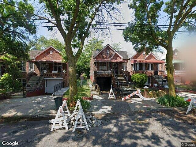
Description: 138 E 89th St, Brooklyn, NY 11236 is a Single Family Home built in 1940. This property was last sold for $98,500 in 1985 and currently has an estimated value of $954,600. According to the Brooklyn public records, the property at 138 E 89th St, Brooklyn, NY 11236 has approximately 1,743 square feet, with a lot size of 2,900 square feet. Nearby schools include Ps 233 Langston Hughes, New American Acad Charter School (The) and Ps 244 Richard R Green.
1,743 sqft
2,900 lot size
Year Built: 1940
Pre-foreclosure
138 E 89th St, Brooklyn, NY 11236
Last Updated: March 13, 2024
1
Single Family Home
Town House
Estimated Market Value EMV $ 954,600
138 E 89th St
bool(false)

bool(true)

bool(true)

int(0)
Estimated Market Value EMV $ 954,600
Foreclosure History
for 138 E 89th St
for 138 E 89th St
Type
Single Family Home
Town House
138 E 89th St, Brooklyn, NY 11236 is a Single Family Home built in 1940. This property was last sold for $98,500 in 1985 and currently has an estimated value of $954,600. According to the Brooklyn public records, the property at 138 E 89th St, Brooklyn, NY 11236 has approximately 1,743 square feet, with a lot size of 2,900 square feet. Nearby schools include Ps 233 Langston Hughes, New American Acad Charter School (The) and Ps 244 Richard R Green.
Property features
Year Built:
Year Built:
1940
1940
Living Area:
Living Area:
1743
1743
Building Class:
A2
One Family Dwellings: One Story (Permanent Living Quarters)
Floors on Main Building:
1.00
Building Dimensions:
22.33'
Actual Square Footage:
1,743
Calculated Square Footage:
1,027
Residential Floor Area:
996
Basement:
Above grade full basement
Address:
138 EAST 89 STREET
BIN
Name 138 EAST 89 STREET
Land Use:
01
One & Two Family Buildings
Calculated Lot Perimeter:
261.68 ft
Zoning Districts:
R5
Lower-density residence district
Max Residential FAR:
1.25
Max Residential Sqft:
3,625
Buildable Residential Sqft:
1,882
Residential Area Distribution:
Assessed Land Value:
$15,180
Assessed Total Value:
$38,040
Last Recording Date:
Jan 8, 2024
Property Assessment Data:
Tax Class:
1
One- to three-unit residential properties
Taxable Assessed Value:
$31,555
Estimated Market Value by NYC DOF :
$634,000
Community District (CD):
317
City Council District:
42
Document DateDocument Type Unit Amount
Date
Event
Price
Price/Sqft
Source
Jun 19, 1985
Sold
$98,500
$57
Public Record
Year
Taxes
Land
Additions
Total Assessment
2022
$5,606
$15,180
$26,520
$41,700
2021
$5,575
$15,180
$29,100
$44,280
2020
$5,608
$15,180
$23,220
$38,400
2019
$5,500
$15,180
$21,180
$36,360
2018
$5,189
$9,686
$15,122
$24,808
2017
$4,770
$14,302
$9,102
$23,404
2016
$4,414
$15,180
$6,900
$22,080
2015
$4,573
$13,845
$9,544
$23,389
2014
$4,323
$11,477
$11,087
$22,564
2013
$3,785
$11,092
$10,196
$21,288
2012
$3,582
$11,344
$9,944
$21,288
2010
$3,053
$12,198
$8,461
$20,659
2009
$2,977
$10,727
$8,764
$19,491
2007
$2,538
$2,912
$14,828
$17,740
Address
Price
Built
Beds
Baths
Sqft
Lot Size
Distance
745 E 93rd St Unit 14
Brooklyn, NY 11236SF
$710,000
11/14/2023
1955
3
3
1,980
+237difference
2,017
0.29 mi
8717 Glenwood Rd
Brooklyn, NY 11236SF
$675,000
02/29/2024
1965
3
3
1,980
+237
1,460
0.77 mi
651 E 53rd St
Brooklyn, NY 11203SF
$525,000
03/19/2024
1925
3
2
1,344
-399
2,300
0.60 mi
610 E 79th St
Brooklyn, NY 11236SF
$635,000
01/31/2024
1960
3
2
1,260
-483
1,800
0.82 mi
635 E 52nd St
Brooklyn, NY 11203SF
$699,600
11/30/2023
1925
3
2
1,232
-511
1,800
0.58 mi
143 Branton St
Brooklyn, NY 11236SF
$400,000
12/18/2023
1940
2
2
1,020
-723
1,530
0.29 mi
981 E 94th St
Brooklyn, NY 11236SF
$700,000
02/21/2024
1940
3
2
1,097
-646
5,000
0.66 mi
552 E 80th St
Brooklyn, NY 11236SF
$395,000
02/22/2024
1970
2
2
968
-775
3,000
0.71 mi
664 E 49th St
Brooklyn, NY 11203SF
$810,000
12/20/2023
1930
3
2
2,800
+1,057
3,383
0.73 mi
9511 Flatlands Ave
Brooklyn, NY 11236SF
$440,000
01/12/2024
1930
3
1
1,176
-567
3,072
0.96 mi
Address
Price
Built
Beds
Baths
Sqft
Lot Size
Distance
3807 Avenue I
Brooklyn, NY 11210SF
$865,000
52 days ago
1930
5
2
1,724
-19difference
2,438
1.75 mi
625 E 93rd St
Brooklyn, NY 11236SF
$650,000
45 days ago
1945
3
—
1,781
+38
2,250
0.24 mi
5119 Avenue J
Brooklyn, NY 11234SF
$650,000
781 days ago
1945
3
2
1,781
+38
2,233
1.52 mi
11 Monaco Pl
Brooklyn, NY 11233MF
$1,200,000
30 days ago
1910
4
4
1,782
+39
1,688
1.95 mi
1090 E 39th St
Brooklyn, NY 11210SF
$750,000
257 days ago
1920
3
2
1,696
-47
4,000
1.73 mi
1333 E 48th St
Brooklyn, NY 11234SF
$599,000
276 days ago
1945
3
2
1,689
-54
2,200
1.58 mi
605 E 57th St
Brooklyn, NY 11234SF
$698,000
49 days ago
1960
3
3
1,800
+57
1,800
0.83 mi
1428 E 48th St
Brooklyn, NY 11234SF
$799,000
64 days ago
1950
3
3
1,802
+59
2,200
1.73 mi
762 E 37th St
Brooklyn, NY 11210SF
$730,000
164 days ago
1940
4
3
1,806
+63
2,200
1.46 mi
1123 E 82nd St
Brooklyn, NY 11236SF
$670,000
563 days ago
1960
4
3
1,680
-63
1,600
1.30 mi
Estimated values are not a substitute for professional expertise. Contact your RE agent for a market assessment.
School Name
Rating
Grades
Parent Rating
Distance
Happy Home Daycare
, Brooklyn , NY 11236
—
PK−3
0.25 mi
Middle School For Art And Philosphy
, Brooklyn , NY 11212
7 / 10
6−8
0.57 mi
Flatbush Sda School
, Brooklyn , NY 11203
—
PK−5
0.19 mi
Ps 233 Langston Hughes
, Brooklyn , NY 11236
4 / 10
K−5
0.25 mi
New American Acad Charter School (The)
, Brooklyn , NY 11236
6 / 10
K−5
—
0.25 mi
Is 285 Meyer Levin
, Brooklyn , NY 11203
7 / 10
6−8
0.21 mi
It Takes A Village Academy
, Brooklyn , NY 11203
3 / 10
9−12
0.23 mi
Ps 244 Richard R Green
, Brooklyn , NY 11203
5 / 10
K−5
0.40 mi
BROOKLYN SCIENCE AND ENGINEERING ACADEMY
, Brooklyn , NY 11203
6 / 10
6−8
0.40 mi
Avenue B Christian Academy Preschool
, Brooklyn , NY 11236
—
1−2
0.20 mi
FEMA Zone (Est.)
X (unshaded)
Flood insurance:
Recommended
Flood risks are increasing as sea levels rise and weather patterns change.
This property has a
Minimal Flood Factor
.
Please Log In
Please wait... If this message is not eventually replaced by the proper contents of the document, your PDF viewer may not be able to display this type of document.
You can upgrade to the latest version of Adobe Reader for Windows®, Mac, or Linux® by visiting
https://get.adobe.com/reader/ this link .
For more assistance with Adobe Reader visit
http://get.adobe.com/reader/ this link .
You can download this PDF-document from
here .