1415 E 84th St, Brooklyn, NY 11236 Kings County Last Updated: April 18, 2024
Pre-Foreclosure: Lis Pendens, Estimated Market Value $1,048,600
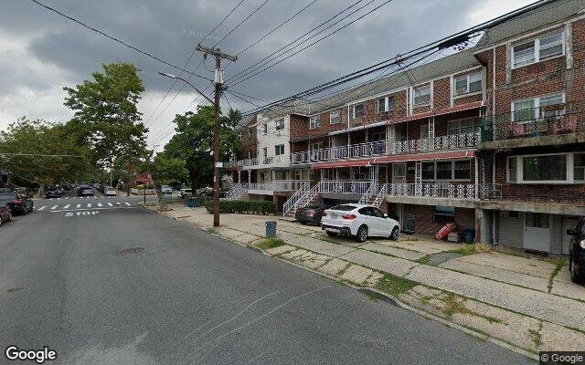
Description: 1415 E 84th St, Brooklyn, NY 11236 is a Multi Family Home built in 1960. This property was last sold for $330,000 in 2001 and currently has an estimated value of $1,048,600. According to the Brooklyn public records, the property at 1415 E 84th St, Brooklyn, NY 11236 has approximately 3,380 square feet, with a lot size of 2,000 square feet. Nearby schools include Success Academy Bergen Beach, Ps 115 Daniel Mucatel School, Explore Excel Charter School and Ps 276 Louis Marshall.
3,380 sqft
2,000 lot size
Year Built: 1960
Pre-foreclosure
1415 E 84th St, Brooklyn, NY 11236
Last Updated: April 18, 2024
1
Multi Family Home
Estimated Market Value EMV $ 1,048,600
1415 E 84th St
bool(false)

bool(true)

bool(true)

int(0)
Estimated Market Value EMV $ 1,048,600
Foreclosure History
for 1415 E 84th St
for 1415 E 84th St
1415 E 84th St, Brooklyn, NY 11236 is a Multi Family Home built in 1960. This property was last sold for $330,000 in 2001 and currently has an estimated value of $1,048,600. According to the Brooklyn public records, the property at 1415 E 84th St, Brooklyn, NY 11236 has approximately 3,380 square feet, with a lot size of 2,000 square feet. Nearby schools include Success Academy Bergen Beach, Ps 115 Daniel Mucatel School, Explore Excel Charter School and Ps 276 Louis Marshall.
Property features
Year Built:
Year Built:
1960
1960
Living Area:
Living Area:
3380
3380
Building Class:
C0
Walk Up Apartments: Three Families
Floors on Main Building:
3
Building Dimensions:
20'
Actual Square Footage:
3,380
Calculated Square Footage:
2,760
Residential Floor Area:
2,760
Basement:
Above grade full basement
Address:
1415 EAST 84 STREET
BIN
Name 1415 EAST 84 STREET
Land Use:
02
Multi-Family Walk-Up Buildings
Calculated Lot Perimeter:
238.32 ft
Zoning Districts:
R5
Lower-density residence district
Max Residential FAR:
1.25
Max Residential Sqft:
2,500
Buildable Residential Sqft:
0
Residential Area Distribution:
Assessed Land Value:
$4,920
Assessed Total Value:
$53,880
Last Recording Date:
Jan 8, 2024
Property Assessment Data:
Tax Class:
1
One- to three-unit residential properties
Taxable Assessed Value:
$42,941
Estimated Market Value by NYC DOF :
$898,000
Community District (CD):
318
City Council District:
46
Document DateDocument Type Unit Amount
Date
Event
Price
Price/Sqft
Source
Nov 5, 2001
Sold
$330,000
$98
Public Record
Jan 19, 1994
Sold
$228,000
$67
Public Record
Year
Taxes
Land
Additions
Total Assessment
2022
$8,026
$4,920
$39,420
$44,340
2021
$7,982
$4,920
$36,900
$41,820
2020
$7,574
$4,920
$45,240
$50,160
2019
$7,485
$4,920
$34,980
$39,900
2018
$7,429
$3,743
$31,772
$35,515
2017
$6,829
$4,169
$29,336
$33,505
2016
$6,318
$4,363
$27,246
$31,609
2015
$5,830
$4,080
$25,740
$29,820
2014
$5,713
$4,080
$25,740
$29,820
2013
$5,722
$4,080
$25,740
$29,820
2012
$6,127
$4,724
$28,937
$33,661
2010
$5,248
$4,382
$28,154
$32,536
2009
$4,992
$4,550
$26,162
$30,712
2007
$4,110
$4,408
$23,643
$28,051
Address
Price
Built
Beds
Baths
Sqft
Lot Size
Distance
1231 E 70th St
Brooklyn, NY 11234MF
$1,135,000
12/18/2023
1970
8
6
3,400
+20difference
4,743
0.74 mi
1030 E 86th St
Brooklyn, NY 11236MF
$999,999
02/22/2024
2000
6
4
3,160
-220
4,833
0.57 mi
1154 Bergen Ave
Brooklyn, NY 11234MF
$1,100,000
01/03/2024
1970
—
4
3,146
-234
2,200
0.72 mi
1225 E 68th St
Brooklyn, NY 11234MF
$1,325,000
03/29/2024
1969
8
4
3,762
+382
4,479
0.87 mi
7322 Avenue M
Brooklyn, NY 11234MF
$1,100,000
01/26/2024
1970
—
5
2,860
-520
2,092
0.57 mi
1453 E 87th St
Brooklyn, NY 11236MF
$775,000
11/14/2023
1960
5
5
2,760
-620
2,550
0.16 mi
1139 E 86th St
Brooklyn, NY 11236MF
$875,000
03/11/2024
1950
4
3
1,892
-1,488
2,150
0.42 mi
1384 Remsen Ave
Brooklyn, NY 11236MF
$925,000
11/16/2023
1960
5
3
2,650
-730
1,900
0.52 mi
1373 E 91st St
Brooklyn, NY 11236MF
$1,200,000
11/15/2023
2023
6
5
2,750
-630
3,310
0.54 mi
1367 E 91st St
Brooklyn, NY 11236MF
$1,275,000
01/05/2024
2023
6
5
2,750
-630
3,249
0.55 mi
Address
Price
Built
Beds
Baths
Sqft
Lot Size
Distance
606 E 54th St
Brooklyn, NY 11203MF
$1,375,000
192 days ago
1935
5
6
3,400
+20difference
—
1.66 mi
1683 E 54th St
Brooklyn, NY 11234MF
$869,000
1206 days ago
1955
6
4
3,400
+20
4,000
1.43 mi
588 Bristol St
Brooklyn, NY 11212MF
$1,185,000
126 days ago
1930
7
5
3,404
+24
2,817
1.96 mi
1238 E 72nd St
Brooklyn, NY 11234MF
$1,399,000
187 days ago
—
8
6
3,448
+68
5,280
0.71 mi
1018 E 81st St
Brooklyn, NY 11236MF
$1,400,000
104 days ago
1965
6
5
3,450
+70
2,000
0.61 mi
739 E 89th St
Brooklyn, NY 11236MF
$1,250,000
320 days ago
1910
6
3
3,496
+116
7,239
0.87 mi
713 Bristol St
Brownville, NY 11233MF
$1,700,000
54 days ago
1930
11
4
3,520
+140
2,650
1.72 mi
637 Osborn St
Brooklyn, NY 11212MF
$1,350,000
87 days ago
1930
—
—
3,200
-180
3,200
1.89 mi
637 Osborn St
Brooklyn, NY 11212MF
$1,350,000
87 days ago
1930
—
—
3,200
-180
3,200
1.89 mi
9421 Farragut Rd
Brooklyn, NY 11236MF
$980,000
28 days ago
1920
6
5
3,150
-230
4,767
1.18 mi
Estimated values are not a substitute for professional expertise. Contact your RE agent for a market assessment.
School Name
Rating
Grades
Parent Rating
Distance
Success Academy Bergen Beach
, Brooklyn , NY 11234
8 / 10
K−7
0.86 mi
High School For Innovation In Advertising And Medi
, Brooklyn , NY 11236
2 / 10
9−12
0.80 mi
High School For Medical Professions
, Brooklyn , NY 11236
4 / 10
9−12
0.80 mi
Urban Action Academy
, Brooklyn , NY 11236
1 / 10
9−12
—
0.79 mi
Our Lady Of Trust Catholic Accadamy
, Brooklyn , NY 11236
—
PK−8
0.49 mi
Ps 115 Daniel Mucatel School
, Brooklyn , NY 11236
6 / 10
K−5
0.43 mi
Explore Excel Charter School
, Brooklyn , NY 11236
6 / 10
K−8
—
1.01 mi
Mesivta Lev Bonim
, Brooklyn , NY 11236
—
10−12
0.47 mi
Mesivta Lev Bonim
, Brooklyn , NY 11236
—
9−12
—
0.47 mi
Ps 276 Louis Marshall
, Brooklyn , NY 11236
5 / 10
K−5
0.53 mi
FEMA Zone (Est.)
X (unshaded)
Flood insurance:
Recommended
Flood risks are increasing as sea levels rise and weather patterns change.
This property has a
Extreme Flood Factor
.
Please Log In
Please wait... If this message is not eventually replaced by the proper contents of the document, your PDF viewer may not be able to display this type of document.
You can upgrade to the latest version of Adobe Reader for Windows®, Mac, or Linux® by visiting
https://get.adobe.com/reader/ this link .
For more assistance with Adobe Reader visit
http://get.adobe.com/reader/ this link .
You can download this PDF-document from
here .