1449 Herkimer St, Brooklyn, NY 11233 Kings County Last Updated: March 18, 2024
Pre-Foreclosure: Lis Pendens, Estimated Market Value $1,085,600
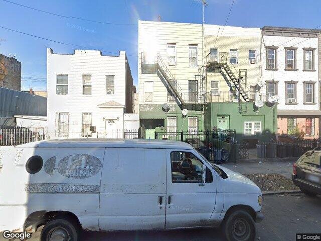
Description: 1449 Herkimer St, Brooklyn, NY 11233 is a Multi Family Home built in 1910. This property was last sold for $335,100 in 2004 and currently has an estimated value of $1,085,600. According to the Brooklyn public records, the property at 1449 Herkimer St, Brooklyn, NY 11233 has approximately 2,075 square feet, with a lot size of 1,750 square feet. Nearby schools include Ps Is 155 Nicholas Herkimer, Leadership Preparatory Ocean Hill Charter School, Ps 298 Dr Betty Shabazz, Ps 178 Saint Clair Mckelway and Ps Is 323.
2,075 sqft
1,750 lot size
Year Built: 1910
Pre-foreclosure
1449 Herkimer St, Brooklyn, NY 11233
Last Updated: March 18, 2024
1
Multi Family Home
Estimated Market Value EMV $ 1,085,600
1449 Herkimer St
bool(false)

bool(true)

bool(true)

int(0)
Estimated Market Value EMV $ 1,085,600
Foreclosure History
for 1449 Herkimer St
for 1449 Herkimer St
Last Sold
$335.1K in 2004
1449 Herkimer St, Brooklyn, NY 11233 is a Multi Family Home built in 1910. This property was last sold for $335,100 in 2004 and currently has an estimated value of $1,085,600. According to the Brooklyn public records, the property at 1449 Herkimer St, Brooklyn, NY 11233 has approximately 2,075 square feet, with a lot size of 1,750 square feet. Nearby schools include Ps Is 155 Nicholas Herkimer, Leadership Preparatory Ocean Hill Charter School, Ps 298 Dr Betty Shabazz, Ps 178 Saint Clair Mckelway and Ps Is 323.
Property features
Year Built:
Year Built:
1910
1910
Living Area:
Living Area:
2075
2075
Building Class:
B9
Two Family Dwellings: Miscellaneous
Floors on Main Building:
3.00
Building Dimensions:
17.50'
Actual Square Footage:
2,075
Calculated Square Footage:
1,943
Residential Floor Area:
2,075
Basement:
Below grade full basement
Address:
1449 HERKIMER STREET
BIN
Name 1449 HERKIMER STREET
Land Use:
01
One & Two Family Buildings
Lot Dimensions:
17.50'
Calculated Lot Perimeter:
242.52 ft
Zoning Districts:
R6B
Moderate-density residence district
Max Residential Sqft:
3,500
Buildable Residential Sqft:
1,425
Residential Area Distribution:
Assessed Land Value:
$18,960
Assessed Total Value:
$47,280
Last Recording Date:
Jan 8, 2024
Property Assessment Data:
Tax Class:
1
One- to three-unit residential properties
Taxable Assessed Value:
$11,606
Estimated Market Value by NYC DOF :
$765,000
Community District (CD):
316
City Council District:
37
Document DateDocument Type Unit Amount
Date
Event
Price
Price/Sqft
Source
Feb 26, 2004
Sold
$335,100
$161
Public Record
Feb 12, 2001
Sold
$201,000
$97
Public Record
Year
Taxes
Land
Additions
Total Assessment
2022
$2,295
$18,960
$30,420
$49,380
2021
$2,283
$18,960
$35,160
$54,120
2020
$2,167
$18,960
$35,520
$54,480
2019
$2,023
$18,960
$34,140
$53,100
2018
$2,023
$4,141
$5,531
$9,672
2017
$1,953
$5,757
$3,826
$9,583
2016
$1,807
$5,049
$3,994
$9,043
2015
$1,668
$3,883
$4,650
$8,533
2014
$1,544
$4,398
$3,662
$8,060
2013
$1,546
$5,273
$2,787
$8,060
2012
$1,453
$5,427
$2,559
$7,986
2010
$1,215
$6,080
$1,456
$7,536
2009
$1,147
$4,595
$2,516
$7,111
2007
$1,027
$998
$5,657
$6,655
Address
Price
Built
Beds
Baths
Sqft
Lot Size
Distance
138 Liberty Ave
Brooklyn, NY 11212MF
$747,500
02/29/2024
2007
7
5
2,026
-49difference
947
0.31 mi
527 Glenmore Ave
Brooklyn, NY 11207MF
$850,000
03/18/2024
1925
5
4
2,136
+61
1,950
0.80 mi
1681 Prospect Pl
Brooklyn, NY 11233MF
$825,000
03/19/2024
1920
8
3
1,976
-99
2,427
0.86 mi
72 Hendrix St
Brooklyn, NY 11207MF
$799,000
12/11/2023
1910
6
3
1,920
-155
1,617
0.76 mi
358 Bradford St
Brooklyn, NY 11207MF
$1,100,000
11/15/2023
1901
6
3
1,900
-175
1,900
0.87 mi
1583 Bushwick Ave
Brooklyn, NY 11207MF
$744,000
01/16/2024
1920
—
2
1,700
-375
1,590
0.30 mi
6 Radde Pl
Stuyvesant Heights, NY 11233MF
$1,100,000
02/28/2024
2005
8
5
3,123
+1,048
1,894
0.49 mi
1579 Saint Marks Ave
Crown Heights, NY 11233MF
$955,000
03/26/2024
2004
5
3
2,700
+625
2,854
0.56 mi
9A Hull St
Brooklyn, NY 11233MF
$1,250,000
02/28/2024
—
6
4
2,410
+335
2,320
0.66 mi
9A Hull St Unit A
Stuyvesant Heights, NY 11233MF
$1,250,000
02/28/2024
2000
6
4
2,410
+335
2,320
0.66 mi
Address
Price
Built
Beds
Baths
Sqft
Lot Size
Distance
544 Hinsdale St
Brooklyn, NY 11207MF
$848,000
121 days ago
1910
5
4
2,080
+5difference
2,233
1.16 mi
116 Hale Ave
Brooklyn, NY 11208MF
$705,000
32 days ago
1910
7
2
2,080
+5
2,775
1.34 mi
544 Hinsdale St
Brooklyn, NY 11207MF
$848,000
121 days ago
1910
5
4
2,080
+5
2,233
1.16 mi
248 Palmetto St Unit 1
Brooklyn, NY 11221MF
$1,395,000
45 days ago
1910
2
3
2,067
-8
—
1.34 mi
689 Madison St
Brooklyn, NY 11221MF
$950,000
14 days ago
1899
5
3
2,052
-23
1,908
1.43 mi
841 Willoughby Ave
Bedford Stuyvesant, NY 11221MF
$1,395,000
8 days ago
1899
3
2
2,100
+25
1,500
1.98 mi
187 Bainbridge St
Brooklyn, NY 11233MF
$1,950,000
23 days ago
1899
6
4
2,100
+25
1,700
1.30 mi
689 Macdonough St
Brooklyn, NY 11233MF
$1,195,000
81 days ago
—
—
2
2,040
-35
1,700
0.83 mi
100 Louisiana Ave
Brooklyn, NY 11207MF
$799,000
89 days ago
1925
—
3
2,124
+49
2,000
1.52 mi
2154 Bergen St
Brooklyn, NY 11233MF
$1,300,000
44 days ago
—
10
3
2,146
+71
2,091
0.33 mi
Estimated values are not a substitute for professional expertise. Contact your RE agent for a market assessment.
School Name
Rating
Grades
Parent Rating
Distance
Ps Is 155 Nicholas Herkimer
, Brooklyn , NY 11233
6 / 10
K−8
0.16 mi
Leadership Preparatory Ocean Hill Charter School
, Brooklyn , NY 11212
3 / 10
K−12
0.36 mi
Ps 298 Dr Betty Shabazz
, Brooklyn , NY 11212
1 / 10
K−5
0.47 mi
New Visions AIM Charter High School I
, Brooklyn , NY 11212
1 / 10
9−12
0.07 mi
Aspirations Diploma Plus High School
, BROOKLYN , NY 11225
1 / 10
9−12
—
0.08 mi
People's Elementary School
, Brooklyn , NY 11207
—
PK−8
0.10 mi
Ps 178 Saint Clair Mckelway
, Brooklyn , NY 11233
2 / 10
K−8
0.54 mi
Our Lady of Lourdes School
, Brooklyn , NY 11207
—
K−8
0.27 mi
Ps Is 323
, Brooklyn , NY 11212
4 / 10
K−8
0.82 mi
New York Christian Center Academy
, Westbury , NY 11590
—
K−12
—
0.09 mi
FEMA Zone (Est.)
X (unshaded)
Flood insurance:
Recommended
Flood risks are increasing as sea levels rise and weather patterns change.
This property has a
Minimal Flood Factor
.
Please Log In
Please wait... If this message is not eventually replaced by the proper contents of the document, your PDF viewer may not be able to display this type of document.
You can upgrade to the latest version of Adobe Reader for Windows®, Mac, or Linux® by visiting
https://get.adobe.com/reader/ this link .
For more assistance with Adobe Reader visit
http://get.adobe.com/reader/ this link .
You can download this PDF-document from
here .