147 E 32nd St, Brooklyn, NY 11226 Kings County Last Updated: March 13, 2024
Pre-Foreclosure: Lis Pendens, Estimated Market Value $824,400
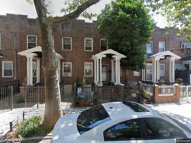
Description: 147 E 32nd St, Brooklyn, NY 11226 is a Single Family Home built in 1920. This property was last sold for $345,000 in 2011 and currently has an estimated value of $824,400. According to the Brooklyn public records, the property at 147 E 32nd St, Brooklyn, NY 11226 has approximately 1,200 square feet, with a lot size of 2,100 square feet. Nearby schools include Central Brooklyn Ascend Charter, Ps 181, Norma Adams Clemons Academy and Ps 399 Stanley Eugene Clarke.
1,200 sqft
2,100 lot size
Year Built: 1920
Pre-foreclosure
147 E 32nd St, Brooklyn, NY 11226
Last Updated: March 13, 2024
1
Single Family Home
Town House
Estimated Market Value EMV $ 824,400
147 E 32nd St
bool(false)

bool(true)

bool(true)

int(0)
Estimated Market Value EMV $ 824,400
Foreclosure History
for 147 E 32nd St
for 147 E 32nd St
Type
Single Family Home
Town House
147 E 32nd St, Brooklyn, NY 11226 is a Single Family Home built in 1920. This property was last sold for $345,000 in 2011 and currently has an estimated value of $824,400. According to the Brooklyn public records, the property at 147 E 32nd St, Brooklyn, NY 11226 has approximately 1,200 square feet, with a lot size of 2,100 square feet. Nearby schools include Central Brooklyn Ascend Charter, Ps 181, Norma Adams Clemons Academy and Ps 399 Stanley Eugene Clarke.
Property features
Year Built:
Year Built:
1920
1920
Living Area:
Living Area:
1200
1200
Building Class:
A1
One Family Dwellings: Two Stories Detached (Small Or Moderate Size, With Or Without Attic)
Floors on Main Building:
2
Building Dimensions:
20'
Actual Square Footage:
1,200
Calculated Square Footage:
1,200
Residential Floor Area:
1,200
Basement:
Below grade full basement
Address:
147 EAST 32 STREET
BIN
Name 147 EAST 32 STREET
Land Use:
01
One & Two Family Buildings
Calculated Lot Perimeter:
249.93 ft
Zoning Districts:
R6
Moderate-density residence district
Max Residential FAR:
2.43
Max Residential Sqft:
5,103
Buildable Residential Sqft:
3,903
Residential Area Distribution:
Assessed Land Value:
$15,480
Assessed Total Value:
$40,680
Last Recording Date:
Jan 8, 2024
Property Assessment Data:
Tax Class:
1
One- to three-unit residential properties
Taxable Assessed Value:
$26,837
Estimated Market Value by NYC DOF :
$678,000
Community District (CD):
317
City Council District:
45
Document DateDocument Type Unit Amount
Date
Event
Price
Price/Sqft
Source
Oct 3, 2011
Sold
$345,000
$288
Public Record
Jul 1, 2008
Sold
$580,000
$483
Public Record
Jan 3, 1990
Sold
$90,000
$75
Public Record
Year
Taxes
Land
Additions
Total Assessment
2022
$4,768
$15,480
$27,480
$42,960
2021
$4,817
$15,480
$25,500
$40,980
2020
$4,845
$15,480
$21,600
$37,080
2019
$4,678
$15,480
$13,980
$29,460
2018
$4,413
$12,778
$8,321
$21,099
2017
$4,057
$12,375
$7,530
$19,905
2016
$3,813
$14,391
$4,685
$19,076
2015
$3,730
$10,202
$8,874
$19,076
2014
$3,570
$10,572
$8,065
$18,637
2013
$3,075
$11,596
$5,987
$17,583
2012
$3,019
$10,742
$5,846
$16,588
2010
$2,716
$10,681
$5,216
$15,897
2009
$2,653
$10,142
$5,755
$15,897
2007
$2,133
$2,174
$11,650
$13,824
Address
Price
Built
Beds
Baths
Sqft
Lot Size
Distance
442 E 43rd St
Brooklyn, NY 11203SF
$475,000
04/12/2024
1945
2
2
1,216
+16difference
1,600
0.56 mi
132 E 28th St
Brooklyn, NY 11226SF
$660,000
12/12/2023
1910
4
1
1,248
+48
2,082
0.24 mi
256 E 43rd St
Brooklyn, NY 11203SF
$407,986
03/12/2024
1920
4
1
1,120
-80
940
0.54 mi
703 E 39th St
Brooklyn, NY 11203SF
$550,000
11/16/2023
1930
3
2
1,280
+80
2,000
0.64 mi
882 Albany Ave
Brooklyn, NY 11203SF
$430,000
03/25/2024
1920
3
1
1,328
+128
1,925
0.52 mi
884 Brooklyn Ave
Brooklyn, NY 11203SF
$600,000
11/20/2023
1920
3
3
1,344
+144
2,033
0.37 mi
314 E 26th St
Brooklyn, NY 11226SF
$863,500
02/05/2024
1905
4
3
1,440
+240
2,000
0.45 mi
213 E 43rd St
Brooklyn, NY 11203SF
$650,000
11/27/2023
1920
3
3
2,432
+1,232
2,000
0.58 mi
642 E 40th St
Brooklyn, NY 11203SF
$674,650
11/13/2023
1930
3
3
1,536
+336
2,000
0.65 mi
379 Hawthorne St
Brooklyn, NY 11225SF
$1,200,000
12/13/2023
1899
3
1
1,640
+440
2,000
0.76 mi
Address
Price
Built
Beds
Baths
Sqft
Lot Size
Distance
532 E 43rd St
Brooklyn, NY 11203SF
$595,000
227 days ago
1940
2
2
1,200
1,600
0.65 mi
138 E 29th St
Brooklyn, NY 11226SF
$689,000
49 days ago
—
3
2
1,192
-8difference
—
0.20 mi
688 E 92nd St
Brooklyn, NY 11236SF
$625,000
30 days ago
1940
3
2
1,188
-12
2,000
1.67 mi
960 E 40th St
Brooklyn, NY 11210SF
$756,000
91 days ago
1910
4
3
1,216
+16
2,317
1.16 mi
3906 Avenue D
Brooklyn, NY 11203SF
$749,000
231 days ago
1930
3
2
1,216
+16
1,950
0.57 mi
865 E 15th St
Brooklyn, NY 11230SF
$1,050,000
182 days ago
1935
4
3
1,224
+24
2,075
1.51 mi
603 E 48th St
Brooklyn, NY 11203SF
$629,999
772 days ago
1925
3
2
1,229
+29
2,000
0.81 mi
2617 Avenue I
Brooklyn, NY 11210SF
$739,000
87 days ago
1915
3
1
1,152
-48
2,000
1.27 mi
587 E 42nd St
Brooklyn, NY 11203SF
$648,000
77 days ago
1925
3
3
1,152
-48
2,000
0.70 mi
587 E 42nd St
Brooklyn, NY 11203SF
$648,000
77 days ago
1925
3
3
1,152
-48
2,000
0.70 mi
Estimated values are not a substitute for professional expertise. Contact your RE agent for a market assessment.
School Name
Rating
Grades
Parent Rating
Distance
Central Brooklyn Ascend Charter
, Brooklyn , NY 11226
6 / 10
K−7
0.57 mi
New Generation Elementary School
, Brooklyn , NY 11203
—
K−2
—
0.18 mi
Preschool Minds Day Care Center
, Brooklyn , NY 11203
—
K−K
0.25 mi
Phyl's Academy Prep
, Brooklyn , NY 11203
—
PK−5
0.18 mi
Ps 181
, Brooklyn , NY 11203
6 / 10
K−8
0.08 mi
Norma Adams Clemons Academy
, Brooklyn , NY 11226
4 / 10
K−5
0.50 mi
Ps 399 Stanley Eugene Clarke
, Brooklyn , NY 11226
5 / 10
K−5
0.26 mi
Ms 246 Walt Whitman
, Brooklyn , NY 11226
6 / 10
6−8
0.33 mi
High School For Service And Learning At Erasmus
, Brooklyn , NY 11226
2 / 10
9−12
—
0.61 mi
Academy of Hospitality and Tourism
, Brooklyn , NY 11226
2 / 10
9−12
—
0.61 mi
FEMA Zone (Est.)
X (unshaded)
Flood insurance:
Recommended
Flood risks are increasing as sea levels rise and weather patterns change.
This property has a
Minimal Flood Factor
.
Please Log In
Please wait... If this message is not eventually replaced by the proper contents of the document, your PDF viewer may not be able to display this type of document.
You can upgrade to the latest version of Adobe Reader for Windows®, Mac, or Linux® by visiting
https://get.adobe.com/reader/ this link .
For more assistance with Adobe Reader visit
http://get.adobe.com/reader/ this link .
You can download this PDF-document from
here .