
bool(false)

bool(true)

bool(true)

int(0)
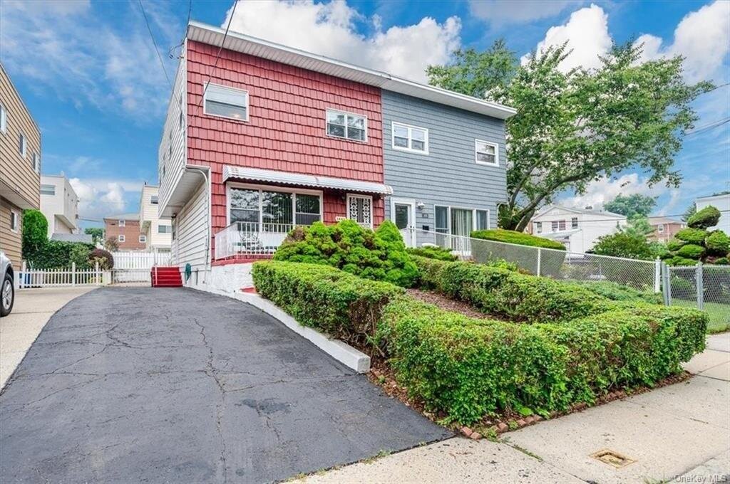
Bronx, NY 10465
Property details
The description and property data below may have been provided by a third party, the homeowner or public records.
1493 Shore Dr, Bronx, NY 10465 is a Single Family Home built in 1960. This property currently has an estimated value of $853,900. According to the Bronx public records, the property at 1493 Shore Dr, Bronx, NY 10465 has approximately 1,332 square feet, with a lot size of 2,588 square feet. Nearby schools include Ps 14 Senator John Calandra and Bronx Delta School.
Primary Land Use and Tax Lot Information
for 1493 Shore Dr

Property Price History
for 1493 Shore Dr
| Date | Event | Price | ||
|---|---|---|---|---|
| Oct 11, 2023 | Sold | $580,000 | $435 | Public Record |
| Oct 4, 2023 | Listing removed | — | — | OneKeyMLS |
Property Tax History
for 1493 Shore Dr
| Year | Taxes | |
|---|---|---|
| 2022 | $5,731 | $33,360 |
| 2021 | $5,689 | $35,040 |
Sold Homes
near 1493 Shore Dr
| Address | Price | Beds | Baths |
|---|---|---|---|
|
Bronx, NY 10461SF
|
$625,000
04/17/2024
|
4
|
3
|
|
Bronx, NY 10465SF
|
$610,000
12/21/2023
|
2
|
2
|
|
Bronx, NY 10461SF
|
$650,000
02/16/2024
|
4
|
2
|
|
Bronx, NY 10461SF
|
$510,000
04/23/2024
|
2
|
2
|
Homes For Sale
near 1493 Shore Dr
| Address | Price | Beds | Baths |
|---|---|---|---|
|
Bronx, NY 10464SF
|
$759,999
27 days ago
|
3
|
2
|
|
Bronx, NY 10461SF
|
$699,000
12 days ago
|
3
|
3
|
|
Bronx, NY 10465SF
|
$710,000
59 days ago
|
3
|
2
|
|
Bronx, NY 10465SF
|
$879,000
55 days ago
|
4
|
3
|
|
Bronx, NY 10465SF
|
$749,900
22 days ago
|
3
|
3
|
Home Value
for 1493 Shore Dr
Estimated values are not a substitute for professional expertise. Contact your RE agent for a market assessment.
Schools
serving 1493 Shore Dr
| School Name | Rating |
|---|---|
|
1016 EDISON AVE, The Bronx, NY 10465
|
— |
|
3041 BRUCKNER BLVD, The Bronx, NY 10461
|
7 / 10 |
|
3000 E TREMONT AVE, The Bronx, NY 10461
|
4 / 10 |
Data provided by
GreatSchools.org © 2024. All Rights Reserved.
School service boundaries are intended to be used as reference only.
To verify enrollment eligibility for a property, contact the school directly.
Flood Factor
for 1493 Shore Dr
3
|10
Moderate

FEMA Zone (Est.)
X (unshaded)
Flood insurance:
Recommended
Flood risks are increasing as sea levels rise and weather patterns change.
This property has a
Moderate Flood Factor
.
Flood Factor data provided by FloodFactor.