1511 Emmons Ave, Brooklyn, NY 11235 Kings County Last Updated: March 18, 2024
Pre-Foreclosure: Lis Pendens, Estimated Market Value $943,100
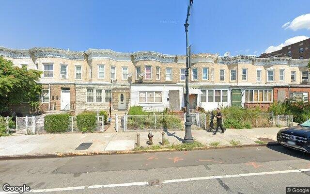
Description: 1511 Emmons Ave, Brooklyn, NY 11235 is a Single Family Home built in 1910. This property was last sold for $456,300 in 2017 and currently has an estimated value of $943,100. According to the Brooklyn public records, the property at 1511 Emmons Ave, Brooklyn, NY 11235 has approximately 1,660 square feet, with a lot size of 2,040 square feet. Nearby schools include Ps 209 Margaret Mead, Ps 225 The Eileen E Zaglin and Ps 771.
1,660 sqft
2,040 lot size
Year Built: 1910
Pre-foreclosure
1511 Emmons Ave, Brooklyn, NY 11235
Last Updated: March 18, 2024
1
Single Family Home
Town House
Estimated Market Value EMV $ 943,100
1511 Emmons Ave
bool(false)

bool(true)

bool(true)

int(0)
Estimated Market Value EMV $ 943,100
Foreclosure History
for 1511 Emmons Ave
for 1511 Emmons Ave
Type
Single Family Home
Town House
Last Sold
$456.3K in 2017
1511 Emmons Ave, Brooklyn, NY 11235 is a Single Family Home built in 1910. This property was last sold for $456,300 in 2017 and currently has an estimated value of $943,100. According to the Brooklyn public records, the property at 1511 Emmons Ave, Brooklyn, NY 11235 has approximately 1,660 square feet, with a lot size of 2,040 square feet. Nearby schools include Ps 209 Margaret Mead, Ps 225 The Eileen E Zaglin and Ps 771.
Property features
Year Built:
Year Built:
1910
1910
Living Area:
Living Area:
1660
1660
Building Class:
A5
One Family Dwellings: Attached Or Semi-detached
Floors on Main Building:
2
Building Dimensions:
20'
Actual Square Footage:
1,660
Calculated Square Footage:
1,280
Residential Floor Area:
1,660
Basement:
Below grade full basement
Address:
1511 EMMONS AVENUE
BIN
Name 1511 EMMONS AVENUE
Land Use:
01
One & Two Family Buildings
Calculated Lot Perimeter:
259.81 ft
Zoning Districts:
R6
Moderate-density residence district
Max Residential FAR:
2.43
Max Residential Sqft:
4,957
Buildable Residential Sqft:
3,297
Residential Area Distribution:
Assessed Land Value:
$13,320
Assessed Total Value:
$61,140
Last Recording Date:
Jan 8, 2024
Property Assessment Data:
Tax Class:
1
One- to three-unit residential properties
Taxable Assessed Value:
$35,686
Estimated Market Value by NYC DOF :
$1,019,000
Community District (CD):
315
City Council District:
48
Document DateDocument Type Unit Amount
Date
Event
Price
Price/Sqft
Source
Feb 13, 2017
Sold
$456,300
$275
Public Record
May 28, 2014
Sold
$500,000
$301
Public Record
Mar 31, 2005
Sold
$899,000
$542
Public Record
Nov 1, 2001
Sold
$350,000
$211
Public Record
Sep 26, 2001
Sold
$350,000
$211
Public Record
Year
Taxes
Land
Additions
Total Assessment
2022
$7,052
$13,320
$38,400
$51,720
2021
$7,019
$13,320
$43,380
$56,700
2020
$6,661
$13,320
$41,400
$54,720
2019
$6,220
$13,320
$43,080
$56,400
2018
$6,220
$8,652
$21,086
$29,738
2017
$6,000
$10,340
$19,098
$29,438
2016
$5,556
$13,185
$14,611
$27,796
2015
$5,127
$9,241
$16,983
$26,224
2014
$4,747
$8,733
$16,049
$24,782
2013
$4,755
$8,733
$16,049
$24,782
2012
$4,466
$13,946
$10,586
$24,532
2010
$3,734
$15,807
$7,357
$23,164
2009
$3,529
$14,556
$7,298
$21,854
2007
$3,155
$2,956
$17,488
$20,444
Address
Price
Built
Beds
Baths
Sqft
Lot Size
Distance
2204 E 16th St
Brooklyn, NY 11229SF
$650,000
01/10/2024
1960
4
3
1,648
-12difference
1,287
0.91 mi
201 Brighton 10th St
Brooklyn, NY 11235SF
$555,000
11/13/2023
1930
2
1
1,680
+20
2,400
0.26 mi
195 Girard St
Brooklyn, NY 11235SF
$1,775,000
01/22/2024
1925
4
3
1,750
+90
4,000
0.57 mi
2284 E 17th St
Brooklyn, NY 11229SF
$1,038,000
02/15/2024
1935
4
2
1,960
+300
2,750
0.79 mi
3031 Voorhies Ave
Brooklyn, NY 11235SF
$700,000
03/14/2024
1930
3
3
1,280
-380
2,000
0.98 mi
79 Amherst St
Brooklyn, NY 11235SF
$2,475,000
02/26/2024
2009
5
8
4,039
+2,379
4,160
0.25 mi
80 Beaumont St
Brooklyn, NY 11235SF
$1,500,000
02/02/2024
1920
5
3
2,132
+472
4,000
0.25 mi
2616 E 11th St
Brooklyn, NY 11235SF
$875,000
01/18/2024
1955
3
2
2,160
+500
2,000
0.42 mi
18 Brighton 8th Pl
Brooklyn, NY 11235SF
$250,000
01/31/2024
1940
1
1
756
-904
2,077
0.43 mi
1808 Avenue Y
Brooklyn, NY 11235SF
$838,000
04/25/2024
1950
3
3
1,088
-572
1,600
0.47 mi
Address
Price
Built
Beds
Baths
Sqft
Lot Size
Distance
28 Lancaster Ave
Brooklyn, NY 11223SF
$4,200,000
54 days ago
1950
6
4
1,650
-10difference
3,000
0.83 mi
3098 Nostrand Ave
Brooklyn, NY 11229SF
$758,000
109 days ago
1940
3
2
1,632
-28
1,680
1.81 mi
1819 Burnett St
Brooklyn, NY 11229SF
$939,000
153 days ago
1935
3
3
1,700
+40
2,150
1.88 mi
739 Avenue X
Brooklyn, NY 11235MF
$950,000
38 days ago
—
3
2
1,704
+44
2,125
0.72 mi
2417 E 4th St
Brooklyn, NY 11223SF
$999,990
55 days ago
1960
3
3
1,597
-63
1,190
0.88 mi
2177 E 19th St
Brooklyn, NY 11229SF
$959,999
112 days ago
1960
3
3
1,595
-65
1,200
0.96 mi
2221 E 28th St
Brooklyn, NY 11229SF
$995,000
60 days ago
1940
3
2
1,592
-68
1,600
1.10 mi
2151 Ford St
Brooklyn, NY 11229SF
$899,888
83 days ago
1940
3
3
1,584
-76
2,250
1.38 mi
2722 Avenue R
Brooklyn, NY 11229SF
$1,748,000
31 days ago
1925
5
2
1,580
-80
3,400
1.67 mi
1559 E 15th St
Brooklyn, NY 11230SF
$1,050,000
102 days ago
1925
3
2
1,566
-94
2,000
1.96 mi
Estimated values are not a substitute for professional expertise. Contact your RE agent for a market assessment.
School Name
Rating
Grades
Parent Rating
Distance
I.S. 98 Bay Academy
, Brooklyn , NY 11235
10 / 10
6−8
0.06 mi
St Mark School
, Brooklyn , NY 11235
—
PK−8
0.34 mi
Ps 209 Margaret Mead
, Brooklyn , NY 11235
8 / 10
K−8
0.51 mi
William E Grady Career And Technical Education High School
, Brooklyn , NY 11235
2 / 10
9−12
0.54 mi
Mesivta/Yeshiva Gedola Manhattan
, Brooklyn , NY 11235
—
9−12
—
0.22 mi
Mazel Day School
, Brooklyn , NY 11235
—
K−8
—
0.21 mi
Ps 225 The Eileen E Zaglin
, Brooklyn , NY 11235
7 / 10
K−8
0.30 mi
Ps 771
, Brooklyn , NY 11235
—
K−12
—
0.30 mi
Abraham Lincoln High School
, Brooklyn , NY 11235
3 / 10
9−12
0.80 mi
Flood insurance:
Required
Flood risks are increasing as sea levels rise and weather patterns change.
This property has a
Extreme Flood Factor
.
Please Log In
Please wait... If this message is not eventually replaced by the proper contents of the document, your PDF viewer may not be able to display this type of document.
You can upgrade to the latest version of Adobe Reader for Windows®, Mac, or Linux® by visiting
https://get.adobe.com/reader/ this link .
For more assistance with Adobe Reader visit
http://get.adobe.com/reader/ this link .
You can download this PDF-document from
here .