157-10 Locke Ave, Whitestone, NY 11357 Queens County Last Updated: March 6, 2024
Pre-Foreclosure: Lis Pendens, Estimated Market Value $1,395,900
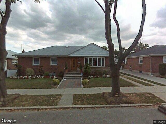
Description: 157-10 Locke Ave, Whitestone, NY 11357 is a Single Family Home built in 1955. This property was last sold for $373,000 in 2002 and currently has an estimated value of $1,395,900. According to the Whitestone public records, the property at 157-10 Locke Ave, Whitestone, NY 11357 has approximately 1,170 square feet, with a lot size of 4,855 square feet. Nearby schools include Ps 193 Alfred J Kennedy, Ps 209 Clearview Gardens and Ps 184 Flushing Manor.
1,170 sqft
4,855 lot size
Year Built: 1955
Pre-foreclosure
157-10 Locke Ave, Whitestone, NY 11357
Last Updated: March 6, 2024
1
Single Family Home
Town House
Estimated Market Value EMV $ 1,395,900
157-10 Locke Ave
bool(false)

bool(true)

bool(true)

int(0)
Estimated Market Value EMV $ 1,395,900
Foreclosure History
for 157-10 Locke Ave
for 157-10 Locke Ave
Type
Single Family Home
Town House
157-10 Locke Ave, Whitestone, NY 11357 is a Single Family Home built in 1955. This property was last sold for $373,000 in 2002 and currently has an estimated value of $1,395,900. According to the Whitestone public records, the property at 157-10 Locke Ave, Whitestone, NY 11357 has approximately 1,170 square feet, with a lot size of 4,855 square feet. Nearby schools include Ps 193 Alfred J Kennedy, Ps 209 Clearview Gardens and Ps 184 Flushing Manor.
Property features
Year Built:
Year Built:
1955
1955
Living Area:
Living Area:
1170
1170
Building Class:
A2
One Family Dwellings: One Story (Permanent Living Quarters)
Floors on Main Building:
1
Building Dimensions:
26'
Actual Square Footage:
1,170
Calculated Square Footage:
1,170
Residential Floor Area:
1,170
Basement:
Below grade full basement
Address:
157-10 LOCKE AVENUE
BIN
Name 157-10 LOCKE AVENUE
Land Use:
01
One & Two Family Buildings
Lot Dimensions:
61'
Calculated Lot Perimeter:
276.97 ft
Zoning Districts:
R2A
Lower-density residence district
Max Residential FAR:
0.50
Max Residential Sqft:
2,428
Buildable Residential Sqft:
1,258
Residential Area Distribution:
Assessed Land Value:
$14,880
Assessed Total Value:
$59,640
Last Recording Date:
Jan 8, 2024
Property Assessment Data:
Tax Class:
1
One- to three-unit residential properties
Taxable Assessed Value:
$49,204
Estimated Market Value by NYC DOF :
$994,000
Community District (CD):
407
City Council District:
19
Document DateDocument Type Unit Amount
Date
Event
Price
Price/Sqft
Source
Feb 19, 2002
Sold
$373,000
$319
Public Record
Year
Taxes
Land
Additions
Total Assessment
2022
$8,742
$14,880
$39,780
$54,660
2021
$9,216
$14,880
$40,500
$55,380
2020
$9,199
$14,880
$42,000
$56,880
2019
$8,577
$14,880
$41,940
$56,820
2018
$8,092
$10,542
$28,141
$38,683
2017
$7,439
$12,765
$23,729
$36,494
2016
$7,296
$11,529
$24,965
$36,494
2015
$7,082
$13,280
$22,939
$36,219
2014
$6,546
$14,368
$19,802
$34,170
2013
$5,887
$14,206
$18,030
$32,236
2011
$4,978
$14,374
$16,038
$30,412
2010
$4,880
$13,432
$16,980
$30,412
2009
$4,629
$16,620
$13,563
$30,183
2007
$3,712
$3,923
$21,421
$25,344
Address
Price
Built
Beds
Baths
Sqft
Lot Size
Distance
160-55 25th Ave
Whitestone, NY 11357SF
$1,100,000
12/19/2023
1960
3
3
1,175
+5difference
3,542
0.73 mi
163-56 20th Rd
Whitestone, NY 11357SF
$1,080,000
03/18/2024
1945
4
3
1,179
+9
4,100
0.56 mi
166-24 24th Ave
Whitestone, NY 11357SF
$999,000
01/22/2024
1940
3
3
1,150
-20
4,000
0.79 mi
151-14 10th Ave
Whitestone, NY 11357SF
$885,000
02/12/2024
1955
3
2
1,144
-26
4,000
0.65 mi
157-49 25 Ave
Whitestone, NY 11357SF
$1,050,000
04/08/2024
1950
2
3
1,196
+26
3,700
0.69 mi
14-21 161st St
Beechhurst, NY 11357SF
$3,050,000
11/02/2023
2018
4
7
3,346
+2,176
6,400
0.29 mi
1307 157th St
Whitestone, NY 11357SF
$1,600,000
04/04/2024
1955
4
3
2,880
+1,710
5,196
0.31 mi
20-04 Clintonville St
Whitestone, NY 11357SF
$1,300,000
12/23/2023
1950
5
4
1,138
-32
4,243
0.34 mi
154-28 20th Ave
Whitestone, NY 11357SF
$1,075,000
11/27/2023
1950
4
2
1,281
+111
3,897
0.35 mi
150-30 15th Dr
Whitestone, NY 11357SF
$824,898
04/22/2024
1920
2
3
1,370
+200
2,438
0.39 mi
Address
Price
Built
Beds
Baths
Sqft
Lot Size
Distance
149-09 12th Ave
Whitestone, NY 11357SF
$830,000
20 days ago
1920
3
3
1,152
-18difference
1,980
0.69 mi
13-18 154 St
Whitestone, NY 11357SF
$999,000
35 days ago
1960
4
2
1,152
-18
5,000
0.34 mi
147-54 5th Ave
Whitestone, NY 11357SF
$1,100,000
51 days ago
1945
3
2
1,190
+20
4,040
1.04 mi
8 Magnolia Pl
Bronx, NY 10465SF
$400,000
283 days ago
1930
2
2
1,150
-20
—
1.93 mi
1 Schuyler Ter Unit 1/415
Bronx, NY 10465SF
$550,000
20 days ago
1920
3
2
1,146
-24
1,296
1.70 mi
28-27 Jordan St
Flushing, NY 11358SF
$989,000
82 days ago
1950
2
2
1,195
+25
3,842
1.20 mi
151-23 24th Ave
Whitestone, NY 11357SF
$1,099,000
96 days ago
1955
3
2
1,144
-26
3,550
0.65 mi
213-03 33rd Ave
Bayside, NY 11361SF
$1,238,000
22 days ago
1950
4
2
1,200
+30
5,500
1.81 mi
24-31 202 St
Bayside, NY 11360SF
$998,000
90 days ago
1950
3
2
1,200
+30
4,275
1.08 mi
17-11 201st St
Bayside, NY 11360SF
$958,000
96 days ago
1910
3
1
1,200
+30
5,000
0.72 mi
Estimated values are not a substitute for professional expertise. Contact your RE agent for a market assessment.
School Name
Rating
Grades
Parent Rating
Distance
Ps 193 Alfred J Kennedy
, Queens , NY 11357
10 / 10
K−5
0.53 mi
Bell Academy
, Queens , NY 11360
9 / 10
6−8
1.43 mi
Whitestone Academy
, Queens , NY 11357
—
8−12
0.57 mi
Qsac School
, Queens , NY 11357
—
—
0.60 mi
St Lukes School
, Queens , NY 11357
—
PK−8
0.27 mi
Jhs 194 William Carr
, Queens , NY 11357
7 / 10
6−8
0.16 mi
Bayside High School
, Queens , NY 11361
7 / 10
9−12
1.59 mi
Ps 209 Clearview Gardens
, Queens , NY 11357
8 / 10
K−5
0.50 mi
Ps 184 Flushing Manor
, Queens , NY 11357
9 / 10
K−5
0.55 mi
Jhs 185 Edward Bleeker
, Queens , NY 11354
9 / 10
6−8
0.99 mi
FEMA Zone (Est.)
X (unshaded)
Flood insurance:
Recommended
Flood risks are increasing as sea levels rise and weather patterns change.
This property has a
Minimal Flood Factor
.
Please Log In
Please wait... If this message is not eventually replaced by the proper contents of the document, your PDF viewer may not be able to display this type of document.
You can upgrade to the latest version of Adobe Reader for Windows®, Mac, or Linux® by visiting
https://get.adobe.com/reader/ this link .
For more assistance with Adobe Reader visit
http://get.adobe.com/reader/ this link .
You can download this PDF-document from
here .