1570 Brooklyn Ave, Brooklyn, NY 11210 Kings County Last Updated: April 17, 2024
Pre-Foreclosure: Lis Pendens, Estimated Market Value $782,300
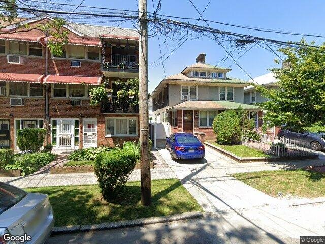
Description: 1570 Brooklyn Ave, Brooklyn, NY 11210 is a Single Family Home built in 1935. This property was last sold for $150,000 in 1994 and currently has an estimated value of $782,300. According to the Brooklyn public records, the property at 1570 Brooklyn Ave, Brooklyn, NY 11210 has approximately 1,380 square feet, with a lot size of 2,200 square feet. Nearby schools include Central Brooklyn Ascend Charter, Ps 269 Nostrand, Ps 361 East Flatbush Early Childhood School and Ps 198.
1,380 sqft
2,200 lot size
Year Built: 1935
Pre-foreclosure
1570 Brooklyn Ave, Brooklyn, NY 11210
Last Updated: April 17, 2024
1
Single Family Home
Town House
Estimated Market Value EMV $ 782,300
1570 Brooklyn Ave
bool(false)

bool(true)

bool(true)

int(0)
Estimated Market Value EMV $ 782,300
Foreclosure History
for 1570 Brooklyn Ave
for 1570 Brooklyn Ave
Type
Single Family Home
Town House
1570 Brooklyn Ave, Brooklyn, NY 11210 is a Single Family Home built in 1935. This property was last sold for $150,000 in 1994 and currently has an estimated value of $782,300. According to the Brooklyn public records, the property at 1570 Brooklyn Ave, Brooklyn, NY 11210 has approximately 1,380 square feet, with a lot size of 2,200 square feet. Nearby schools include Central Brooklyn Ascend Charter, Ps 269 Nostrand, Ps 361 East Flatbush Early Childhood School and Ps 198.
Property features
Year Built:
Year Built:
1935
1935
Living Area:
Living Area:
1380
1380
Building Class:
A9
One Family Dwellings: Miscellaneous
Floors on Main Building:
2
Building Dimensions:
15'
Actual Square Footage:
1,380
Calculated Square Footage:
1,260
Residential Floor Area:
1,380
Basement:
Below grade full basement
Address:
1570 BROOKLYN AVENUE
BIN
Name 1570 BROOKLYN AVENUE
Land Use:
01
One & Two Family Buildings
Calculated Lot Perimeter:
248.65 ft
Zoning Districts:
R6
Moderate-density residence district
Max Residential FAR:
2.43
Max Residential Sqft:
5,346
Buildable Residential Sqft:
3,966
Residential Area Distribution:
Assessed Land Value:
$17,340
Assessed Total Value:
$45,840
Last Recording Date:
Jan 8, 2024
Property Assessment Data:
Tax Class:
1
One- to three-unit residential properties
Taxable Assessed Value:
$30,103
Estimated Market Value by NYC DOF :
$764,000
Community District (CD):
317
City Council District:
45
Document DateDocument Type Unit Amount
Recorded DateDocument Type Unit Amount
Date
Event
Price
Price/Sqft
Source
Jul 7, 1994
Sold
$150,000
$109
Public Record
Dec 30, 1993
Sold
$33,000
$24
Public Record
Jan 1, 1981
Sold
$46,363
$34
Public Record
Year
Taxes
Land
Additions
Total Assessment
2022
$5,348
$17,340
$18,960
$36,300
2021
$5,320
$17,340
$15,060
$32,400
2020
$5,351
$17,340
$18,780
$36,120
2019
$5,247
$17,340
$22,620
$39,960
2018
$4,950
$11,268
$12,399
$23,667
2017
$4,551
$13,556
$8,772
$22,328
2016
$4,211
$13,712
$7,355
$21,067
2015
$4,119
$11,807
$9,260
$21,067
2014
$4,005
$14,073
$6,832
$20,905
2013
$3,785
$14,317
$5,406
$19,723
2012
$3,387
$12,319
$6,288
$18,607
2010
$2,999
$9,885
$7,671
$17,556
2009
$2,976
$11,560
$5,996
$17,556
2007
$2,393
$2,743
$12,763
$15,506
Address
Price
Built
Beds
Baths
Sqft
Lot Size
Distance
1796 Schenectady Ave
Brooklyn, NY 11234SF
$790,000
03/29/2024
1925
3
3
1,376
-4difference
2,033
0.73 mi
1800 Troy Ave
Brooklyn, NY 11234SF
$350,000
02/16/2024
1915
—
—
1,396
+16
2,000
0.63 mi
1885 Schenectady Ave
Brooklyn, NY 11234SF
$710,000
04/10/2024
1925
3
2
1,414
+34
2,500
0.86 mi
1074 E 37th St
Brooklyn, NY 11210SF
$475,000
03/29/2024
1925
3
2
1,344
-36
2,000
0.31 mi
1922 New York Ave
Brooklyn, NY 11210SF
$670,000
01/23/2024
1925
3
1
1,428
+48
2,000
0.65 mi
840 E 40th St
East Flatbush, NY 11203SF
$670,000
03/14/2024
1920
3
2
1,522
+142
2,300
0.20 mi
3522 Avenue H
Brooklyn, NY 11210SF
$795,000
12/28/2023
1920
4
3
1,472
+92
1,950
0.22 mi
4012 Farragut Rd
Brooklyn, NY 11210SF
$780,000
04/30/2024
1920
4
2
1,836
+456
2,375
0.26 mi
1060 E 39th St
Brooklyn, NY 11210SF
$689,000
03/26/2024
1920
3
4
1,284
-96
2,000
0.32 mi
703 E 39th St
Brooklyn, NY 11203SF
$550,000
11/16/2023
1930
3
2
1,280
-100
2,000
0.38 mi
Address
Price
Built
Beds
Baths
Sqft
Lot Size
Distance
2514 Quentin Rd
Brooklyn, NY 11229SF
$899,000
54 days ago
1925
3
2
1,376
-4difference
2,667
1.80 mi
3316 Farragut Rd
East Flatbush, NY 11203SF
$965,000
78 days ago
1920
3
2
1,404
+24
2,000
0.15 mi
394 Linden Blvd
Brooklyn, NY 11203SF
$899,000
100 days ago
1920
4
2
1,404
+24
2,160
1.23 mi
3702 Avenue J
Brooklyn, NY 11210SF
$715,000
41 days ago
—
3
2
1,404
+24
—
0.55 mi
403 Linden Blvd
Brooklyn, NY 11203SF
$725,000
3 days ago
1930
3
1
1,405
+25
2,165
1.27 mi
145 E 38th St
Brooklyn, NY 11203SF
$685,000
26 days ago
1920
3
3
1,350
-30
2,000
1.31 mi
1349 E 65th St
Brooklyn, NY 11234SF
$424,000
16 days ago
1925
2
2
1,338
-42
4,800
1.69 mi
1813 E 24th St
Brooklyn, NY 11229SF
$1,450,000
60 days ago
1930
3
3
1,428
+48
1,999
1.99 mi
449 E 34th St
Brooklyn, NY 11203SF
$509,600
48 days ago
1910
3
1
1,328
-52
1,123
0.77 mi
1192 E 18th St
Brooklyn, NY 11230SF
$1,250,000
79 days ago
1920
3
2
1,440
+60
2,400
1.24 mi
Estimated values are not a substitute for professional expertise. Contact your RE agent for a market assessment.
School Name
Rating
Grades
Parent Rating
Distance
New Vistas Academy
, Brooklyn , NY 11210
—
1−12
—
0.13 mi
Central Brooklyn Ascend Charter
, Brooklyn , NY 11226
6 / 10
K−7
0.46 mi
St. Vincent Ferrer School
, Brooklyn , NY 11210
—
K−8
—
0.06 mi
Ps 269 Nostrand
, Brooklyn , NY 11210
—
3−5
0.34 mi
Ps 361 East Flatbush Early Childhood School
, Brooklyn , NY 11210
3 / 10
K−5
0.34 mi
New Vistas Academy
, Brooklyn , NY 11210
—
K−12
0.10 mi
Midwood High School
, Brooklyn , NY 11210
7 / 10
9−12
0.55 mi
Ps 198
, Brooklyn , NY 11210
5 / 10
K−5
0.32 mi
Andries Hudde School
, Brooklyn , NY 11210
5 / 10
6−8
0.81 mi
James Madison High School
, Brooklyn , NY 11229
4 / 10
9−12
1.75 mi
FEMA Zone (Est.)
X (unshaded)
Flood insurance:
Recommended
Flood risks are increasing as sea levels rise and weather patterns change.
This property has a
Minimal Flood Factor
.
Please Log In
Please wait... If this message is not eventually replaced by the proper contents of the document, your PDF viewer may not be able to display this type of document.
You can upgrade to the latest version of Adobe Reader for Windows®, Mac, or Linux® by visiting
https://get.adobe.com/reader/ this link .
For more assistance with Adobe Reader visit
http://get.adobe.com/reader/ this link .
You can download this PDF-document from
here .