1647 Taylor Ave, Bronx, NY 10460 Bronx County Last Updated: March 5, 2024
Pre-Foreclosure: Lis Pendens, Estimated Market Value $736,400
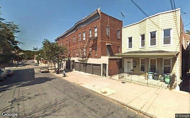
Description: 1647 Taylor Ave, Bronx, NY 10460 is a Multi Family Home built in 1899. This property was last sold for $410,000 in 2010 and currently has an estimated value of $736,400. According to the Bronx public records, the property at 1647 Taylor Ave, Bronx, NY 10460 has approximately 1,070 square feet, with a lot size of 2,375 square feet. Nearby schools include Stem Bridge School (The), Bronx Charter School For Excellence 2, P.S. 83 Donald Hertz, Icahn Charter School 2 and Ps Ms 498 Van Nest Academy.
1,070 sqft
2,375 lot size
Year Built: 1899
Pre-foreclosure
1647 Taylor Ave, Bronx, NY 10460
Last Updated: March 5, 2024
1
Multi Family Home
Estimated Market Value EMV $ 736,400
1647 Taylor Ave
bool(false)

bool(true)

bool(true)

int(0)
Estimated Market Value EMV $ 736,400
Foreclosure History
for 1647 Taylor Ave
for 1647 Taylor Ave
1647 Taylor Ave, Bronx, NY 10460 is a Multi Family Home built in 1899. This property was last sold for $410,000 in 2010 and currently has an estimated value of $736,400. According to the Bronx public records, the property at 1647 Taylor Ave, Bronx, NY 10460 has approximately 1,070 square feet, with a lot size of 2,375 square feet. Nearby schools include Stem Bridge School (The), Bronx Charter School For Excellence 2, P.S. 83 Donald Hertz, Icahn Charter School 2 and Ps Ms 498 Van Nest Academy.
Property features
Year Built:
Year Built:
1899
1899
Living Area:
Living Area:
1070
1070
Building Class:
B1
Two Family Dwellings: Brick
Floors on Main Building:
2
Building Dimensions:
20'
Actual Square Footage:
1,070
Calculated Square Footage:
1,600
Residential Floor Area:
1,070
Basement:
Below grade full basement
Address:
1647 TAYLOR AVENUE
BIN
Name 1647 TAYLOR AVENUE
Land Use:
01
One & Two Family Buildings
Calculated Lot Perimeter:
241.99 ft
Zoning Districts:
R5
Lower-density residence district
Max Residential FAR:
1.25
Max Residential Sqft:
2,969
Buildable Residential Sqft:
1,899
Residential Area Distribution:
Assessed Land Value:
$11,040
Assessed Total Value:
$35,280
Last Recording Date:
Jan 8, 2024
Property Assessment Data:
Tax Class:
1
One- to three-unit residential properties
Taxable Assessed Value:
$30,413
Estimated Market Value by NYC DOF :
$588,000
Community District (CD):
211
City Council District:
13
Document DateDocument Type Unit Amount
Date
Event
Price
Price/Sqft
Source
Jun 11, 2007
Sold
$520,000
$486
Public Record
Jan 6, 1997
Sold
$169,000
$158
Public Record
Oct 8, 1996
Sold
$97,500
$91
Public Record
Jul 27, 1988
Sold
$148,000
$138
Public Record
Apr 23, 1985
Sold
$65,000
$61
Public Record
Year
Taxes
Land
Additions
Total Assessment
2022
$5,404
$11,040
$26,160
$37,200
2021
$5,606
$11,040
$23,220
$34,260
2020
$5,638
$11,040
$25,260
$36,300
2019
$1,759
$11,040
$18,840
$29,880
2018
$5,002
$8,852
$15,059
$23,911
2017
$4,598
$8,889
$13,671
$22,560
2016
$4,437
$11,040
$11,160
$22,200
2015
$4,377
$12,146
$10,241
$22,387
2015
$4,045
$9,748
$11,372
$21,120
2014
$3,525
$11,365
$8,561
$19,926
2011
$3,105
$10,642
$8,158
$18,800
2010
$2,958
$10,642
$8,158
$18,800
2009
$2,771
$12,604
$6,052
$18,656
2007
$2,218
$2,397
$13,270
$15,667
Address
Price
Built
Beds
Baths
Sqft
Lot Size
Distance
1146 Thieriot Ave
Bronx, NY 10472MF
$600,000
12/12/2023
1925
4
3
1,656
+586difference
2,500
0.89 mi
1818 Haight Ave
Bronx, NY 10461MF
$690,000
03/21/2024
1940
3
3
1,782
+712
1,800
1.00 mi
1951 Benedict Ave
Bronx, NY 10462MF
$1,100,000
04/04/2024
1925
5
4
1,890
+820
5,001
0.71 mi
1735 Hone Ave
Bronx, NY 10461MF
$942,000
11/09/2023
1925
3
3
2,183
+1,113
5,000
0.87 mi
1735 Hone Ave Unit Townhouse
Bronx, NY 10461MF
$942,000
11/09/2023
1925
3
3
2,183
+1,113
5,000
0.87 mi
1705 Hone Ave
Bronx, NY 10461MF
$912,000
04/08/2024
1925
4
—
2,340
+1,270
3,742
0.87 mi
1722 Saint Peters Ave
Bronx, NY 10461MF
$950,000
01/11/2024
1910
6
4
2,268
+1,198
2,417
0.99 mi
Address
Price
Built
Beds
Baths
Sqft
Lot Size
Distance
2056 Arthur Ave
Bronx, NY 10457MF
$599,000
68 days ago
1901
—
—
1,072
+2difference
1,816
1.30 mi
1947 Fowler Ave
Bronx, NY 10462SF
$599,000
26 days ago
1940
2
2
1,120
+50
2,108
0.69 mi
1960 Chatterton Ave
Bronx, NY 10472SF
$899,000
208 days ago
1950
2
1
966
-104
5,149
1.16 mi
Estimated values are not a substitute for professional expertise. Contact your RE agent for a market assessment.
School Name
Rating
Grades
Parent Rating
Distance
Stem Bridge School (The)
, The Bronx , NY 10462
10 / 10
K−5
0.22 mi
Bronx Charter School For Excellence 2
, The Bronx , NY 10462
10 / 10
K−5
0.37 mi
St Anthony School
, Bronx , NY 10460
—
K−8
0.27 mi
P.S. 83 Donald Hertz
, The Bronx , NY 10462
7 / 10
K−8
0.74 mi
Icahn Charter School 2
, The Bronx , NY 10462
9 / 10
K−8
0.60 mi
Ps Ms 498 Van Nest Academy
, The Bronx , NY 10462
7 / 10
K−8
0.60 mi
Bronx High School For The Visual Arts
, The Bronx , NY 10462
4 / 10
9−12
0.72 mi
Iahd-St. Mary & St. Jude
, Bronx , NY 10462
—
—
0.65 mi
St Raymond Elementary School
, The Bronx , NY 10462
—
PK−8
0.75 mi
Urban Assembly Charter - Computer Science
, The Bronx , NY 10472
7 / 10
9−11
0.85 mi
FEMA Zone (Est.)
X (unshaded)
Flood insurance:
Recommended
Flood risks are increasing as sea levels rise and weather patterns change.
This property has a
Severe Flood Factor
.
Please Log In
Please wait... If this message is not eventually replaced by the proper contents of the document, your PDF viewer may not be able to display this type of document.
You can upgrade to the latest version of Adobe Reader for Windows®, Mac, or Linux® by visiting
https://get.adobe.com/reader/ this link .
For more assistance with Adobe Reader visit
http://get.adobe.com/reader/ this link .
You can download this PDF-document from
here .