
bool(false)

bool(true)

bool(true)

int(0)
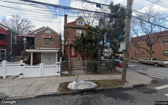
Bronx, NY 10466
Auction Information
| Auction Date | Apr 22, 2024 |
| Auction Time | 2:20 PM |
| Auction Location | COURTROOM 411 851 GRAND CONCOURSE |
Property details
The description and property data below may have been provided by a third party, the homeowner or public records.
1815 Edenwald Ave, Bronx, NY 10466 is a Multi Family Home built in 1930. This property currently has an estimated value of $830,000. According to the Bronx public records, the property at 1815 Edenwald Ave, Bronx, NY 10466 has approximately 2,341 square feet, with a lot size of 2,500 square feet. Nearby schools include Ps 87 and Ps 68.
Primary Land Use and Tax Lot Information
for 1815 Edenwald Ave

Property Tax History
for 1815 Edenwald Ave
| Year | Taxes | |
|---|---|---|
| 2022 | $6,195 | $49,020 |
| 2021 | $6,197 | $40,020 |
Sold Homes
near 1815 Edenwald Ave
| Address | Price | Beds | Baths |
|---|---|---|---|
|
Bronx, NY 10466MF
|
$965,000
12/11/2023
|
6
|
7
|
|
Bronx, NY 10466MF
|
$838,000
02/23/2024
|
6
|
2
|
|
Bronx, NY 10469MF
|
$800,000
12/12/2023
|
5
|
3
|
|
Bronx, NY 10466MF
|
$710,000
03/28/2024
|
5
|
3
|
Homes For Sale
near 1815 Edenwald Ave
| Address | Price | Beds | Baths |
|---|---|---|---|
|
Bronx, NY 10466MF
|
$899,000
25 days ago
|
9
|
4
|
|
Bronx, NY 10470MF
|
$1,200,000
39 days ago
|
7
|
5
|
|
Bronx, NY 10466MF
|
$1,115,000
70 days ago
|
6
|
4
|
|
Bronx, NY 10470MF
|
$849,000
12 days ago
|
5
|
2
|
|
Mount Vernon, NY 10550MF
|
$770,000
662 days ago
|
6
|
3
|
Home Value
for 1815 Edenwald Ave
Estimated values are not a substitute for professional expertise. Contact your RE agent for a market assessment.
Schools
serving 1815 Edenwald Ave
| School Name | Rating |
|---|---|
|
1935 BUSSING AVE, The Bronx, NY 10466
|
5 / 10 |
|
1137 E 223RD ST, The Bronx, NY 10466
|
— |
|
4300 Baychester Avenue, Bronx, NY 10466
|
— |
Data provided by
GreatSchools.org © 2024. All Rights Reserved.
School service boundaries are intended to be used as reference only.
To verify enrollment eligibility for a property, contact the school directly.
Flood Factor
for 1815 Edenwald Ave
1
|10
Minimal

FEMA Zone (Est.)
X (unshaded)
Flood insurance:
Recommended
Flood risks are increasing as sea levels rise and weather patterns change.
This property has a
Minimal Flood Factor
.
Although flood risks across the country are changing because of the environment, this property is unlikely to flood over the next 30 years.
Although flood risks across the country are changing because of the environment, this property is unlikely to flood over the next 30 years.
Flood Factor data provided by FloodFactor.