1853 E 28th St, Brooklyn, NY 11229 Kings County Last Updated: March 13, 2024
Pre-Foreclosure: Lis Pendens, Estimated Market Value $1,343,100
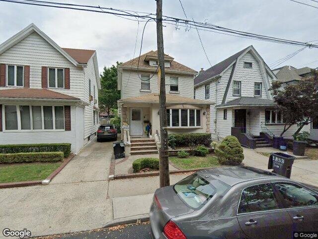
Description: 1853 E 28th St, Brooklyn, NY 11229 is a Single Family Home built in 1925. This property was last sold for $257,000 in 1998 and currently has an estimated value of $1,343,100. According to the Brooklyn public records, the property at 1853 E 28th St, Brooklyn, NY 11229 has approximately 1,410 square feet, with a lot size of 3,000 square feet. Nearby schools include Ps 206 Joseph F Lamb, Ps 197 The Kings Highway Academy and Ps 255 Barbara Reing School.
1,410 sqft
3,000 lot size
Year Built: 1925
Pre-foreclosure
1853 E 28th St, Brooklyn, NY 11229
Last Updated: March 13, 2024
1
Single Family Home
Town House
Estimated Market Value EMV $ 1,343,100
1853 E 28th St
bool(false)

bool(true)

bool(true)

int(0)
Estimated Market Value EMV $ 1,343,100
Foreclosure History
for 1853 E 28th St
for 1853 E 28th St
Type
Single Family Home
Town House
1853 E 28th St, Brooklyn, NY 11229 is a Single Family Home built in 1925. This property was last sold for $257,000 in 1998 and currently has an estimated value of $1,343,100. According to the Brooklyn public records, the property at 1853 E 28th St, Brooklyn, NY 11229 has approximately 1,410 square feet, with a lot size of 3,000 square feet. Nearby schools include Ps 206 Joseph F Lamb, Ps 197 The Kings Highway Academy and Ps 255 Barbara Reing School.
Property features
Year Built:
Year Built:
1925
1925
Zoning:
Zoning:
R3-2
R3-2
Living Area:
Living Area:
1410
1410
Building Class:
A1
One Family Dwellings: Two Stories Detached (Small Or Moderate Size, With Or Without Attic)
Floors on Main Building:
2
Building Dimensions:
20'
Actual Square Footage:
1,410
Calculated Square Footage:
1,200
Residential Floor Area:
1,410
Basement:
Below grade full basement
Address:
1853 EAST 28 STREET
BIN
Name 1853 EAST 28 STREET
Land Use:
01
One & Two Family Buildings
Calculated Lot Perimeter:
261.09 ft
Zoning Districts:
R3-2
Lower-density residence district
Max Residential FAR:
0.50
Max Residential Sqft:
1,500
Buildable Residential Sqft:
90
Residential Area Distribution:
Assessed Land Value:
$17,160
Assessed Total Value:
$67,740
Exempt Total Value:
$1,400
Last Recording Date:
Jan 8, 2024
Property Assessment Data:
Tax Class:
1
One- to three-unit residential properties
Taxable Assessed Value:
$48,472
Estimated Market Value by NYC DOF :
$1,129,000
Community District (CD):
315
City Council District:
48
Document DateDocument Type Unit Amount
Date
Event
Price
Price/Sqft
Source
Aug 31, 2016
Sold
$257,000
$428
Brooklyn
Jun 15, 1998
Sold
$257,000
$182
Public Record
Apr 30, 1998
Listed
$289,000
$482
Brooklyn
Dec 1, 1981
Sold
$102,727
$73
Public Record
Year
Taxes
Land
Additions
Total Assessment
2022
$8,639
$17,160
$57,240
$74,400
2021
$8,661
$17,160
$48,240
$65,400
2020
$8,710
$17,160
$50,160
$67,320
2019
$8,401
$17,160
$43,860
$61,020
2018
$7,939
$11,171
$28,241
$39,412
2017
$7,296
$13,288
$23,975
$37,263
2016
$6,780
$11,893
$23,577
$35,470
2015
$6,624
$11,230
$24,227
$35,457
2014
$6,330
$13,158
$21,476
$34,634
2013
$6,004
$13,254
$19,590
$32,844
2012
$5,360
$16,807
$14,246
$31,053
2010
$4,772
$17,744
$11,815
$29,559
2009
$4,696
$19,911
$9,637
$29,548
2007
$3,794
$4,507
$21,371
$25,878
Address
Price
Built
Beds
Baths
Sqft
Lot Size
Distance
4122 Fillmore Ave
Brooklyn, NY 11234SF
$1,150,000
01/25/2024
1925
3
3
1,408
-2difference
4,000
1.00 mi
1596 E 22nd St
Brooklyn, NY 11210SF
$970,000
03/05/2024
1920
3
2
1,404
-6
2,000
0.62 mi
1596 E 21st St
Brooklyn, NY 11210SF
$1,290,000
02/07/2024
1930
3
3
1,404
-6
2,383
0.74 mi
2046 E 23rd St
Brooklyn, NY 11229SF
$950,000
04/18/2024
1925
3
3
1,400
-10
1,950
0.42 mi
3031 Avenue R
Brooklyn, NY 11229SF
$995,000
11/15/2023
1920
3
2
1,386
-24
3,200
0.34 mi
2610 Avenue S
Brooklyn, NY 11229SF
$1,925,000
04/18/2024
1935
3
2
2,148
+738
4,000
0.13 mi
1820 Haring St
Brooklyn, NY 11229SF
$720,000
02/11/2024
1940
3
2
1,890
+480
1,890
0.14 mi
2958 Avenue S
Brooklyn, NY 11229SF
$1,254
01/08/2024
1930
3
3
2,367
+957
2,500
0.17 mi
3944 Bedford Ave
Brooklyn, NY 11229SF
$1,550,000
03/05/2024
1930
3
2
1,792
+382
3,133
0.18 mi
1969 E 28th St
Brooklyn, NY 11229SF
$925,000
11/09/2023
1930
4
3
1,360
-50
1,792
0.18 mi
Address
Price
Built
Beds
Baths
Sqft
Lot Size
Distance
3702 Avenue J
Brooklyn, NY 11210SF
$715,000
42 days ago
—
3
2
1,404
-6difference
—
1.49 mi
1632 W 4th St
Brooklyn, NY 11223SF
$928,000
39 days ago
1920
3
1
1,400
-10
2,000
1.75 mi
1513 W 5th St
Brooklyn, NY 11204SF
$975,000
13 days ago
1925
3
3
1,430
+20
2,000
1.82 mi
4003 Avenue R
Brooklyn, NY 11234SF
$999,999
20 days ago
1925
3
2
1,440
+30
1,860
0.92 mi
2514 Quentin Rd
Brooklyn, NY 11229SF
$899,000
55 days ago
1925
3
2
1,376
-34
2,667
0.28 mi
2065 Brown St
Brooklyn, NY 11229SF
$935,400
41 days ago
1940
3
2
1,366
-44
2,083
0.40 mi
2241 W 1st St
Brooklyn, NY 11223SF
$2,650,000
38 days ago
2024
3
4
1,350
-60
2,000
1.63 mi
1913 W 10th St
Brooklyn, NY 11223SF
$1,715,000
31 days ago
1930
3
3
1,480
+70
2,500
1.99 mi
1349 E 65th St
Brooklyn, NY 11234SF
$424,000
17 days ago
1925
2
2
1,338
-72
4,800
1.84 mi
1875 W 8th St
Brooklyn, NY 11223SF
$930,000
41 days ago
1915
3
2
1,330
-80
1,595
1.89 mi
Estimated values are not a substitute for professional expertise. Contact your RE agent for a market assessment.
School Name
Rating
Grades
Parent Rating
Distance
Sarah Dabah School
, Brooklyn , NY 11229
—
K−8
—
0.30 mi
Yeshiva Ahavas Torah
, Brooklyn , NY 11229
—
PK−8
0.44 mi
Ps 206 Joseph F Lamb
, Brooklyn , NY 11229
5 / 10
K−8
0.63 mi
Ps 197 The Kings Highway Academy
, Brooklyn , NY 11210
7 / 10
K−5
0.59 mi
Ps 255 Barbara Reing School
, Brooklyn , NY 11229
8 / 10
K−5
0.60 mi
Jhs 234 Arthur W Cunningham
, Brooklyn , NY 11229
8 / 10
6−8
0.57 mi
James Madison High School
, Brooklyn , NY 11229
4 / 10
9−12
0.34 mi
New Visions Charter HS-Adv Ma/Science III
, Brooklyn , NY 11235
9 / 10
9−12
—
0.94 mi
Origins High School
, Brooklyn , NY 11235
4 / 10
9−12
—
0.96 mi
Professional Pathways High School
, Brooklyn , NY 11235
1 / 10
9−12
—
0.96 mi
FEMA Zone (Est.)
X (unshaded)
Flood insurance:
Recommended
Flood risks are increasing as sea levels rise and weather patterns change.
This property has a
Minimal Flood Factor
.
Please Log In
Please wait... If this message is not eventually replaced by the proper contents of the document, your PDF viewer may not be able to display this type of document.
You can upgrade to the latest version of Adobe Reader for Windows®, Mac, or Linux® by visiting
https://get.adobe.com/reader/ this link .
For more assistance with Adobe Reader visit
http://get.adobe.com/reader/ this link .
You can download this PDF-document from
here .