")

bool(false)

bool(true)

bool(true)

int(0)
Broad Channel, NY 11693
Foreclosure History
Property details
The description and property data below may have been provided by a third party, the homeowner or public records.
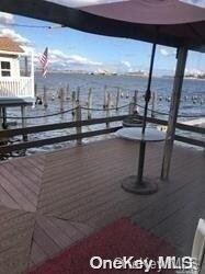
AMAZING RAISED WATERFRONT HOME LOCATED IN A FANTASTIC SECTION OF BROAD CHANNEL. THIS LOVELY HOME HAS BEEN UPDATED WITH HARDWOOD FLOORING UPDATED KITCHEN AND BATHS. WITH A LITTLE PAINT AND SOME DECORATING YOU WILL HAVE A MAGNIFICENT DREAM HOME.WITH A SPLIT LEVEL LAYOUT THE HOME HAS A VERY MODERN FEEL. 3 GOOD SIZED BEDROOMS 2 BATHS AND A GROUND LEVEL WHICH WILL MAKE A GREAT OFFICE DEN OR PLAY ROOM . TENANT OCCUPIED , Additional information: Appearance:EXCELLENT
Primary Land Use and Tax Lot Information
for 21 Van Brunt Rd

Property Price History
for 21 Van Brunt Rd
| Date | Event | Price | ||
|---|---|---|---|---|
| Dec 3, 2024 | Listed | $359,000 | $199 | OneKeyMLS |
| Dec 3, 2024 | Listing removed | — | — | OneKeyMLS |
Property Tax History
for 21 Van Brunt Rd
| Year | Taxes | |
|---|---|---|
| 2023 | $4,672 | $34,260 |
| 2022 | $4,378 | $28,560 |
Sold Homes
near 21 Van Brunt Rd
| Address | Price | Beds | Baths |
|---|---|---|---|
|
Broad Channel, NY 11693SF
|
$675,000
02/04/2025
|
3
|
2
|
|
Rockaway Beach, NY 11693SF
|
$330,000
02/04/2025
|
3
|
1
|
|
Broad Channel, NY 11693SF
|
$490,000
05/09/2025
|
3
|
2
|
|
Rockaway Beach, NY 11693SF
|
$600,000
03/17/2025
|
4
|
2
|
|
Broad Channel, NY 11693SF
|
$430,000
12/31/2024
|
3
|
1
|
Homes For Sale
near 21 Van Brunt Rd
| Address | Price | Beds | Baths |
|---|---|---|---|
|
Arverne, NY 11692SF
|
$599,000
501 days ago
|
3
|
1
|
|
Broad Channel, NY 11693SF
|
$699,000
212 days ago
|
3
|
2
|
Schools
serving 21 Van Brunt Rd
| School Name | Rating |
|---|---|
|
505 Beach 129th St, Belle Harbor, NY 11694
|
— |
|
2-45 BEACH 79TH ST, Queens, NY 11693
|
3 / 10 |
|
190 BEACH 110TH ST, Queens, NY 11694
|
7 / 10 |
Data provided by
GreatSchools.org © 2025. All Rights Reserved.
School service boundaries are intended to be used as reference only.
To verify enrollment eligibility for a property, contact the school directly.
Flood Factor
for 21 Van Brunt Rd
9
|10
Extreme

FEMA Zone (Est.)
AE
Flood insurance:
Required
Flood risks are increasing as sea levels rise and weather patterns change.
This property has a
Extreme Flood Factor
.
Flood Factor data provided by FloodFactor.