219 Covert St, Brooklyn, NY 11207 Kings County Last Updated: April 5, 2024
Pre-Foreclosure: Lis Pendens, Estimated Market Value $1,460,700
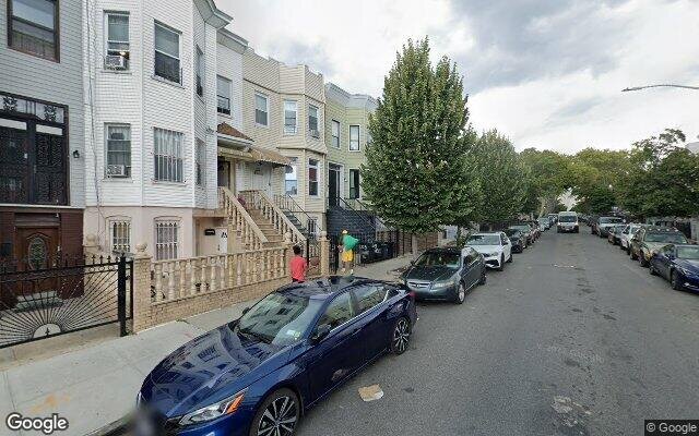
Description: 219 Covert St, Brooklyn, NY 11207 is a Multi Family Home built in 1910. This property was last sold for $51,000 in 1992 and currently has an estimated value of $1,460,700. According to the Brooklyn public records, the property at 219 Covert St, Brooklyn, NY 11207 has approximately 2,844 square feet, with a lot size of 1,975 square feet. Nearby schools include Bushwick Ascend Charter School, Ps Is 384 Frances E Carter and Ps 151 Lyndon B Johnson.
2,844 sqft
1,975 lot size
Year Built: 1910
Pre-foreclosure
219 Covert St, Brooklyn, NY 11207
Last Updated: April 5, 2024
1
Multi Family Home
Estimated Market Value EMV $ 1,460,700
219 Covert St
bool(false)

bool(true)

bool(true)

int(0)
Estimated Market Value EMV $ 1,460,700
Foreclosure History
for 219 Covert St
for 219 Covert St
219 Covert St, Brooklyn, NY 11207 is a Multi Family Home built in 1910. This property was last sold for $51,000 in 1992 and currently has an estimated value of $1,460,700. According to the Brooklyn public records, the property at 219 Covert St, Brooklyn, NY 11207 has approximately 2,844 square feet, with a lot size of 1,975 square feet. Nearby schools include Bushwick Ascend Charter School, Ps Is 384 Frances E Carter and Ps 151 Lyndon B Johnson.
Property features
Year Built:
Year Built:
1910
1910
Living Area:
Living Area:
2844
2844
Building Class:
B2
Two Family Dwellings: Frame
Floors on Main Building:
2.00
Building Dimensions:
19.75'
Actual Square Footage:
2,844
Calculated Square Footage:
1,896
Residential Floor Area:
1,896
Basement:
Above grade full basement
Address:
219 COVERT STREET
Land Use:
01
One & Two Family Buildings
Lot Dimensions:
19.75'
Calculated Lot Perimeter:
255.94 ft
Zoning Districts:
R6
Moderate-density residence district
Commercial Overlays:
C1-3
Commercial districts that are predominantly residential in character
Max Residential FAR:
2.43
Max Residential Sqft:
4,799
Buildable Residential Sqft:
1,955
Residential Area Distribution:
Assessed Land Value:
$11,280
Assessed Total Value:
$101,940
Last Recording Date:
Jan 8, 2024
Property Assessment Data:
Tax Class:
1
One- to three-unit residential properties
Taxable Assessed Value:
$15,906
Estimated Market Value by NYC DOF :
$1,438,000
Community District (CD):
304
City Council District:
37
Document DateDocument Type Unit Amount
Recorded DateDocument Type Unit Amount
Date
Event
Price
Price/Sqft
Source
Jun 5, 1992
Sold
$51,000
$18
Public Record
Year
Taxes
Land
Additions
Total Assessment
2022
$2,831
$11,280
$83,280
$94,560
2021
$2,819
$11,280
$66,720
$78,000
2020
$2,831
$11,280
$53,940
$65,220
2019
$2,772
$11,280
$48,300
$59,580
2018
$2,616
$2,728
$9,779
$12,507
2017
$2,409
$2,691
$9,131
$11,822
2016
$2,231
$3,429
$7,735
$11,164
2015
$2,179
$3,863
$7,283
$11,146
2014
$2,116
$3,387
$7,659
$11,046
2013
$2,000
$3,806
$6,617
$10,423
2012
$1,793
$7,024
$2,828
$9,852
2010
$1,587
$5,960
$3,344
$9,304
2009
$1,572
$6,027
$3,262
$9,289
2007
$1,249
$1,298
$6,912
$8,210
Address
Price
Built
Beds
Baths
Sqft
Lot Size
Distance
924 Jefferson Ave
Brooklyn, NY 11221MF
$1,150,000
04/26/2024
1992
—
3
2,856
+12difference
2,025
0.72 mi
875 Hancock St
Brooklyn, NY 11233MF
$1,220,000
11/09/2023
1992
5
3
2,856
+12
2,025
0.72 mi
875 Hancock St Unit Townhouse
Brooklyn, NY 11233MF
$1,220,000
11/09/2023
1992
5
3
2,856
+12
2,025
0.72 mi
972 Madison St
Brooklyn, NY 11221MF
$1,245,000
11/08/2023
1910
8
4
2,814
-30
1,875
0.58 mi
60-30 71st Ave
Ridgewood, NY 11385MF
$995,000
04/10/2024
1911
6
3
2,970
+126
1,600
0.89 mi
268 Eldert St
Brooklyn, NY 11207MF
$1,975,000
01/16/2024
1910
6
4
2,700
-144
2,000
0.06 mi
385 Cornelia St
Brooklyn, NY 11237MF
$1,150,000
03/04/2024
1901
5
2
2,200
-644
2,000
0.43 mi
20 Weirfield St
Brooklyn, NY 11221MF
$1,085,000
11/30/2023
1915
5
3
3,300
+456
2,000
0.49 mi
16-11 Cornelia St
Ridgewood, NY 11385MF
$1,125,000
03/06/2024
1910
7
3
2,096
-748
2,000
0.51 mi
989 Hancock St
Brooklyn, NY 11221MF
$802,400
12/13/2023
1910
10
4
3,420
+576
1,900
0.51 mi
Address
Price
Built
Beds
Baths
Sqft
Lot Size
Distance
1979 Fulton St
Brooklyn, NY 11233MF
$1,799,999
88 days ago
1899
8
5
2,850
+6difference
1,742
0.93 mi
660 Central Ave
Brooklyn, NY 11207MF
$1,250,000
86 days ago
2003
5
3
2,835
-9
2,000
0.21 mi
48 Schenck Ave
Brooklyn, NY 11207MF
$1,300,000
37 days ago
2008
10
4
2,853
+9
—
1.18 mi
19 Menahan St Unit 15
Ridgewood, NY 11385MF
$1,400,000
45 days ago
1915
4
4
2,825
-19
2,500
1.12 mi
72-23 67th St
Queens, NY 11385MF
$1,295,000
115 days ago
1931
12
6
2,871
+27
2,800
1.36 mi
114 Shepherd Ave
Brooklyn, NY 11208MF
$899,000
8 days ago
1910
6
3
2,810
-34
2,000
1.47 mi
114 Shepherd Ave
Brooklyn, NY 11208MF
$899,000
8 days ago
1910
6
3
2,810
-34
2,000
1.47 mi
1063 Jefferson Ave
Brooklyn, NY 11221MF
$2,250,000
88 days ago
1905
12
7
2,880
+36
2,000
0.50 mi
2411 Dean St
Brooklyn, NY 11233MF
$1,700,000
26 days ago
1910
8
3
2,880
+36
—
1.12 mi
60-71 60th Ln
Maspeth, NY 11378MF
$1,179,000
32 days ago
2002
6
6
2,805
-39
2,500
1.67 mi
Estimated values are not a substitute for professional expertise. Contact your RE agent for a market assessment.
School Name
Rating
Grades
Parent Rating
Distance
Bushwick Ascend Charter School
, Brooklyn , NY 11221
8 / 10
K−8
0.20 mi
Evergreen Middle School-Urban Exploration
, Brooklyn , NY 11207
5 / 10
6−8
—
0.18 mi
St. Marks Lutheran Schools
, Brooklyn , NY 11221
—
K−8
0.40 mi
Ps Is 384 Frances E Carter
, Brooklyn , NY 11207
5 / 10
K−8
0.18 mi
Bushwick School for Social Justice
, Brooklyn , NY 11237
2 / 10
9−12
—
0.45 mi
Academy Of Urban Planning
, Brooklyn , NY 11237
5 / 10
9−12
0.45 mi
Ps 151 Lyndon B Johnson
, Brooklyn , NY 11237
6 / 10
K−5
0.17 mi
Pope John Paul Ii Family Academy
, Brooklyn , NY 11221
—
K−4
—
0.69 mi
Our Lady of Lourdes School
, Brooklyn , NY 11207
—
K−8
0.68 mi
Brooklyn School For Math And Researc
, Brooklyn , NY 11237
5 / 10
9−12
0.44 mi
FEMA Zone (Est.)
X (unshaded)
Flood insurance:
Recommended
Flood risks are increasing as sea levels rise and weather patterns change.
This property has a
Minimal Flood Factor
.
Please Log In
Please wait... If this message is not eventually replaced by the proper contents of the document, your PDF viewer may not be able to display this type of document.
You can upgrade to the latest version of Adobe Reader for Windows®, Mac, or Linux® by visiting
https://get.adobe.com/reader/ this link .
For more assistance with Adobe Reader visit
http://get.adobe.com/reader/ this link .
You can download this PDF-document from
here .