226-56 129th Ave, Springfield Gardens, NY 11413 Queens County Last Updated: March 6, 2024
Auction: Estimated Market Value $820,300
Description: 226-56 129th Ave, Springfield Gardens, NY 11413 is a Single Family Home built in 1950. This property was last sold for $460,000 in 2006 and currently has an estimated value of $820,300. According to the Springfield Gardens public records, the property at 226-56 129th Ave, Springfield Gardens, NY 11413 has approximately 1,148 square feet, with a lot size of 4,000 square feet. Nearby schools include Ps 132 Ralph Bunche, Ps 176 Cambria Heights and The Gordon Parks School.
1,148 sqft
4,000 lot size
Year Built: 1950
Auction
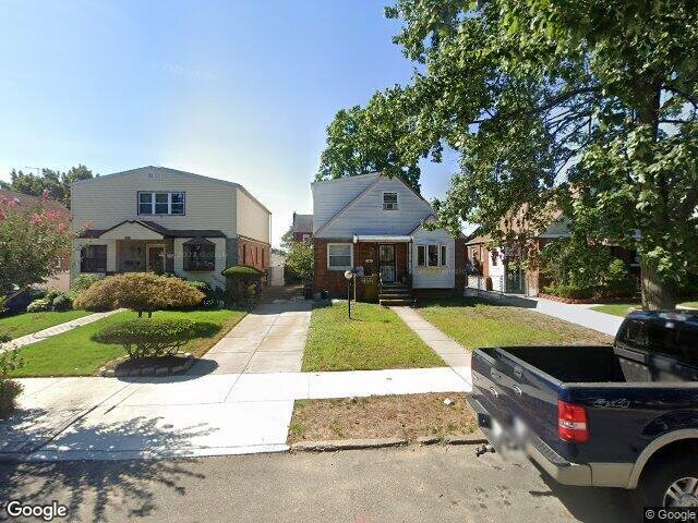
226-56 129th Ave, Springfield Gardens, NY 11413
Last Updated: March 6, 2024
1
Single Family Home
Town House
Estimated Market Value EMV $ 820,300
226-56 129th Ave
bool(false)

bool(true)

bool(true)

int(0)
Estimated Market Value EMV $ 820,300
Springfield Gardens, NY 11413
for 226-56 129th Ave
Friday
5
April
2024
10:15 AM
Auction Date
Apr 5, 2024
Auction Time
10:15 AM
Auction Location
COUNTY COURTHOUSE
for 226-56 129th Ave
Type
Single Family Home
Town House
226-56 129th Ave, Springfield Gardens, NY 11413 is a Single Family Home built in 1950. This property was last sold for $460,000 in 2006 and currently has an estimated value of $820,300. According to the Springfield Gardens public records, the property at 226-56 129th Ave, Springfield Gardens, NY 11413 has approximately 1,148 square feet, with a lot size of 4,000 square feet. Nearby schools include Ps 132 Ralph Bunche, Ps 176 Cambria Heights and The Gordon Parks School.
Property features
Year Built:
Year Built:
1950
1950
Living Area:
Living Area:
1148
1148
Building Class:
A2
One Family Dwellings: One Story (Permanent Living Quarters)
Floors on Main Building:
1.5
Building Dimensions:
27'
Actual Square Footage:
1,148
Calculated Square Footage:
1,377
Residential Floor Area:
1,148
Basement:
Below grade full basement
Address:
226-56 129 AVENUE
Land Use:
01
One & Two Family Buildings
Calculated Lot Perimeter:
277.46 ft
Zoning Districts:
R2A
Lower-density residence district
Max Residential FAR:
0.50
Max Residential Sqft:
2,000
Buildable Residential Sqft:
852
Residential Area Distribution:
Assessed Land Value:
$11,520
Assessed Total Value:
$41,280
Last Recording Date:
Jan 8, 2024
Property Assessment Data:
Tax Class:
1
One- to three-unit residential properties
Taxable Assessed Value:
$33,200
Estimated Market Value by NYC DOF :
$664,000
Community District (CD):
413
City Council District:
31
Document DateDocument Type Unit Amount
Date
Event
Price
Price/Sqft
Source
Sep 27, 2006
Sold
$460,000
$401
Public Record
Sep 6, 1991
Sold
$102,500
$89
Public Record
Year
Taxes
Land
Additions
Total Assessment
2022
$5,996
$11,520
$22,860
$34,380
2021
$5,963
$11,520
$25,260
$36,780
2020
$5,856
$11,520
$20,400
$31,920
2019
$5,787
$11,520
$20,520
$32,040
2018
$5,550
$10,547
$15,986
$26,533
2017
$5,102
$11,443
$13,589
$25,032
2016
$4,721
$11,307
$12,309
$23,616
2015
$4,508
$12,247
$10,809
$23,056
2014
$4,417
$11,036
$12,020
$23,056
2013
$3,944
$10,466
$11,645
$22,111
2011
$3,417
$11,786
$9,074
$20,860
2010
$3,283
$12,780
$6,900
$19,680
2009
$3,283
$12,364
$6,850
$19,214
2007
$2,755
$2,805
$15,051
$17,856
Address
Price
Built
Beds
Baths
Sqft
Lot Size
Distance
119-32 220 St
Cambria Heights, NY 11411SF
$275,500
10/31/2023
1994
—
—
1,140
-8difference
4,000
0.62 mi
135-25 225th St
Laurelton, NY 11413SF
$599,000
03/29/2024
1945
4
2
1,160
+12
2,000
0.64 mi
120-39 222nd St
Cambria Heights, NY 11411SF
$550,000
11/28/2023
1945
4
2
1,163
+15
4,000
0.43 mi
118-01 226th St
Cambria Heights, NY 11411SF
$645,000
12/06/2023
1950
3
1
1,128
-20
4,000
0.65 mi
119-48 228th St
Cambria Heights, NY 11411SF
$600,000
04/08/2024
1945
4
2
1,170
+22
5,000
0.43 mi
130-09 229th St
Laurelton, NY 11413SF
$620,000
02/16/2024
1930
3
4
1,636
+488
2,100
0.08 mi
130-13 230th St
Laurelton, NY 11413SF
$650,000
03/08/2024
1945
2
2
888
-260
3,742
0.12 mi
130-55 225th St
Laurelton, NY 11413SF
$700,000
02/12/2024
1935
3
2
1,542
+394
2,000
0.21 mi
13125 227th St
Laurelton, NY 11413SF
$485,000
03/05/2024
1935
3
2
1,577
+429
3,200
0.25 mi
131-45 228th St
Laurelton, NY 11413SF
$625,000
03/07/2024
1940
5
2
1,500
+352
3,200
0.28 mi
Address
Price
Built
Beds
Baths
Sqft
Lot Size
Distance
128-43 226th St
Laurelton, NY 11413SF
$475,000
1642 days ago
1945
3
2
1,148
10,518
0.10 mi
143-61 230th St
Laurelton, NY 11413SF
$625,000
86 days ago
1910
3
1
1,154
+6difference
4,000
1.41 mi
1033 Stafford Rd
Valley Stream, NY 11580SF
$299,000
450 days ago
1950
3
2
1,158
+10
6,900
1.65 mi
1999 Byron Ave
Elmont, NY 11003SF
$759,000
36 days ago
1951
3
2
1,168
+20
7,400
1.38 mi
119-34 234th St
Cambria Heights, NY 11411SF
$739,000
4 days ago
1945
4
3
1,125
-23
3,900
0.54 mi
11827 219th St
Cambria Heights, NY 11411SF
$560,000
150 days ago
1925
3
1
1,184
+36
3,999
0.74 mi
1187 Ormonde Blvd
Valley Stream, NY 11580SF
$545,000
50 days ago
1950
4
1
1,109
-39
5,334
0.96 mi
48 Grant Dr N
Valley Stream, NY 11580SF
$669,000
717 days ago
1948
3
2
1,109
-39
8,300
1.98 mi
212 Norfeld Blvd
Elmont, NY 11003SF
$499,900
135 days ago
1948
2
2
1,192
+44
6,250
1.94 mi
135-40 246th St
Rosedale, NY 11422SF
$639,000
26 days ago
1955
3
2
1,102
-46
6,000
1.00 mi
Estimated values are not a substitute for professional expertise. Contact your RE agent for a market assessment.
School Name
Rating
Grades
Parent Rating
Distance
Ps 132 Ralph Bunche
, Queens , NY 11413
5 / 10
K−5
0.58 mi
Middletons Early Learning Center
, Queens , NY 11413
—
PK−K
0.47 mi
Is 59 Springfield Gardens
, Queens , NY 11413
5 / 10
6−8
0.76 mi
Cheder at the Ohel
, Brooklyn , NY 11213
—
1−8
—
0.32 mi
Tracy's Day Care Center
, Springfield Gardens , NY 11413
—
K−8
0.45 mi
Ps 176 Cambria Heights
, Queens , NY 11411
6 / 10
K−5
0.49 mi
The Gordon Parks School
, Queens , NY 11422
5 / 10
K−8
0.54 mi
Institute For Health Profesions
, Queens , NY 11411
4 / 10
8−12
—
1.16 mi
Queens United Middle School
, Queens , NY 11413
4 / 10
6−8
0.72 mi
Humanities And Arts Magnet High School
, Queens , NY 11411
4 / 10
9−12
1.15 mi
FEMA Zone (Est.)
X (unshaded)
Flood insurance:
Recommended
Flood risks are increasing as sea levels rise and weather patterns change.
This property has a
Minimal Flood Factor
.
Please Log In
Please wait... If this message is not eventually replaced by the proper contents of the document, your PDF viewer may not be able to display this type of document.
You can upgrade to the latest version of Adobe Reader for Windows®, Mac, or Linux® by visiting
https://get.adobe.com/reader/ this link .
For more assistance with Adobe Reader visit
http://get.adobe.com/reader/ this link .
You can download this PDF-document from
here .