2316 Gleason Ave, Bronx, NY 10462 Bronx County Last Updated: June 27, 2023
Pre-Foreclosure: Lis Pendens, Estimated Market Value $794,700
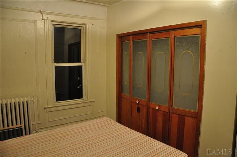
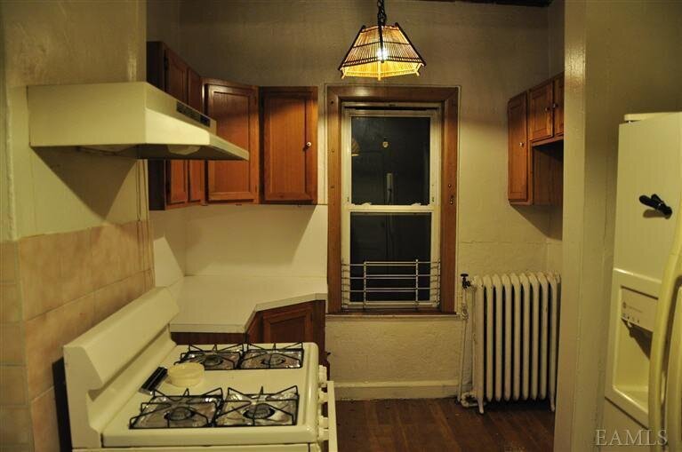
Description: 2316 Gleason Ave, Bronx, NY 10462 is a Multi Family Home built in 1905. This property was last sold for $474,000 in 2008 and currently has an estimated value of $794,700. According to the Bronx public records, the property at 2316 Gleason Ave, Bronx, NY 10462 has approximately 1,724 square feet, with a lot size of 2,575 square feet. Nearby schools include Ps 36 Unionport, DR Emmett W Bassett School (The) and Bronx Charter School For Excellence.
1,724 sqft
2,575 lot size
3 beds
1 baths
Year Built: 1905
Pre-foreclosure
2316 Gleason Ave, Bronx, NY 10462
Last Updated: June 27, 2023
2
Multi Family Home
Estimated Market Value EMV $ 794,700
2316 Gleason Ave
bool(false)

bool(true)

bool(true)

int(0)
Estimated Market Value EMV $ 794,700
Foreclosure History
for 2316 Gleason Ave
for 2316 Gleason Ave
2316 Gleason Ave, Bronx, NY 10462 is a Multi Family Home built in 1905. This property was last sold for $474,000 in 2008 and currently has an estimated value of $794,700. According to the Bronx public records, the property at 2316 Gleason Ave, Bronx, NY 10462 has approximately 1,724 square feet, with a lot size of 2,575 square feet. Nearby schools include Ps 36 Unionport, DR Emmett W Bassett School (The) and Bronx Charter School For Excellence.
Property features
Full Bathrooms:
Full Bathrooms:
1
1
County:
County:
Bronx
Bronx
Property Type:
Property Type:
House
House
Village:
Village:
Bronx
Bronx
Building Class:
B2
Two Family Dwellings: Frame
Floors on Main Building:
2
Building Dimensions:
21'
Actual Square Footage:
1,724
Calculated Square Footage:
1,932
Residential Floor Area:
1,724
Basement:
Below grade full basement
Address:
2316 GLEASON AVENUE
BIN
Name 2316 GLEASON AVENUE
Land Use:
01
One & Two Family Buildings
Calculated Lot Perimeter:
257.15 ft
Zoning Districts:
R5
Lower-density residence district
Max Residential FAR:
1.25
Max Residential Sqft:
3,219
Buildable Residential Sqft:
1,495
Residential Area Distribution:
Assessed Land Value:
$8,940
Assessed Total Value:
$39,840
Last Recording Date:
Jan 8, 2024
Property Assessment Data:
Tax Class:
1
One- to three-unit residential properties
Taxable Assessed Value:
$30,097
Estimated Market Value by NYC DOF :
$664,000
Community District (CD):
209
City Council District:
18
Document DateDocument Type Unit Amount
Date
Event
Price
Price/Sqft
Source
Jan 1, 2012
Listing removed
$1,600
$1
HudsonGatewayMLSEast
Nov 25, 2011
Price Changed for rent
$1,600
$1
HudsonGatewayMLSEast
Nov 6, 2011
Listed for rent
$1,800
$1
HudsonGatewayMLSEast
Dec 19, 2008
Sold
$474,000
$275
Public Record
Feb 15, 1991
Sold
$220,000
$128
Public Record
Sep 4, 1990
Sold
$59,000
$34
Public Record
Year
Taxes
Land
Additions
Total Assessment
2022
$5,957
$8,940
$30,480
$39,420
2021
$5,926
$8,940
$32,460
$41,400
2020
$5,624
$8,940
$27,960
$36,900
2019
$5,246
$8,940
$20,820
$29,760
2018
$5,247
$6,432
$18,649
$25,081
2017
$5,069
$7,594
$17,277
$24,871
2016
$4,691
$7,875
$15,592
$23,467
2015
$4,330
$8,597
$13,547
$22,144
2015
$4,003
$8,192
$12,709
$20,901
2014
$3,712
$12,177
$8,724
$20,901
2011
$3,243
$12,478
$7,078
$19,556
2010
$2,923
$12,478
$7,078
$19,556
2009
$2,740
$11,829
$6,625
$18,454
2007
$2,466
$2,721
$14,551
$17,272
Address
Price
Built
Beds
Baths
Sqft
Lot Size
Distance
1146 Thieriot Ave
Bronx, NY 10472MF
$600,000
12/12/2023
1925
4
3
1,656
-68difference
2,500
0.88 mi
1951 Benedict Ave
Bronx, NY 10462MF
$1,100,000
04/04/2024
1925
5
4
1,890
+166
5,001
0.63 mi
1581 Mayflower Ave
Bronx, NY 10461MF
$700,000
03/15/2024
1920
4
2
2,178
+454
2,375
0.98 mi
1722 Saint Peters Ave
Bronx, NY 10461MF
$950,000
01/11/2024
1910
6
4
2,268
+544
2,417
0.71 mi
2267 Ellis Ave
Bronx, NY 10462MF
$1,095,000
04/25/2024
—
6
3
2,540
+816
2,472
0.11 mi
2126 Blackrock Ave
Bronx, NY 10472MF
$1,150,000
11/30/2023
1927
7
4
3,403
+1,679
3,090
0.37 mi
35 Marvin Pl
Bronx, NY 10461MF
$950,000
12/07/2023
1910
6
3
2,700
+976
3,893
0.66 mi
Address
Price
Built
Beds
Baths
Sqft
Lot Size
Distance
2016 Tomlinson Ave
Bronx, NY 10461MF
$725,000
4 days ago
1955
3
2
1,734
+10difference
2,500
1.59 mi
281 Hollywood Ave
Bronx, NY 10465MF
$895,000
75 days ago
1930
3
1
1,700
-24
—
1.91 mi
1846 Edison Ave
Bronx, NY 10461MF
$699,999
52 days ago
1949
3
2
1,692
-32
2,509
1.38 mi
2824 Wellman Ave
Bronx, NY 10461MF
$689,000
270 days ago
1920
2
2
1,682
-42
2,375
0.85 mi
402 Harding Park
Bronx, NY 10473MF
$599,000
181 days ago
1910
3
1
1,650
-74
3,135
1.89 mi
1369 Edwards Ave
Bronx, NY 10461MF
$775,000
12 days ago
1950
4
3
1,800
+76
1,764
0.69 mi
1532 Robertson Pl
Bronx, NY 10465MF
$948,000
82 days ago
1930
3
4
1,632
-92
2,500
1.57 mi
1760 Tomlinson Ave
Bronx, NY 10461MF
$739,000
182 days ago
1945
3
2
1,557
-167
2,435
1.21 mi
2105 Matthews Ave
Bronx, NY 10462MF
$945,000
33 days ago
1940
3
1
1,555
-169
—
1.72 mi
Estimated values are not a substitute for professional expertise. Contact your RE agent for a market assessment.
School Name
Rating
Grades
Parent Rating
Distance
Santa Maria School
, The Bronx , NY 10462
—
PK−8
0.43 mi
Ps 36 Unionport
, The Bronx , NY 10472
7 / 10
K−5
0.24 mi
Holy Family School
, The Bronx , NY 10472
—
PK−8
0.29 mi
Jhs 125 Henry Hudson
, Bronx , NY 10472
—
6−8
0.57 mi
Herbert H Lehman High School
, The Bronx , NY 10461
4 / 10
8−12
0.71 mi
DR Emmett W Bassett School (The)
, The Bronx , NY 10472
6 / 10
K−5
0.57 mi
Bronx Charter School For Excellence
, The Bronx , NY 10462
8 / 10
K−8
0.61 mi
Schuylerville Preparatory High School
, The Bronx , NY 10461
2 / 10
9−12
0.71 mi
Bronx River High School
, The Bronx , NY 10461
2 / 10
9−12
0.71 mi
Pelham Lab High School
, The Bronx , NY 10461
2 / 10
9−12
0.71 mi
FEMA Zone (Est.)
X (unshaded)
Flood insurance:
Recommended
Flood risks are increasing as sea levels rise and weather patterns change.
This property has a
Minimal Flood Factor
.
Please Log In
Please wait... If this message is not eventually replaced by the proper contents of the document, your PDF viewer may not be able to display this type of document.
You can upgrade to the latest version of Adobe Reader for Windows®, Mac, or Linux® by visiting
https://get.adobe.com/reader/ this link .
For more assistance with Adobe Reader visit
http://get.adobe.com/reader/ this link .
You can download this PDF-document from
here .