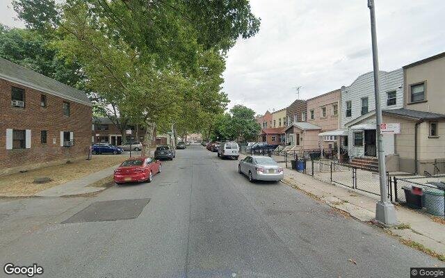
2537 E 6th St, Brooklyn, NY 11235 Kings County Last Updated: March 13, 2024
Pre-Foreclosure: Lis Pendens, Estimated Market Value $1,118,300
Description: 2537 E 6th St, Brooklyn, NY 11235 is a Multi Family Home built in 1920. This property was last sold for $5,000 in 2022 and currently has an estimated value of $1,118,300. According to the Brooklyn public records, the property at 2537 E 6th St, Brooklyn, NY 11235 has approximately 1,360 square feet, with a lot size of 1,900 square feet. Nearby schools include Ps 216 Arturo Toscanini, Ps 209 Margaret Mead and Ps 225 The Eileen E Zaglin.
1,360 sqft
1,900 lot size
Year Built: 1920
Pre-foreclosure
2537 E 6th St, Brooklyn, NY 11235
Last Updated: March 13, 2024
1
Multi Family Home
Estimated Market Value EMV $ 1,118,300
2537 E 6th St
bool(false)

bool(true)

bool(true)

int(0)
Estimated Market Value EMV $ 1,118,300
Foreclosure History
for 2537 E 6th St
for 2537 E 6th St
2537 E 6th St, Brooklyn, NY 11235 is a Multi Family Home built in 1920. This property was last sold for $5,000 in 2022 and currently has an estimated value of $1,118,300. According to the Brooklyn public records, the property at 2537 E 6th St, Brooklyn, NY 11235 has approximately 1,360 square feet, with a lot size of 1,900 square feet. Nearby schools include Ps 216 Arturo Toscanini, Ps 209 Margaret Mead and Ps 225 The Eileen E Zaglin.
Property features
Year Built:
Year Built:
1920
1920
Living Area:
Living Area:
1360
1360
Building Class:
B3
Two Family Dwellings: Converted From One Family
Floors on Main Building:
2
Building Dimensions:
20'
Actual Square Footage:
1,360
Calculated Square Footage:
1,360
Residential Floor Area:
1,360
Basement:
Below grade full basement
Address:
2537 EAST 6 STREET
BIN
Name 2537 EAST 6 STREET
Land Use:
01
One & Two Family Buildings
Calculated Lot Perimeter:
229.30 ft
Zoning Districts:
R4
Lower-density residence district
Special Purpose Districts:
OP
Special Ocean Parkway District
Max Residential FAR:
0.75
Max Residential Sqft:
1,425
Buildable Residential Sqft:
65
Residential Area Distribution:
Assessed Land Value:
$10,860
Assessed Total Value:
$51,600
Last Recording Date:
Jan 8, 2024
Property Assessment Data:
Tax Class:
1
One- to three-unit residential properties
Taxable Assessed Value:
$34,396
Estimated Market Value by NYC DOF :
$860,000
Community District (CD):
313
City Council District:
48
Document DateDocument Type Unit Amount
Date
Event
Price
Price/Sqft
Source
Aug 17, 2022
Sold
$25,000
$18
Public Record
Year
Taxes
Land
Additions
Total Assessment
2022
$6,179
$10,860
$45,540
$56,400
2021
$6,514
$10,860
$37,680
$48,540
2020
$6,427
$10,860
$34,920
$45,780
2019
$5,996
$10,860
$32,760
$43,620
2018
$4,612
$7,269
$19,959
$27,228
2017
$4,612
$6,548
$19,247
$25,795
2016
$1,957
$7,629
$18,166
$25,795
2015
$1,852
$10,552
$14,751
$25,303
2014
$1,679
$9,961
$13,925
$23,886
2013
$1,580
$9,462
$13,228
$22,690
2012
$1,371
$12,527
$8,969
$21,496
2010
$1,247
$13,250
$8,246
$21,496
2009
$1,227
$13,269
$7,817
$21,086
2007
$2,565
$2,898
$15,016
$17,914
Address
Price
Built
Beds
Baths
Sqft
Lot Size
Distance
430 Avenue X
Brooklyn, NY 11223MF
$883,000
04/12/2024
1950
3
2
1,370
+10difference
1,992
0.24 mi
2749 E 11th St
Brooklyn, NY 11235MF
$885,000
02/23/2024
1925
3
2
1,176
-184
1,311
0.38 mi
2171 W 7th St
Brooklyn, NY 11223MF
$1,140,000
04/15/2024
1920
5
3
1,548
+188
2,400
0.87 mi
2410 McDonald Ave
Brooklyn, NY 11223MF
$750,000
03/13/2024
—
—
3
1,582
+222
2,788
0.65 mi
727 Crawford Ave
Brooklyn, NY 11223MF
$1,300,000
03/15/2024
—
—
3
1,710
+350
1,958
0.31 mi
2557 E 6th St
Brooklyn, NY 11235MF
$1,050,000
11/16/2023
1955
5
3
1,852
+492
1,710
0.03 mi
2566 E 1st St
Brooklyn, NY 11223MF
$1,650,000
03/12/2024
1960
7
5
3,465
+2,105
2,500
0.28 mi
2419 E 1st St
Brooklyn, NY 11223MF
$1,040,000
03/28/2024
1940
5
3
2,980
+1,620
2,000
0.31 mi
1012 Avenue X
Brooklyn, NY 11235MF
$999,000
11/29/2023
1930
3
3
2,580
+1,220
1,160
0.31 mi
1323 Avenue Y
Brooklyn, NY 11235MF
$1,205,000
12/18/2023
1930
5
2
2,280
+920
2,070
0.44 mi
Address
Price
Built
Beds
Baths
Sqft
Lot Size
Distance
1409 Neptune Ave
Brooklyn, NY 11224MF
$880,000
200 days ago
1925
4
3
1,380
+20difference
885
1.15 mi
2672 Ford St
Brooklyn, NY 11235MF
$800,000
43 days ago
1960
—
3
1,400
+40
1,950
1.46 mi
1124 Banner Ave
Brooklyn, NY 11235MF
$859,000
48 days ago
1920
3
2
1,400
+40
1,400
0.43 mi
26 Bay 41st St
Brooklyn, NY 11214MF
$1,100,000
1435 days ago
1925
4
4
1,428
+68
1,933
1.33 mi
1799 W 7th St
Brooklyn, NY 11223MF
$1,980,000
42 days ago
1955
—
3
1,430
+70
2,800
1.35 mi
2967 Coney Island Ave
Brooklyn, NY 11235MF
$899,000
431 days ago
1915
5
3
1,280
-80
2,000
0.35 mi
6314 24th Ave
Brooklyn, NY 11204MF
$1,899,000
484 days ago
—
—
4
1,449
+89
2,600
1.79 mi
97 Ebony Ct
Brooklyn, NY 11229MF
$850,000
261 days ago
1925
—
2
1,269
-91
1,785
1.79 mi
1755 W 12th St
Brooklyn, NY 11223MF
$1,388,000
146 days ago
1915
4
4
1,260
-100
4,000
1.54 mi
1755 W 12th St
Brooklyn, NY 11223MF
$1,388,000
146 days ago
1915
4
4
1,260
-100
4,000
1.54 mi
Estimated values are not a substitute for professional expertise. Contact your RE agent for a market assessment.
School Name
Rating
Grades
Parent Rating
Distance
Ps 216 Arturo Toscanini
, Brooklyn , NY 11223
7 / 10
K−5
0.34 mi
Yeshivat Magen Abraham
, Brooklyn , NY 11223
—
9−12
—
0.21 mi
Ahi Ezer Yeshiva School
, Brooklyn , NY 11235
—
PK−8
0.16 mi
Harma Inst of Secondary Education
, Brooklyn , NY 11223
—
12−12
0.32 mi
Ps 209 Margaret Mead
, Brooklyn , NY 11235
8 / 10
K−8
0.14 mi
Abraham Lincoln High School
, Brooklyn , NY 11235
3 / 10
9−12
0.46 mi
William E Grady Career And Technical Education High School
, Brooklyn , NY 11235
2 / 10
9−12
0.33 mi
Is 303 Herbert S Eisenberg
, Brooklyn , NY 11224
6 / 10
6−8
0.58 mi
Rachel Carson High School For Coastal Studies
, Brooklyn , NY 11224
3 / 10
9−12
0.58 mi
Ps 225 The Eileen E Zaglin
, Brooklyn , NY 11235
7 / 10
K−8
0.69 mi
FEMA Zone (Est.)
X (shaded)
Flood insurance:
Recommended
Flood risks are increasing as sea levels rise and weather patterns change.
This property has a
Severe Flood Factor
.
Please Log In
Please wait... If this message is not eventually replaced by the proper contents of the document, your PDF viewer may not be able to display this type of document.
You can upgrade to the latest version of Adobe Reader for Windows®, Mac, or Linux® by visiting
https://get.adobe.com/reader/ this link .
For more assistance with Adobe Reader visit
http://get.adobe.com/reader/ this link .
You can download this PDF-document from
here .