2741 Miles Ave, Bronx, NY 10465 Bronx County Last Updated: March 5, 2024
Pre-Foreclosure: Lis Pendens, Estimated Market Value $683,900
Description: 2741 Miles Ave, Bronx, NY 10465 is a Single Family Home built in 1960. This property was last sold for $340,000 in 2005 and currently has an estimated value of $683,900. According to the Bronx public records, the property at 2741 Miles Ave, Bronx, NY 10465 has approximately 1,998 square feet, with a lot size of 1,800 square feet. Nearby schools include Ps 304 Early Childhood School, Ps 72 Dr William Dorney and Bronx Delta School.
1,998 sqft
1,800 lot size
Year Built: 1960
Pre-foreclosure
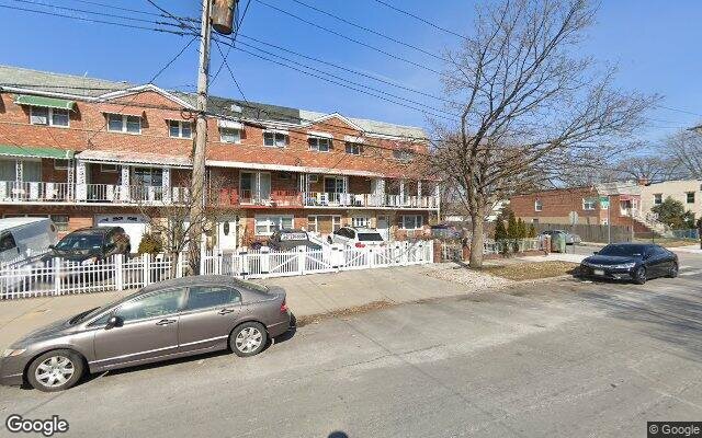
2741 Miles Ave, Bronx, NY 10465
Last Updated: March 5, 2024
1
Single Family Home
Town House
Estimated Market Value EMV $ 683,900
2741 Miles Ave
bool(false)

bool(true)

bool(true)

int(0)
Estimated Market Value EMV $ 683,900
Foreclosure History
for 2741 Miles Ave
for 2741 Miles Ave
Type
Single Family Home
Town House
2741 Miles Ave, Bronx, NY 10465 is a Single Family Home built in 1960. This property was last sold for $340,000 in 2005 and currently has an estimated value of $683,900. According to the Bronx public records, the property at 2741 Miles Ave, Bronx, NY 10465 has approximately 1,998 square feet, with a lot size of 1,800 square feet. Nearby schools include Ps 304 Early Childhood School, Ps 72 Dr William Dorney and Bronx Delta School.
Property features
Year Built:
Year Built:
1960
1960
Zoning:
Zoning:
R3-2
R3-2
Living Area:
Living Area:
1998
1998
Building Class:
A5
One Family Dwellings: Attached Or Semi-detached
Floors on Main Building:
3
Building Dimensions:
18'
Actual Square Footage:
1,998
Calculated Square Footage:
1,998
Residential Floor Area:
1,998
Address:
2741 MILES AVENUE
Land Use:
01
One & Two Family Buildings
Calculated Lot Perimeter:
233.46 ft
Zoning Districts:
R3-2
Lower-density residence district
Max Residential FAR:
0.50
Max Residential Sqft:
900
Buildable Residential Sqft:
0
Residential Area Distribution:
Assessed Land Value:
$7,860
Assessed Total Value:
$42,720
Exempt Total Value:
$1,400
Last Recording Date:
Jan 8, 2024
Property Assessment Data:
Tax Class:
1
One- to three-unit residential properties
Taxable Assessed Value:
$28,840
Estimated Market Value by NYC DOF :
$712,000
Community District (CD):
210
City Council District:
13
Document DateDocument Type Unit Amount
Date
Event
Price
Price/Sqft
Source
Oct 24, 2005
Sold
$340,000
$170
Public Record
Year
Taxes
Land
Additions
Total Assessment
2022
$5,476
$7,860
$28,200
$36,060
2021
$5,477
$7,860
$30,000
$37,860
2020
$5,358
$7,860
$26,520
$34,380
2019
$4,978
$7,860
$20,760
$28,620
2018
$4,952
$6,745
$18,383
$25,128
2017
$4,604
$7,860
$16,200
$24,060
2016
$4,260
$7,860
$15,000
$22,860
2015
$4,043
$8,029
$14,231
$22,260
2015
$3,717
$8,700
$12,300
$21,000
2014
$3,719
$13,560
$7,380
$20,940
2011
$3,793
$12,476
$10,102
$22,578
2010
$3,417
$12,476
$10,102
$22,578
2009
$3,779
$13,560
$7,740
$21,300
2007
$3,125
$3,096
$17,154
$20,250
Address
Price
Built
Beds
Baths
Sqft
Lot Size
Distance
2733 Miles Ave
Bronx, NY 10465SF
$650,000
02/20/2024
1960
4
4
1,798
-200difference
1,800
0.01 mi
2738 Miles Ave
Bronx, NY 10465SF
$325,000
03/05/2024
1930
3
1
936
-1,062
2,500
0.03 mi
Address
Price
Built
Beds
Baths
Sqft
Lot Size
Distance
3154A Miles Ave Unit A
Bronx, NY 10465SF
$699,900
39 days ago
1955
3
3
1,998
1,799
0.83 mi
1036 Brinsmade Ave
Bronx, NY 10465SF
$795,999
16 days ago
1950
4
2
1,980
-18difference
3,000
0.98 mi
2007 Gildersleeve Ave
Bronx, NY 10473SF
$635,000
29 days ago
—
3
4
2,041
+43
—
1.55 mi
151 Prentiss Ave
Bronx, NY 10465SF
$710,000
86 days ago
1925
3
3
1,948
-50
2,749
0.76 mi
1053 Swinton Ave
Bronx, NY 10465SF
$400,000
4 days ago
1950
3
2
2,048
+50
3,742
1.02 mi
421 Olmstead Ave
Bronx, NY 10473SF
$299,999
42 days ago
1965
4
4
1,944
-54
1,943
1.47 mi
1017 Swinton Ave
Bronx, NY 10465SF
$789,900
4 days ago
1955
3
2
1,938
-60
—
0.96 mi
234 Quincy Ave
Bronx, NY 10465SF
$380,000
67 days ago
1925
5
3
1,900
-98
1,941
0.23 mi
2021 Watson Ave
Bronx, NY 10472SF
$849,000
194 days ago
—
3
2
1,890
-108
—
1.93 mi
835 Dean Ave
Bronx, NY 10465SF
$959,000
35 days ago
1925
4
3
1,870
-128
—
1.11 mi
Estimated values are not a substitute for professional expertise. Contact your RE agent for a market assessment.
School Name
Rating
Grades
Parent Rating
Distance
Ps 304 Early Childhood School
, The Bronx , NY 10465
8 / 10
K−5
0.78 mi
St Frances De Chantal School
, The Bronx , NY 10465
—
PK−8
0.51 mi
Women S Academy Of Excellence
, The Bronx , NY 10473
1 / 10
9−12
1.75 mi
Ps 72 Dr William Dorney
, The Bronx , NY 10465
5 / 10
K−5
0.47 mi
Preston High School
, The Bronx , NY 10465
—
9−12
0.28 mi
Mott Hall Community School
, The Bronx , NY 10465
4 / 10
6−8
0.72 mi
Urban Institute Of Mathematics
, The Bronx , NY 10465
8 / 10
6−8
0.72 mi
Bronx Delta School
, The Bronx , NY 10465
4 / 10
K−5
0.72 mi
Herbert H Lehman High School
, The Bronx , NY 10461
4 / 10
8−12
1.83 mi
Bronx Community High School
, The Bronx , NY 10473
2 / 10
9−12
1.74 mi
Flood insurance:
Required
Flood risks are increasing as sea levels rise and weather patterns change.
This property has a
Moderate Flood Factor
.
Please Log In
Please wait... If this message is not eventually replaced by the proper contents of the document, your PDF viewer may not be able to display this type of document.
You can upgrade to the latest version of Adobe Reader for Windows®, Mac, or Linux® by visiting
https://get.adobe.com/reader/ this link .
For more assistance with Adobe Reader visit
http://get.adobe.com/reader/ this link .
You can download this PDF-document from
here .