288 Whitman Dr, Brooklyn, NY 11234 Kings County Last Updated: April 24, 2024
Pre-Foreclosure: Lis Pendens, Estimated Market Value $1,606,900
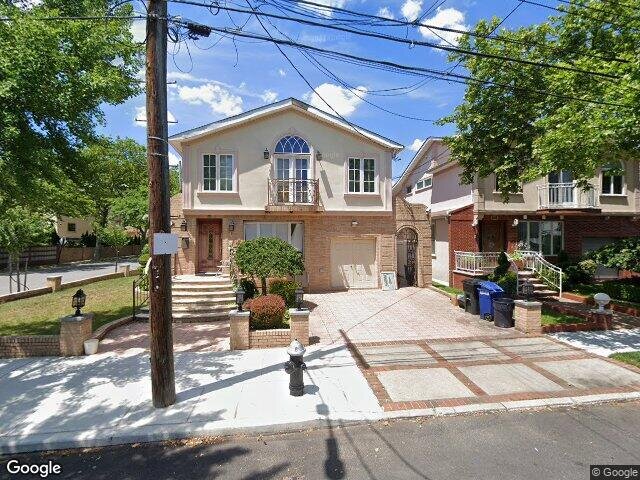
Description: 288 Whitman Dr, Brooklyn, NY 11234 is a Single Family Home built in 1960. This property was last sold for $395,000 in 2000 and currently has an estimated value of $1,606,900. According to the Brooklyn public records, the property at 288 Whitman Dr, Brooklyn, NY 11234 has approximately 2,624 square feet, with a lot size of 5,375 square feet. Nearby schools include Ps 236 Mill Basin, Success Academy Bergen Beach, Ps 312 Bergen Beach and Hebrew Language Academy.
2,624 sqft
5,375 lot size
Year Built: 1960
Pre-foreclosure
288 Whitman Dr, Brooklyn, NY 11234
Last Updated: April 24, 2024
1
Single Family Home
Town House
Estimated Market Value EMV $ 1,606,900
288 Whitman Dr
bool(false)

bool(true)

bool(true)

int(0)
Estimated Market Value EMV $ 1,606,900
Foreclosure History
for 288 Whitman Dr
for 288 Whitman Dr
Type
Single Family Home
Town House
288 Whitman Dr, Brooklyn, NY 11234 is a Single Family Home built in 1960. This property was last sold for $395,000 in 2000 and currently has an estimated value of $1,606,900. According to the Brooklyn public records, the property at 288 Whitman Dr, Brooklyn, NY 11234 has approximately 2,624 square feet, with a lot size of 5,375 square feet. Nearby schools include Ps 236 Mill Basin, Success Academy Bergen Beach, Ps 312 Bergen Beach and Hebrew Language Academy.
Property features
Year Built:
Year Built:
1960
1960
Living Area:
Living Area:
2624
2624
Building Class:
A1
One Family Dwellings: Two Stories Detached (Small Or Moderate Size, With Or Without Attic)
Floors on Main Building:
2.00
Building Dimensions:
26.50'
Actual Square Footage:
2,624
Calculated Square Footage:
2,624
Residential Floor Area:
2,624
Basement:
Above grade full basement
Address:
288 WHITMAN DRIVE
Land Use:
01
One & Two Family Buildings
Lot Dimensions:
53.75'
Calculated Lot Perimeter:
301.48 ft
Zoning Districts:
R2
Lower-density residence district
Max Residential FAR:
0.50
Max Residential Sqft:
2,688
Buildable Residential Sqft:
64
Residential Area Distribution:
Assessed Land Value:
$24,060
Assessed Total Value:
$77,880
Last Recording Date:
Jan 8, 2024
Property Assessment Data:
Tax Class:
1
One- to three-unit residential properties
Taxable Assessed Value:
$71,663
Estimated Market Value by NYC DOF :
$1,298,000
Community District (CD):
318
City Council District:
46
Document DateDocument Type Unit Amount
Recorded DateDocument Type Unit Amount
Date
Event
Price
Price/Sqft
Source
Jun 6, 2000
Sold
$395,000
$151
Public Record
Year
Taxes
Land
Additions
Total Assessment
2022
$13,750
$24,060
$44,820
$68,880
2021
$14,120
$24,060
$44,520
$68,580
2020
$13,398
$24,060
$44,640
$68,700
2019
$12,492
$24,060
$42,300
$66,360
2018
$12,180
$22,194
$36,032
$58,226
2017
$11,869
$18,967
$39,259
$58,226
2016
$11,177
$18,515
$37,400
$55,915
2015
$10,314
$26,228
$26,522
$52,750
2014
$9,534
$24,744
$25,022
$49,766
2013
$9,311
$24,126
$24,396
$48,522
2012
$8,833
$25,677
$22,845
$48,522
2010
$7,511
$29,590
$17,006
$46,596
2009
$7,086
$24,904
$19,055
$43,959
2007
$6,240
$10,687
$29,748
$40,435
Address
Price
Built
Beds
Baths
Sqft
Lot Size
Distance
199 Whitman Dr
Brooklyn, NY 11234SF
$1,250,000
03/13/2024
1960
3
3
2,506
-118difference
3,800
0.15 mi
2460 E 70th St
Brooklyn, NY 11234SF
$840,000
11/17/2023
1970
3
3
2,279
-345
2,650
0.47 mi
2310 E 65th St
Brooklyn, NY 11234SF
$1,850,000
11/28/2023
1950
4
4
3,240
+616
5,100
0.45 mi
2033 E 70th St
Brooklyn, NY 11234SF
$757,000
01/19/2024
1965
3
3
1,881
-743
2,783
0.94 mi
2265 E 64th St
Brooklyn, NY 11234SF
$810,000
04/18/2024
1955
3
1
1,614
-1,010
4,800
0.49 mi
2387 56th Dr
Brooklyn, NY 11234SF
$3,500,000
01/31/2024
2006
3
4
6,828
+4,204
11,000
0.26 mi
2437 E 63rd St
Brooklyn, NY 11234SF
$660,000
02/21/2024
1960
3
3
1,224
-1,400
2,250
0.33 mi
2642 E 63rd St
Brooklyn, NY 11234SF
$760,000
01/25/2024
1960
3
3
1,152
-1,472
2,100
0.35 mi
2264 56th Dr
Brooklyn, NY 11234SF
$684,000
02/16/2024
1965
3
2
1,404
-1,220
2,209
0.38 mi
2334 E 65th St
Brooklyn, NY 11234SF
$800,000
11/07/2023
1950
3
2
972
-1,652
5,100
0.41 mi
Address
Price
Built
Beds
Baths
Sqft
Lot Size
Distance
2744 Arkansas Dr
Brooklyn, NY 11234SF
$1,699,000
66 days ago
1965
4
3
2,651
+27difference
4,000
0.35 mi
1556 E 56th St
Brooklyn, NY 11234SF
$1,500,000
97 days ago
1975
6
5
2,590
-34
6,000
1.10 mi
2321 E 64th St
Brooklyn, NY 11234SF
$1,199,000
98 days ago
1950
4
3
2,569
-55
4,783
0.43 mi
65 Bevy Ct
Brooklyn, NY 11229SF
$948,000
24 days ago
1925
4
3
2,680
+56
3,570
1.50 mi
2164 E 72nd St
Brooklyn, NY 11234SF
$1,099,000
170 days ago
1950
3
3
2,700
+76
3,200
0.82 mi
2232 E 70th St
Brooklyn, NY 11234SF
$1,099,000
12 days ago
1988
3
3
2,520
-104
2,500
0.68 mi
2446 E 66th St
Brooklyn, NY 11234SF
$1,599,999
152 days ago
1960
4
3
2,496
-128
5,500
0.26 mi
2254 E 66th St
Brooklyn, NY 11234SF
$1,800,000
65 days ago
1960
5
3
2,460
-164
5,033
0.54 mi
3007 Avenue S
Brooklyn, NY 11229SF
$999,000
18 days ago
1940
3
3
2,450
-174
5,831
1.80 mi
2303 E 66th St
Brooklyn, NY 11234SF
$1,659,000
170 days ago
1960
6
4
2,800
+176
4,000
0.48 mi
Estimated values are not a substitute for professional expertise. Contact your RE agent for a market assessment.
School Name
Rating
Grades
Parent Rating
Distance
St Bernard Elementary School
, Brooklyn , NY 11234
—
PK−8
0.89 mi
Ps 236 Mill Basin
, Brooklyn , NY 11234
6 / 10
K−5
0.69 mi
Jhs 78 Roy H Mann
, Brooklyn , NY 11234
5 / 10
6−8
1.04 mi
Yeshivah of Crown Heights
, Brooklyn , NY 11234
—
PK−8
0.76 mi
Success Academy Bergen Beach
, Brooklyn , NY 11234
8 / 10
K−7
1.03 mi
Ps 312 Bergen Beach
, Brooklyn , NY 11234
6 / 10
K−5
1.03 mi
Hebrew Language Academy
, Brooklyn , NY 11234
6 / 10
K−8
0.55 mi
Mary Queen of Heaven Catholic Academy
, Brooklyn , NY 11234
—
PK−8
1.27 mi
Professional Pathways High School
, Brooklyn , NY 11235
1 / 10
9−12
—
1.88 mi
Origins High School
, Brooklyn , NY 11235
4 / 10
9−12
—
1.88 mi
FEMA Zone (Est.)
X (unshaded)
Flood insurance:
Recommended
Flood risks are increasing as sea levels rise and weather patterns change.
This property has a
Extreme Flood Factor
.
Please Log In
Please wait... If this message is not eventually replaced by the proper contents of the document, your PDF viewer may not be able to display this type of document.
You can upgrade to the latest version of Adobe Reader for Windows®, Mac, or Linux® by visiting
https://get.adobe.com/reader/ this link .
For more assistance with Adobe Reader visit
http://get.adobe.com/reader/ this link .
You can download this PDF-document from
here .