")

bool(false)

bool(true)

bool(true)

int(0)
Brooklyn, NY 11212
Foreclosure History
Property details
The description and property data below may have been provided by a third party, the homeowner or public records.
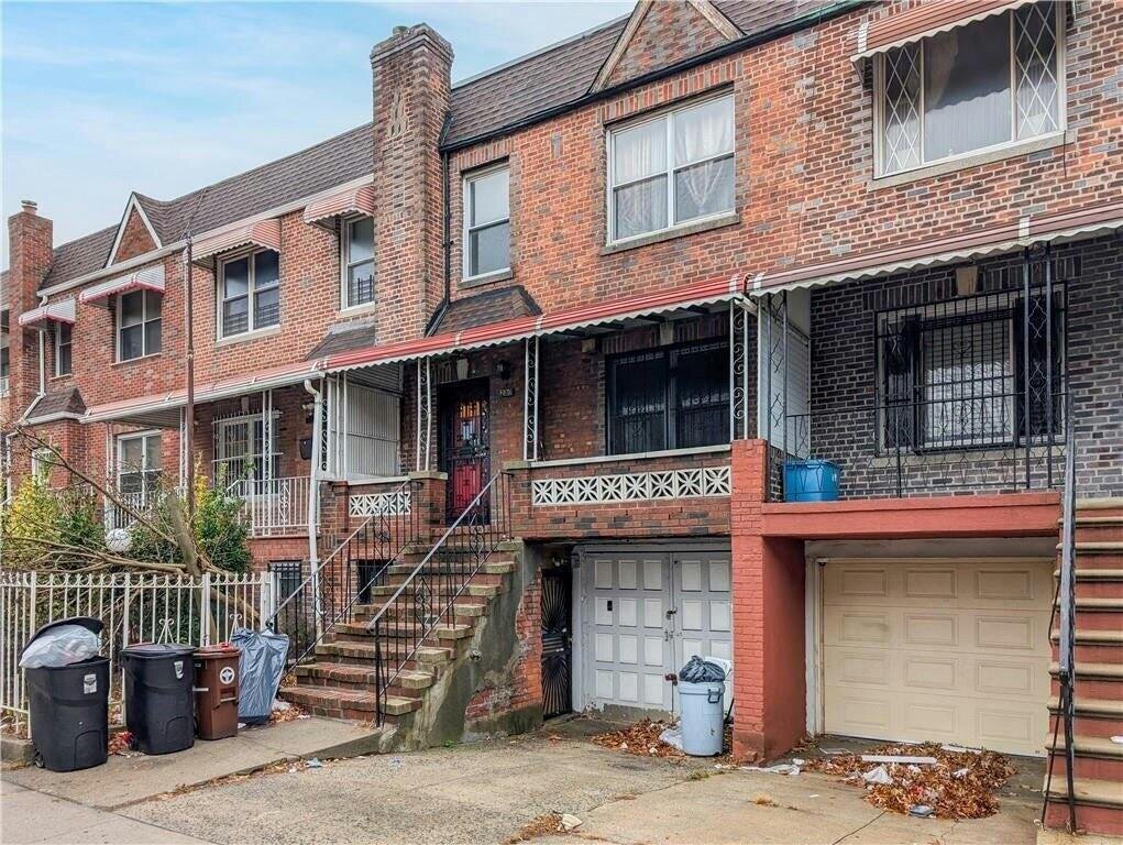
290 Rockaway Pkwy, Brooklyn, NY 11212 is a Multi Family Home built in 1930. This property was last sold for $535,000 in 2007 and currently has an estimated value of $692,200. According to the Brooklyn public records, the property at 290 Rockaway Pkwy, Brooklyn, NY 11212 has approximately 1,920 square feet, with a lot size of 1,600 square feet. Nearby schools include Ps 219 Kennedy King, Kings Collegiate Charter School and Brooklyn Ascend Charter School.
Primary Land Use and Tax Lot Information
for 290 Rockaway Pkwy

Property Price History
for 290 Rockaway Pkwy
| Date | Event | Price | ||
|---|---|---|---|---|
| Feb 19, 2025 | Listing removed | — | — | Brooklyn |
| Jan 30, 2025 | Listing removed | $799,000 | — | OneKeyMLS |
Property Tax History
for 290 Rockaway Pkwy
| Year | Taxes | |
|---|---|---|
| 2024 | $5,800 | $49,380 |
| 2023 | $5,533 | $58,860 |
Sold Homes
near 290 Rockaway Pkwy
| Address | Price | Beds | Baths |
|---|---|---|---|
|
Brooklyn, NY 11212MF
|
$945,000
04/11/2025
|
5
|
2
|
|
Brooklyn, NY 11212MF
|
$750,000
06/02/2025
|
7
|
2
|
|
Brooklyn, NY 11212MF
|
$630,550
01/29/2025
|
3
|
3
|
|
Brooklyn, NY 11203MF
|
$730,000
01/14/2025
|
4
|
2
|
|
Brooklyn, NY 11212MF
|
$920,000
06/03/2025
|
—
|
—
|
Homes For Sale
near 290 Rockaway Pkwy
| Address | Price | Beds | Baths |
|---|---|---|---|
|
Brooklyn, NY 11213MF
|
$1,150,000
47 days ago
|
4
|
2
|
|
Brooklyn, NY 11203MF
|
$989,000
29 days ago
|
3
|
2
|
|
Brooklyn, NY 11226MF
|
$849,000
47 days ago
|
4
|
3
|
|
Brooklyn, NY 11207MF
|
$899,995
108 days ago
|
4
|
3
|
|
Brooklyn, NY 11236MF
|
$899,900
85 days ago
|
4
|
3
|
Home Value
for 290 Rockaway Pkwy
Estimated values are not a substitute for professional expertise. Contact your RE agent for a market assessment.
Schools
serving 290 Rockaway Pkwy
| School Name | Rating |
|---|---|
|
440 E 96th St, Brooklyn, NY 11212
|
— |
|
1060 Clarkson Avenue, Brooklyn, NY 11212
|
4 / 10 |
|
905 Winthrop Street, Brooklyn, NY 11203
|
6 / 10 |
Data provided by
GreatSchools.org © 2025. All Rights Reserved.
School service boundaries are intended to be used as reference only.
To verify enrollment eligibility for a property, contact the school directly.
Flood Factor
for 290 Rockaway Pkwy
7
|10
Severe

FEMA Zone (Est.)
X (unshaded)
Flood insurance:
Recommended
Flood risks are increasing as sea levels rise and weather patterns change.
This property has a
Severe Flood Factor
.
Flood Factor data provided by FloodFactor.