3093 Mullan Pl, Bronx, NY 10465 Bronx County Last Updated: March 19, 2024
Pre-Foreclosure: Lis Pendens, Estimated Market Value $925,300
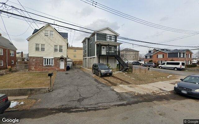
Description: 3093 Mullan Pl, Bronx, NY 10465 is a Multi Family Home built in 1925. This property was last sold for $581,440 in 2005 and currently has an estimated value of $925,300. According to the Bronx public records, the property at 3093 Mullan Pl, Bronx, NY 10465 has approximately 1,914 square feet, with a lot size of 3,556 square feet. Nearby schools include Ps 72 Dr William Dorney and Bronx Delta School.
1,914 sqft
3,556 lot size
Year Built: 1925
Pre-foreclosure
3093 Mullan Pl, Bronx, NY 10465
Last Updated: March 19, 2024
1
Multi Family Home
Estimated Market Value EMV $ 925,300
3093 Mullan Pl
bool(false)

bool(true)

bool(true)

int(0)
Estimated Market Value EMV $ 925,300
Foreclosure History
for 3093 Mullan Pl
for 3093 Mullan Pl
Last Sold
$581.4K in 2005
3093 Mullan Pl, Bronx, NY 10465 is a Multi Family Home built in 1925. This property was last sold for $581,440 in 2005 and currently has an estimated value of $925,300. According to the Bronx public records, the property at 3093 Mullan Pl, Bronx, NY 10465 has approximately 1,914 square feet, with a lot size of 3,556 square feet. Nearby schools include Ps 72 Dr William Dorney and Bronx Delta School.
Property features
Year Built:
Year Built:
1925
1925
Zoning:
Zoning:
R3-1
R3-1
Living Area:
Living Area:
1914
1914
Building Class:
B3
Two Family Dwellings: Converted From One Family
Floors on Main Building:
2.75
Building Dimensions:
22'
Actual Square Footage:
1,914
Calculated Square Footage:
1,694
Residential Floor Area:
1,914
Extension:
Extension and garage
Basement:
Below grade full basement
Address:
3093 MULLAN PLACE
Land Use:
01
One & Two Family Buildings
Lot Dimensions:
38'
Calculated Lot Perimeter:
258.60 ft
Zoning Districts:
R3-1
Lower-density residence district
Max Residential FAR:
0.50
Max Residential Sqft:
1,778
Buildable Residential Sqft:
0
Residential Area Distribution:
Assessed Land Value:
$10,140
Assessed Total Value:
$41,280
Last Recording Date:
Jan 8, 2024
Property Assessment Data:
Tax Class:
1
One- to three-unit residential properties
Taxable Assessed Value:
$36,029
Estimated Market Value by NYC DOF :
$711,000
Community District (CD):
210
City Council District:
13
Document DateDocument Type Unit Amount
Recorded DateDocument Type Unit Amount
Date
Event
Price
Price/Sqft
Source
Sep 22, 2005
Sold
$581,440
$304
Public Record
Oct 24, 2001
Sold
$266,000
$139
Public Record
Aug 7, 2000
Sold
$89,500
$47
Public Record
Year
Taxes
Land
Additions
Total Assessment
2022
$5,217
$10,140
$24,540
$34,680
2021
$6,800
$10,140
$22,800
$32,940
2020
$6,736
$10,140
$26,280
$36,420
2019
$6,280
$10,140
$24,840
$34,980
2018
$6,281
$8,429
$21,595
$30,024
2017
$5,818
$9,667
$18,876
$28,543
2016
$5,383
$7,806
$19,122
$26,928
2015
$5,185
$9,972
$16,549
$26,521
2015
$4,793
$11,280
$13,740
$25,020
2014
$4,838
$15,092
$10,121
$25,213
2011
$4,085
$15,120
$7,320
$22,440
2010
$4,039
$15,120
$7,320
$22,440
2009
$3,826
$13,729
$9,535
$23,264
2007
$3,264
$4,148
$17,002
$21,150
Address
Price
Built
Beds
Baths
Sqft
Lot Size
Distance
645 Hollywood Ave
Bronx, NY 10465MF
$910,000
12/19/2023
1960
5
3
2,570
+656difference
3,248
0.95 mi
3167 Wissman Ave
Bronx, NY 10465MF
$535,000
03/07/2024
1940
2
2
520
-1,394
3,242
0.35 mi
Address
Price
Built
Beds
Baths
Sqft
Lot Size
Distance
257 Revere Ave
Bronx, NY 10465MF
$849,000
87 days ago
1955
4
2
1,944
+30difference
2,800
0.52 mi
150-15 12 Rd
Whitestone, NY 11357MF
$995,000
167 days ago
1920
4
3
1,872
-42
2,186
1.80 mi
275 Balcom Ave
Bronx, NY 10465MF
$940,000
27 days ago
1955
5
4
1,998
+84
1,799
0.80 mi
10-43 Burton St
Beechhurst, NY 11357MF
$1,490,000
139 days ago
1925
4
2
1,800
-114
6,000
1.82 mi
2850 Philip Ave
Bronx, NY 10465MF
$875,000
62 days ago
1950
6
2
1,788
-126
—
1.18 mi
151-25 14th Ave
Whitestone, NY 11357MF
$1,198,000
9 days ago
1925
4
3
1,785
-129
2,500
1.81 mi
559 Logan Ave
Bronx, NY 10465MF
$1,180,000
231 days ago
2021
5
4
1,768
-146
2,500
0.81 mi
557 Logan Ave
Bronx, NY 10465MF
$1,180,000
231 days ago
2021
5
3
1,768
-146
2,500
0.81 mi
Estimated values are not a substitute for professional expertise. Contact your RE agent for a market assessment.
School Name
Rating
Grades
Parent Rating
Distance
St Frances De Chantal School
, The Bronx , NY 10465
—
PK−8
0.27 mi
Herbert H Lehman High School
, The Bronx , NY 10461
4 / 10
8−12
2.37 mi
Schuylerville Preparatory High School
, The Bronx , NY 10461
2 / 10
9−12
2.37 mi
Bronx River High School
, The Bronx , NY 10461
2 / 10
9−12
2.37 mi
Westchester Square Academy
, The Bronx , NY 10461
3 / 10
9−12
2.37 mi
Pelham Lab High School
, The Bronx , NY 10461
2 / 10
9−12
2.37 mi
Preston High School
, The Bronx , NY 10465
—
9−12
0.64 mi
Ps 72 Dr William Dorney
, The Bronx , NY 10465
5 / 10
K−5
0.72 mi
Bronx Delta School
, The Bronx , NY 10465
4 / 10
K−5
0.94 mi
Urban Institute Of Mathematics
, The Bronx , NY 10465
8 / 10
6−8
0.94 mi
Flood insurance:
Required
Flood risks are increasing as sea levels rise and weather patterns change.
This property has a
Severe Flood Factor
.
Please Log In
Please wait... If this message is not eventually replaced by the proper contents of the document, your PDF viewer may not be able to display this type of document.
You can upgrade to the latest version of Adobe Reader for Windows®, Mac, or Linux® by visiting
https://get.adobe.com/reader/ this link .
For more assistance with Adobe Reader visit
http://get.adobe.com/reader/ this link .
You can download this PDF-document from
here .