")

bool(false)

bool(true)

bool(true)

int(0)
bool(false)
bool(true)
bool(true)
int(0)
Brooklyn, NY 11212
Foreclosure History
Lis Pendens
Property details
The description and property data below may have been provided by a third party, the homeowner or public records.
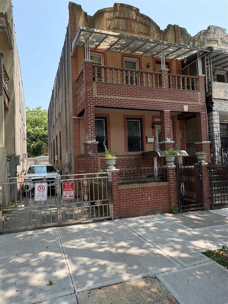
Step into a fantastic well maintain 2 family home with unlimited potential perfectly located in the desirable Brownsville section of Brooklyn.This move in ready property offers an impressive 6 nice size bedrooms in total we have 3 bedrooms on each floor Each of the two spacious units offers comfortable living space, making it an attractive option for potential owners or renters. This property is ideally situated near local shops, restaurants, and Lincoln Terrace / Arthur S. Somers Park, with convenient access to public transportation.
Primary Land Use and Tax Lot Information
for 31 Tapscott St

Personal Property Records
for 31 Tapscott St | Document Type | ||||
|---|---|---|---|---|
Property Price History
for 31 Tapscott St
| Date | Event | Price | ||
|---|---|---|---|---|
| Jun 7, 2025 | Listed | $979,999 | $437 | OneKeyMLS |
| Jun 24, 2020 | Sold | $770,000 | $344 | Public Record |
Property Tax History
for 31 Tapscott St
| Year | Taxes | |
|---|---|---|
| 2024 | $826 | $45,600 |
| 2023 | $721 | $44,460 |
Sold Homes
near 31 Tapscott St
| Address | Price | Beds | Baths |
|---|---|---|---|
|
Brooklyn, NY 11212MF
|
$485,000
06/13/2025
|
6
|
4
|
|
Brooklyn, NY 11213MF
|
$940,000
08/20/2025
|
6
|
2
|
|
Brooklyn, NY 11233MF
|
$940,000
06/18/2025
|
—
|
3
|
|
Brooklyn, NY 11233MF
|
$780,000
07/03/2025
|
6
|
4
|
|
Brooklyn, NY 11203MF
|
$940,000
07/02/2025
|
—
|
—
|
Homes For Sale
near 31 Tapscott St
| Address | Price | Beds | Baths |
|---|---|---|---|
|
Brooklyn, NY 11212MF
|
$925,000
50 days ago
|
6
|
2
|
|
Brooklyn, NY 11212MF
|
$672,000
55 days ago
|
6
|
2
|
|
Brooklyn, NY 11221MF
|
$1,290,000
130 days ago
|
6
|
4
|
|
Brooklyn, NY 11203MF
|
$1,050,000
42 days ago
|
5
|
3
|
|
Brooklyn, NY 11236MF
|
$999,000
30 days ago
|
7
|
2
|
Schools
serving 31 Tapscott St
| School Name | Rating |
|---|---|
|
521 Thomas Boyland St, Brooklyn, NY 11212
|
— |
|
564 Thomas S Boyland Street, Brooklyn, NY 11212
|
— |
|
104 Sutter Avenue, Brooklyn, NY 11212
|
5 / 10 |
Data provided by
GreatSchools.org © 2025. All Rights Reserved.
School service boundaries are intended to be used as reference only.
To verify enrollment eligibility for a property, contact the school directly.
Flood Factor
for 31 Tapscott St
1
|10
Minimal

FEMA Zone (Est.)
X (unshaded)
Flood insurance:
Recommended
Flood risks are increasing as sea levels rise and weather patterns change.
This property has a
Minimal Flood Factor
.
Although flood risks across the country are changing because of the environment, this property is unlikely to flood over the next 30 years.
Although flood risks across the country are changing because of the environment, this property is unlikely to flood over the next 30 years.
Flood Factor data provided by FloodFactor.