
bool(false)

bool(true)

bool(true)

int(0)
Bronx, NY 10469
Property details
The description and property data below may have been provided by a third party, the homeowner or public records.
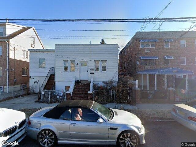
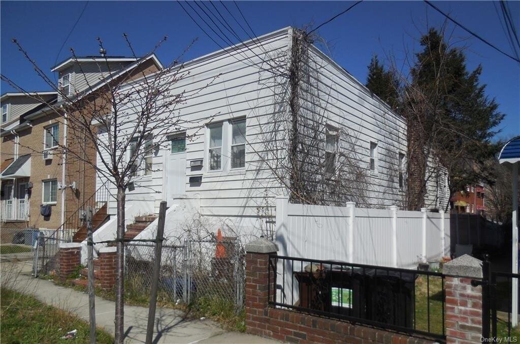
Single family home located in the Baychester section of the Bronx. Property is being SOLD OCCUPIED WITH NO INTERIOR ACCESS. DO NOT DISTURB OCCUPANTS.
Primary Land Use and Tax Lot Information
for 3198 Edson Ave

Property Price History
for 3198 Edson Ave
| Date | Event | Price | ||
|---|---|---|---|---|
| Apr 10, 2024 | Listed | $372,000 | $278 | OneKeyMLS |
| Feb 16, 2010 | Sold | $390,000 | $291 | Public Record |
Property Tax History
for 3198 Edson Ave
| Year | Taxes | |
|---|---|---|
| 2022 | $3,194 | $29,280 |
| 2021 | $3,261 | $27,000 |
Sold Homes
near 3198 Edson Ave
| Address | Price | Beds | Baths |
|---|---|---|---|
|
Bronx, NY 10469SF
|
$710,000
02/02/2024
|
4
|
3
|
|
Bronx, NY 10469SF
|
$625,000
03/29/2024
|
4
|
3
|
Homes For Sale
near 3198 Edson Ave
| Address | Price | Beds | Baths |
|---|---|---|---|
|
Bronx, NY 10469SF
|
$649,999
30 days ago
|
3
|
3
|
|
Bronx, NY 10469SF
|
$679,000
9 days ago
|
3
|
2
|
|
Bronx, NY 10466SF
|
$550,000
239 days ago
|
2
|
1
|
|
Bronx, NY 10466SF
|
$550,000
12 days ago
|
4
|
1
|
|
Bronx, NY 10466SF
|
$650,000
30 days ago
|
4
|
3
|
Schools
serving 3198 Edson Ave
| School Name | Rating |
|---|---|
|
750 BAYCHESTER AVE, The Bronx, NY 10475
|
6 / 10 |
|
750 BAYCHESTER AVE, The Bronx, NY 10475
|
— |
|
850 BAYCHESTER AVE, The Bronx, NY 10475
|
— |
Data provided by
GreatSchools.org © 2024. All Rights Reserved.
School service boundaries are intended to be used as reference only.
To verify enrollment eligibility for a property, contact the school directly.
Flood Factor
for 3198 Edson Ave
1
|10
Minimal

FEMA Zone (Est.)
X (unshaded)
Flood insurance:
Recommended
Flood risks are increasing as sea levels rise and weather patterns change.
This property has a
Minimal Flood Factor
.
Although flood risks across the country are changing because of the environment, this property is unlikely to flood over the next 30 years.
Although flood risks across the country are changing because of the environment, this property is unlikely to flood over the next 30 years.
Flood Factor data provided by FloodFactor.