321 Brinsmade Ave, Bronx, NY 10465 Bronx County Last Updated: March 5, 2024
Pre-Foreclosure: Lis Pendens, Estimated Market Value $777,700
Description: 321 Brinsmade Ave, Bronx, NY 10465 is a Single Family Home built in 1950. This property was last sold for $560,000 in 2019 and currently has an estimated value of $777,700. According to the Bronx public records, the property at 321 Brinsmade Ave, Bronx, NY 10465 has approximately 1,995 square feet, with a lot size of 2,300 square feet. Nearby schools include Ps 304 Early Childhood School, Ps 72 Dr William Dorney and Bronx Delta School.
1,995 sqft
2,300 lot size
Year Built: 1950
Pre-foreclosure
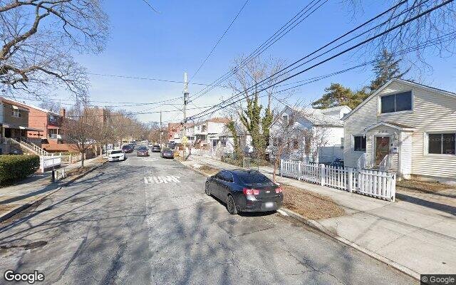
321 Brinsmade Ave, Bronx, NY 10465
Last Updated: March 5, 2024
1
Single Family Home
Town House
Estimated Market Value EMV $ 777,700
321 Brinsmade Ave
bool(false)

bool(true)

bool(true)

int(0)
Estimated Market Value EMV $ 777,700
Foreclosure History
for 321 Brinsmade Ave
for 321 Brinsmade Ave
Type
Single Family Home
Town House
321 Brinsmade Ave, Bronx, NY 10465 is a Single Family Home built in 1950. This property was last sold for $560,000 in 2019 and currently has an estimated value of $777,700. According to the Bronx public records, the property at 321 Brinsmade Ave, Bronx, NY 10465 has approximately 1,995 square feet, with a lot size of 2,300 square feet. Nearby schools include Ps 304 Early Childhood School, Ps 72 Dr William Dorney and Bronx Delta School.
Property features
Year Built:
Year Built:
1950
1950
Zoning:
Zoning:
R3-2
R3-2
Living Area:
Living Area:
1995
1995
Building Class:
A5
One Family Dwellings: Attached Or Semi-detached
Floors on Main Building:
2
Building Dimensions:
19'
Actual Square Footage:
1,995
Calculated Square Footage:
1,330
Residential Floor Area:
1,330
Basement:
Above grade full basement
Address:
321 BRINSMADE AVENUE
BIN
Name 321 BRINSMADE AVENUE
Land Use:
01
One & Two Family Buildings
Calculated Lot Perimeter:
249.38 ft
Zoning Districts:
R3-2
Lower-density residence district
Max Residential FAR:
0.50
Max Residential Sqft:
1,150
Buildable Residential Sqft:
0
Residential Area Distribution:
Assessed Land Value:
$9,000
Assessed Total Value:
$42,480
Last Recording Date:
Jan 8, 2024
Property Assessment Data:
Tax Class:
1
One- to three-unit residential properties
Taxable Assessed Value:
$31,812
Estimated Market Value by NYC DOF :
$711,000
Community District (CD):
210
City Council District:
13
Document DateDocument Type Unit Amount
Recorded DateDocument Type Unit Amount
Date
Event
Price
Price/Sqft
Source
Jun 14, 2019
Sold
$560,000
$281
Public Record
Apr 7, 2019
Listing removed
—
—
HudsonGatewayMLS
Mar 25, 2019
Listed
$575,000
$288
HudsonGatewayMLS
Apr 17, 2015
Sold
$430,000
$216
Public Record
Mar 6, 2015
Listing removed
$459,000
$230
HudsonGatewayMLS
Dec 19, 2014
Listed
$459,000
$230
HudsonGatewayMLS
Year
Taxes
Land
Additions
Total Assessment
2022
$5,652
$9,000
$26,700
$35,700
2021
$5,621
$9,000
$27,300
$36,300
2020
$5,654
$9,000
$24,900
$33,900
2019
$5,545
$9,000
$21,540
$30,540
2018
$5,232
$7,399
$17,611
$25,010
2017
$4,809
$8,653
$14,942
$23,595
2016
$4,449
$9,000
$13,260
$22,260
2015
$4,419
$10,020
$13,740
$23,760
2015
$4,646
$10,020
$13,740
$23,760
2014
$4,432
$14,340
$9,480
$23,820
2011
$4,162
$13,184
$10,316
$23,500
2010
$3,807
$13,184
$10,316
$23,500
2009
$3,518
$14,135
$8,516
$22,651
2007
$2,933
$3,028
$16,556
$19,584
Address
Price
Built
Beds
Baths
Sqft
Lot Size
Distance
2733 Miles Ave
Bronx, NY 10465SF
$650,000
02/20/2024
1960
4
4
1,798
-197difference
1,800
0.07 mi
2738 Miles Ave
Bronx, NY 10465SF
$325,000
03/05/2024
1930
3
1
936
-1,059
2,500
0.09 mi
Address
Price
Built
Beds
Baths
Sqft
Lot Size
Distance
3154A Miles Ave Unit A
Bronx, NY 10465SF
$699,900
37 days ago
1955
3
3
1,998
+3difference
1,799
0.78 mi
1036 Brinsmade Ave
Bronx, NY 10465SF
$795,999
14 days ago
1950
4
2
1,980
-15
3,000
0.96 mi
2007 Gildersleeve Ave
Bronx, NY 10473SF
$635,000
27 days ago
—
3
4
2,041
+46
—
1.60 mi
151 Prentiss Ave
Bronx, NY 10465SF
$710,000
84 days ago
1925
3
3
1,948
-47
2,749
0.74 mi
421 Olmstead Ave
Bronx, NY 10473SF
$299,999
40 days ago
1965
4
4
1,944
-51
1,943
1.50 mi
1053 Swinton Ave
Bronx, NY 10465SF
$400,000
2 days ago
1950
3
2
2,048
+53
3,742
0.99 mi
1017 Swinton Ave
Bronx, NY 10465SF
$789,900
2 days ago
1955
3
2
1,938
-57
—
0.93 mi
234 Quincy Ave
Bronx, NY 10465SF
$380,000
65 days ago
1925
5
3
1,900
-95
1,941
0.22 mi
2021 Watson Ave
Bronx, NY 10472SF
$849,000
192 days ago
—
3
2
1,890
-105
—
1.94 mi
835 Dean Ave
Bronx, NY 10465SF
$959,000
33 days ago
1925
4
3
1,870
-125
—
1.06 mi
Estimated values are not a substitute for professional expertise. Contact your RE agent for a market assessment.
School Name
Rating
Grades
Parent Rating
Distance
Ps 304 Early Childhood School
, The Bronx , NY 10465
8 / 10
K−5
0.75 mi
St Frances De Chantal School
, The Bronx , NY 10465
—
PK−8
0.49 mi
Ps 72 Dr William Dorney
, The Bronx , NY 10465
5 / 10
K−5
0.41 mi
Preston High School
, The Bronx , NY 10465
—
9−12
0.31 mi
Mott Hall Community School
, The Bronx , NY 10465
4 / 10
6−8
0.66 mi
Urban Institute Of Mathematics
, The Bronx , NY 10465
8 / 10
6−8
0.66 mi
Bronx Delta School
, The Bronx , NY 10465
4 / 10
K−5
0.66 mi
Renaissance High School for Musical Theater and Technology
, The Bronx , NY 10461
3 / 10
9−12
1.74 mi
Herbert H Lehman High School
, The Bronx , NY 10461
4 / 10
8−12
1.81 mi
Bronx Community High School
, The Bronx , NY 10473
2 / 10
9−12
1.77 mi
Flood insurance:
Required
Flood risks are increasing as sea levels rise and weather patterns change.
This property has a
Major Flood Factor
.
Please Log In
Please wait... If this message is not eventually replaced by the proper contents of the document, your PDF viewer may not be able to display this type of document.
You can upgrade to the latest version of Adobe Reader for Windows®, Mac, or Linux® by visiting
https://get.adobe.com/reader/ this link .
For more assistance with Adobe Reader visit
http://get.adobe.com/reader/ this link .
You can download this PDF-document from
here .