
bool(false)

bool(true)

bool(true)

int(0)
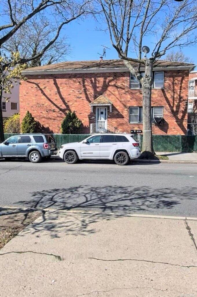
Flushing, NY 11358
Property details
The description and property data below may have been provided by a third party, the homeowner or public records.
33-08 Francis Lewis Blvd, Flushing, NY 11358 is a Multi Family Home built in 1970. According to the Flushing public records, the property at 33-08 Francis Lewis Blvd, Flushing, NY 11358 has approximately 2,961 square feet, with a lot size of 2,894 square feet. Nearby schools include Ps 32 State Street and P.S. 130.
Property facts
Primary Land Use and Tax Lot Information
for 33-08 Francis Lewis Blvd

Sold Homes
near 33-08 Francis Lewis Blvd
| Address | Price | Beds | Baths |
|---|---|---|---|
|
Bayside, NY 11361MF
|
$1,300,000
01/19/2024
|
4
|
3
|
|
Flushing, NY 11358MF
|
$1,387,000
12/06/2023
|
5
|
3
|
|
Flushing, NY 11358MF
|
$1,340,000
03/28/2024
|
5
|
3
|
|
Bayside, NY 11361MF
|
$1,338,000
02/06/2024
|
6
|
3
|
|
Bayside, NY 11361MF
|
$995,000
12/15/2023
|
2
|
3
|
Homes For Sale
near 33-08 Francis Lewis Blvd
| Address | Price | Beds | Baths |
|---|---|---|---|
|
Flushing, NY 11358MF
|
$1,595,000
165 days ago
|
7
|
6
|
Schools
serving 33-08 Francis Lewis Blvd
| School Name | Rating |
|---|---|
|
171-11 35TH AVE, Queens, NY 11358
|
7 / 10 |
|
34-65 192ND ST, Queens, NY 11358
|
8 / 10 |
|
200-01 42ND AVE, Queens, NY 11361
|
10 / 10 |
Data provided by
GreatSchools.org © 2024. All Rights Reserved.
School service boundaries are intended to be used as reference only.
To verify enrollment eligibility for a property, contact the school directly.
Flood Factor
for 33-08 Francis Lewis Blvd
1
|10
Minimal

FEMA Zone (Est.)
X (unshaded)
Flood insurance:
Flood risks are increasing as sea levels rise and weather patterns change.
This property has a
Minimal Flood Factor
.
Although flood risks across the country are changing because of the environment, this property is unlikely to flood over the next 30 years.
Although flood risks across the country are changing because of the environment, this property is unlikely to flood over the next 30 years.
Flood Factor data provided by FloodFactor.