3310 Bronxwood Ave, Bronx, NY 10469 Bronx County Last Updated: March 5, 2024
Pre-Foreclosure: Lis Pendens, Estimated Market Value $874,400
Description: 3310 Bronxwood Ave, Bronx, NY 10469 is a Multi Family Home built in 1960. This property was last sold for $230,000 in 1992 and currently has an estimated value of $874,400. According to the Bronx public records, the property at 3310 Bronxwood Ave, Bronx, NY 10469 has approximately 2,288 square feet, with a lot size of 2,500 square feet. Nearby schools include Ps 76 The Bennington School and Ps 78 Anne Hutchinson.
2,288 sqft
2,500 lot size
Year Built: 1960
Pre-foreclosure
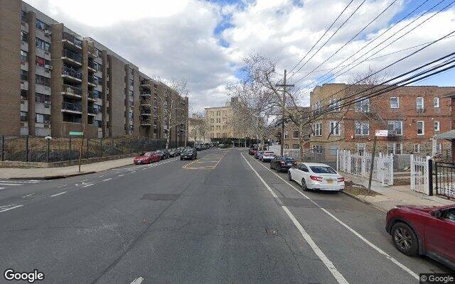
3310 Bronxwood Ave, Bronx, NY 10469
Last Updated: March 5, 2024
1
Multi Family Home
Estimated Market Value EMV $ 874,400
3310 Bronxwood Ave
bool(false)

bool(true)

bool(true)

int(0)
Estimated Market Value EMV $ 874,400
Foreclosure History
for 3310 Bronxwood Ave
for 3310 Bronxwood Ave
3310 Bronxwood Ave, Bronx, NY 10469 is a Multi Family Home built in 1960. This property was last sold for $230,000 in 1992 and currently has an estimated value of $874,400. According to the Bronx public records, the property at 3310 Bronxwood Ave, Bronx, NY 10469 has approximately 2,288 square feet, with a lot size of 2,500 square feet. Nearby schools include Ps 76 The Bennington School and Ps 78 Anne Hutchinson.
Property features
Year Built:
Year Built:
1960
1960
Living Area:
Living Area:
2288
2288
Building Class:
B1
Two Family Dwellings: Brick
Floors on Main Building:
2
Building Dimensions:
22'
Actual Square Footage:
2,288
Calculated Square Footage:
2,288
Residential Floor Area:
2,288
Basement:
Below grade full basement
Address:
3310 BRONXWOOD AVENUE
BIN
Name 3310 BRONXWOOD AVENUE
Land Use:
01
One & Two Family Buildings
Calculated Lot Perimeter:
250.82 ft
Zoning Districts:
R5
Lower-density residence district
Max Residential FAR:
1.25
Max Residential Sqft:
3,125
Buildable Residential Sqft:
837
Residential Area Distribution:
Assessed Land Value:
$8,760
Assessed Total Value:
$51,720
Exempt Total Value:
$1,400
Last Recording Date:
Jan 8, 2024
Property Assessment Data:
Tax Class:
1
One- to three-unit residential properties
Taxable Assessed Value:
$31,614
Estimated Market Value by NYC DOF :
$799,000
Community District (CD):
212
City Council District:
12
Document DateDocument Type Unit Amount
Date
Event
Price
Price/Sqft
Source
Jun 10, 1992
Sold
$230,000
$101
Public Record
Mar 17, 1992
Sold
$230,000
$101
Public Record
Year
Taxes
Land
Additions
Total Assessment
2022
$5,578
$8,760
$40,380
$49,140
2021
$5,537
$8,760
$39,240
$48,000
2020
$5,571
$8,760
$35,160
$43,920
2019
$5,462
$8,760
$28,620
$37,380
2018
$5,125
$8,535
$17,420
$25,955
2017
$4,691
$8,106
$16,380
$24,486
2016
$4,308
$8,760
$14,340
$23,100
2015
$4,623
$9,536
$16,189
$25,725
2015
$4,759
$9,609
$16,311
$25,920
2014
$4,358
$14,615
$9,654
$24,269
2011
$3,615
$16,440
$5,160
$21,600
2010
$3,876
$16,440
$5,160
$21,600
2009
$3,624
$14,743
$9,201
$23,944
2007
$3,090
$3,157
$18,155
$21,312
Address
Price
Built
Beds
Baths
Sqft
Lot Size
Distance
3978 Paulding Ave
Bronx, NY 10466MF
$838,000
02/23/2024
—
6
2
2,124
-164difference
3,434
0.95 mi
761 S Oak Dr
Bronx, NY 10467MF
$725,000
03/01/2024
—
4
2
2,846
+558
4,600
0.23 mi
933 E 217th St
Bronx, NY 10469MF
$800,000
12/12/2023
1925
5
3
3,208
+920
5,921
0.51 mi
660 Magenta St
Bronx, NY 10467MF
$815,000
04/09/2024
1920
8
3
4,428
+2,140
2,350
0.42 mi
Address
Price
Built
Beds
Baths
Sqft
Lot Size
Distance
746 E 224th St
Bronx, NY 10466MF
$939,000
8 days ago
1925
6
4
2,280
-8difference
2,858
0.89 mi
4331 Byron Ave
Bronx, NY 10466MF
$930,000
190 days ago
1910
5
2
2,280
-8
2,614
1.60 mi
2543 Bouck Ave
Bronx, NY 10469MF
$699,000
8 days ago
1930
5
3
2,278
-10
12,380
0.84 mi
1167 E 223rd St
Bronx, NY 10466MF
$1,115,000
75 days ago
2018
6
4
2,300
+12
—
0.91 mi
2023 Yates Ave
Bronx, NY 10461MF
$875,000
151 days ago
1955
4
3
2,305
+17
2,701
1.33 mi
3661 Varian Ave
Bronx, NY 10466MF
$999,999
246 days ago
1999
5
4
2,270
-18
—
1.64 mi
2884 Valentine Ave
Bronx, NY 10458MF
$929,000
238 days ago
1915
6
6
2,310
+22
—
1.47 mi
2746B Creston Ave Unit B
Bronx, NY 10468MF
$799,000
47 days ago
2005
5
4
2,323
+35
1,429
1.70 mi
801 S Oak Dr
Bronx, NY 10467MF
$900,000
172 days ago
1920
4
3
2,250
-38
3,990
0.13 mi
1032 Rhinelander Ave
Bronx, NY 10461MF
$859,000
64 days ago
1920
7
3
2,250
-38
2,252
1.62 mi
Estimated values are not a substitute for professional expertise. Contact your RE agent for a market assessment.
School Name
Rating
Grades
Parent Rating
Distance
Ps 76 The Bennington School
, The Bronx , NY 10469
4 / 10
K−5
0.29 mi
Leaders of Tomorrow
, The Bronx , NY 10467
3 / 10
6−8
—
0.50 mi
The Learning Tree
, Bronx , NY 10467
—
PK−8
0.09 mi
North Bronx School of Empowerment
, The Bronx , NY 10467
2 / 10
6−8
0.50 mi
Bronx Lab School
, The Bronx , NY 10467
2 / 10
8−12
0.14 mi
Bronx Aerospace High School
, The Bronx , NY 10467
2 / 10
9−12
0.12 mi
Bronx High School For Writing And Communication Ar
, The Bronx , NY 10467
2 / 10
9−12
0.12 mi
Bronx Academy Of Health Careers
, The Bronx , NY 10467
3 / 10
9−12
0.11 mi
Ps 78 Anne Hutchinson
, The Bronx , NY 10469
5 / 10
K−5
0.64 mi
Immaculate Conception School
, Bronx , NY 10467
—
K−9
0.22 mi
FEMA Zone (Est.)
X (unshaded)
Flood insurance:
Recommended
Flood risks are increasing as sea levels rise and weather patterns change.
This property has a
Severe Flood Factor
.
Please Log In
Please wait... If this message is not eventually replaced by the proper contents of the document, your PDF viewer may not be able to display this type of document.
You can upgrade to the latest version of Adobe Reader for Windows®, Mac, or Linux® by visiting
https://get.adobe.com/reader/ this link .
For more assistance with Adobe Reader visit
http://get.adobe.com/reader/ this link .
You can download this PDF-document from
here .