338 Stanley Ave, Staten Island, NY 10301 Richmond County Last Updated: March 12, 2024
Pre-Foreclosure: Lis Pendens, Estimated Market Value $560,900
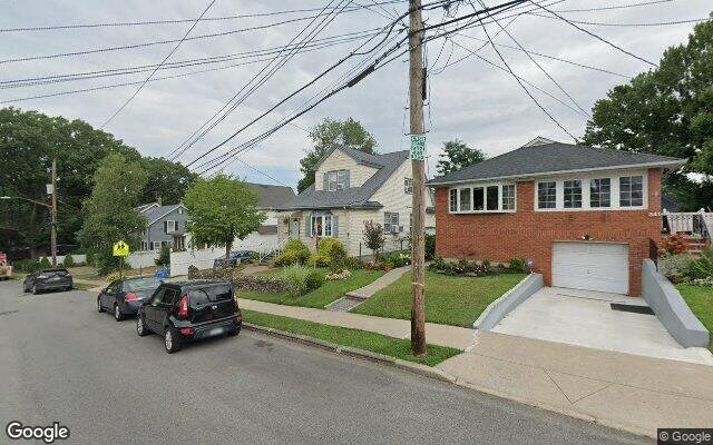
Description: 338 Stanley Ave, Staten Island, NY 10301 is a Single Family Home built in 1899. This property was last sold for $499,550 in 2009 and currently has an estimated value of $560,900. According to the Staten Island public records, the property at 338 Stanley Ave, Staten Island, NY 10301 has approximately 1,400 square feet, with a lot size of 2,496 square feet. Nearby schools include Ps 31 William T Davis, Ps 45 John Tyler and Ps 74 Future Leaders Elementary School.
1,400 sqft
2,496 lot size
Year Built: 1899
Pre-foreclosure
338 Stanley Ave, Staten Island, NY 10301
Last Updated: March 12, 2024
1
Single Family Home
Town House
Estimated Market Value EMV $ 560,900
338 Stanley Ave
bool(false)

bool(true)

bool(true)

int(0)
Estimated Market Value EMV $ 560,900
Foreclosure History
for 338 Stanley Ave
for 338 Stanley Ave
Type
Single Family Home
Town House
Last Sold
$499.6K in 2009
338 Stanley Ave, Staten Island, NY 10301 is a Single Family Home built in 1899. This property was last sold for $499,550 in 2009 and currently has an estimated value of $560,900. According to the Staten Island public records, the property at 338 Stanley Ave, Staten Island, NY 10301 has approximately 1,400 square feet, with a lot size of 2,496 square feet. Nearby schools include Ps 31 William T Davis, Ps 45 John Tyler and Ps 74 Future Leaders Elementary School.
Property features
Year Built:
Year Built:
1899
1899
Living Area:
Living Area:
1400
1400
Building Class:
A1
One Family Dwellings: Two Stories Detached (Small Or Moderate Size, With Or Without Attic)
Floors on Main Building:
2.5
Building Dimensions:
21'
Actual Square Footage:
1,400
Calculated Square Footage:
1,418
Residential Floor Area:
1,400
Basement:
Below grade full basement
Address:
338 STANLEY AVENUE
Borough:
Staten Island (5)
BIN
Name 338 STANLEY AVENUE
Land Use:
01
One & Two Family Buildings
Calculated Lot Perimeter:
242.39 ft
Zoning Districts:
R3A
Lower-density residence district
Special Purpose Districts:
HS
Special Hillsides Preservation District
Max Residential FAR:
0.50
Max Residential Sqft:
1,248
Buildable Residential Sqft:
0
Residential Area Distribution:
Assessed Land Value:
$11,640
Assessed Total Value:
$42,720
Last Recording Date:
Jan 8, 2024
Property Assessment Data:
Tax Class:
1
One- to three-unit residential properties
Taxable Assessed Value:
$23,488
Estimated Market Value by NYC DOF :
$630,000
Community District (CD):
501
City Council District:
49
Document DateDocument Type Unit Amount
Date
Event
Price
Price/Sqft
Source
Feb 11, 2013
Listing removed
$315,000
$225
StatenIsland
Feb 16, 2012
Price Changed
$315,000
$225
StatenIsland
Jan 9, 2012
Listed
$345,000
$246
StatenIsland
May 6, 2009
Sold
$499,550
$357
Public Record
Jun 30, 2000
Sold
$160,000
$114
Public Record
Year
Taxes
Land
Additions
Total Assessment
2022
$4,653
$11,640
$24,180
$35,820
2021
$4,628
$11,640
$18,000
$29,640
2020
$4,391
$11,640
$13,920
$25,560
2019
$4,094
$11,640
$14,760
$26,400
2018
$4,094
$11,038
$8,535
$19,573
2017
$3,959
$9,564
$9,861
$19,425
2016
$3,663
$11,215
$7,111
$18,326
2015
$3,380
$11,114
$6,175
$17,289
2014
$3,028
$9,896
$6,415
$16,311
2014
$3,124
$10,362
$5,949
$16,311
2012
$2,947
$10,660
$5,528
$16,188
2010
$2,501
$8,820
$6,452
$15,272
2009
$2,086
$8,621
$5,787
$14,408
2007
$1,882
$2,127
$11,363
$13,490
Address
Price
Built
Beds
Baths
Sqft
Lot Size
Distance
89 Taft Ave
Staten Island, NY 10301SF
$518,000
02/28/2024
2023
3
4
1,440
+40difference
2,500
0.72 mi
173 Wright St
Staten Island, NY 10304SF
$525,300
04/04/2024
1915
3
3
1,450
+50
1,708
0.87 mi
770 Brighton Ave
Staten Island, NY 10301SF
$520,000
01/09/2024
1930
3
2
1,476
+76
3,270
0.08 mi
10 Elizabeth Ave
Staten Island, NY 10310SF
$598,000
11/08/2023
1930
3
3
1,322
-78
2,673
0.99 mi
192 Hart Blvd
Staten Island, NY 10301SF
$647,500
03/25/2024
1901
3
1
1,316
-84
4,255
0.34 mi
15 Portland Pl
Staten Island, NY 10301SF
$575,000
04/04/2024
1940
2
1
1,200
-200
5,340
0.14 mi
23 Randall Ave
Staten Island, NY 10301SF
$585,000
02/09/2024
1925
4
3
1,995
+595
6,120
0.15 mi
44 Hunter Pl
Staten Island, NY 10301SF
$663,000
03/20/2024
1955
3
1
1,300
-100
3,960
0.31 mi
321 Glen Ave
Staten Island, NY 10301SF
$470,000
11/10/2023
1993
3
3
1,080
-320
2,596
0.32 mi
132 Robert Ln
Staten Island, NY 10301SF
$499,000
01/30/2024
1998
3
3
1,800
+400
1,560
0.34 mi
Address
Price
Built
Beds
Baths
Sqft
Lot Size
Distance
657 Pelton Ave
Staten Island, NY 10310SF
$794,500
22 days ago
1935
3
3
1,395
-5difference
3,960
0.83 mi
657 Pelton Ave
Staten Island, NY 10310SF
$794,500
22 days ago
1935
3
3
1,395
-5
3,960
0.83 mi
657 Pelton Ave
Staten Island, NY 10310SF
$794,500
22 days ago
1935
3
3
1,395
-5
3,960
0.83 mi
86 Oneida Ave
Staten Island, NY 10301SF
$739,999
12 days ago
1970
3
2
1,412
+12
2,350
1.58 mi
86 Oneida Ave
Staten Island, NY 10301SF
$739,999
12 days ago
1970
3
2
1,412
+12
2,350
1.58 mi
184 Hillside Ave
Staten Island, NY 10304SF
$668,000
62 days ago
1991
3
2
1,425
+25
2,950
1.30 mi
184 Hillside Ave
Staten Island, NY 10304SF
$668,000
62 days ago
1991
3
2
1,425
+25
2,950
1.30 mi
45 Randall Ave
Staten Island, NY 10301SF
$689,000
38 days ago
1935
4
1
1,430
+30
4,080
0.16 mi
45 Randall Ave
Staten Island, NY 10301SF
$689,000
38 days ago
1935
4
1
1,430
+30
4,080
0.16 mi
882 Delafield Ave
Staten Island, NY 10310SF
$749,999
48 days ago
2023
3
4
1,440
+40
2,500
1.73 mi
Estimated values are not a substitute for professional expertise. Contact your RE agent for a market assessment.
School Name
Rating
Grades
Parent Rating
Distance
Ps 31 William T Davis
, Staten Island , NY 10301
2 / 10
K−5
0.79 mi
Notre Dame Academy Elementary
, Staten Island , NY 10301
—
PK−8
0.52 mi
Building Blocks Montessori School
, Staten Island , NY 10301
—
PK−5
0.34 mi
Ralph R Mckee Career And Technical Education High School
, Staten Island , NY 10301
2 / 10
9−12
1.09 mi
St Peters Boys High School
, Staten Island , NY 10301
—
9−12
0.38 mi
Is 61 William A Morris
, Staten Island , NY 10301
4 / 10
6−8
0.08 mi
Ps 45 John Tyler
, Staten Island , NY 10310
5 / 10
K−5
0.70 mi
Is 27 Anning S Prall
, Staten Island , NY 10310
5 / 10
6−8
1.18 mi
Ps 74 Future Leaders Elementary School
, Staten Island , NY 10301
6 / 10
K−5
0.94 mi
Is 49 Bertha A Dreyfus
, Staten Island , NY 10304
4 / 10
6−8
1.22 mi
FEMA Zone (Est.)
X (unshaded)
Flood insurance:
Recommended
Flood risks are increasing as sea levels rise and weather patterns change.
This property has a
Minimal Flood Factor
.
Please Log In
Please wait... If this message is not eventually replaced by the proper contents of the document, your PDF viewer may not be able to display this type of document.
You can upgrade to the latest version of Adobe Reader for Windows®, Mac, or Linux® by visiting
https://get.adobe.com/reader/ this link .
For more assistance with Adobe Reader visit
http://get.adobe.com/reader/ this link .
You can download this PDF-document from
here .