4156 Murdock Ave, Bronx, NY 10466 Bronx County Last Updated: April 15, 2024
Pre-Foreclosure: Lis Pendens, Estimated Market Value $555,400
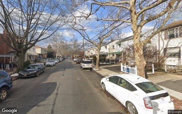
Description: 4156 Murdock Ave, Bronx, NY 10466 is a Single Family Home built in 1950. This property was last sold for $403,000 in 2019 and currently has an estimated value of $555,400. According to the Bronx public records, the property at 4156 Murdock Ave, Bronx, NY 10466 has approximately 690 square feet, with a lot size of 1,958 square feet. Nearby schools include Ps 87, Ps 68 and Ps 112 Bronxwood.
690 sqft
1,958 lot size
Year Built: 1950
Pre-foreclosure
4156 Murdock Ave, Bronx, NY 10466
Last Updated: April 15, 2024
1
Single Family Home
Town House
Estimated Market Value EMV $ 555,400
4156 Murdock Ave
bool(false)

bool(true)

bool(true)

int(0)
Estimated Market Value EMV $ 555,400
Foreclosure History
for 4156 Murdock Ave
for 4156 Murdock Ave
Type
Single Family Home
Town House
4156 Murdock Ave, Bronx, NY 10466 is a Single Family Home built in 1950. This property was last sold for $403,000 in 2019 and currently has an estimated value of $555,400. According to the Bronx public records, the property at 4156 Murdock Ave, Bronx, NY 10466 has approximately 690 square feet, with a lot size of 1,958 square feet. Nearby schools include Ps 87, Ps 68 and Ps 112 Bronxwood.
Property features
Year Built:
Year Built:
1950
1950
Zoning:
Zoning:
R4-1
R4-1
Living Area:
Living Area:
690
690
Building Class:
A5
One Family Dwellings: Attached Or Semi-detached
Floors on Main Building:
2.00
Building Dimensions:
15.33'
Actual Square Footage:
690
Calculated Square Footage:
715
Residential Floor Area:
690
Basement:
Below grade full basement
Address:
4156 MURDOCK AVENUE
BIN
Name 4156 MURDOCK AVENUE
Land Use:
01
One & Two Family Buildings
Lot Dimensions:
19.58'
Calculated Lot Perimeter:
238.81 ft
Zoning Districts:
R4-1
Lower-density residence district
Max Residential FAR:
0.75
Max Residential Sqft:
1,469
Buildable Residential Sqft:
779
Residential Area Distribution:
Assessed Land Value:
$5,940
Assessed Total Value:
$25,620
Last Recording Date:
Jan 8, 2024
Property Assessment Data:
Tax Class:
1
One- to three-unit residential properties
Taxable Assessed Value:
$17,539
Estimated Market Value by NYC DOF :
$427,000
Community District (CD):
212
City Council District:
12
Document DateDocument Type Unit Amount
Recorded DateDocument Type Unit Amount
Date
Event
Price
Price/Sqft
Source
Jan 12, 2021
Listing removed
$215,000
$312
OneKeyMLS
Jan 12, 2021
Listing removed
$210,000
$304
OneKeyMLS
May 30, 2019
Sold
$403,000
$584
Public Record
Mar 15, 2019
Listing removed
—
—
HudsonGatewayMLS
Feb 12, 2019
Price Changed
$399,000
$448
HudsonGatewayMLS
Dec 20, 2018
Price Changed
$429,000
$482
HudsonGatewayMLS
Nov 21, 2018
Price Changed
$439,000
$493
HudsonGatewayMLS
Oct 26, 2018
Price Changed
$449,000
$504
HudsonGatewayMLS
Oct 5, 2018
Relisted
$459,000
$516
HudsonGatewayMLS
Sep 28, 2018
Listing removed
$459,000
$516
HudsonGatewayMLS
Sep 21, 2018
Listed
$459,000
$516
HudsonGatewayMLS
May 26, 2017
Listing removed
$225,000
$326
HudsonGatewayMLS
May 22, 2017
Listed
$225,000
$326
HudsonGatewayMLS
Jun 3, 2016
Listing removed
$150,000
$217
HudsonGatewayMLS
May 31, 2016
Price Changed
$150,000
$217
HudsonGatewayMLS
Jan 13, 2016
Listed
$220,000
$319
HudsonGatewayMLS
Dec 31, 2015
Listing removed
$225,000
$326
HudsonGatewayMLS
Oct 8, 2015
Relisted
$225,000
$326
HudsonGatewayMLS
Jul 2, 2015
Listing removed
$199,000
$288
HudsonGatewayMLS
May 21, 2015
Price Changed
$199,000
$288
HudsonGatewayMLS
Aug 12, 2014
Listed
$269,000
$390
HudsonGatewayMLS
Oct 29, 1997
Sold
$138,000
$200
Public Record
Year
Taxes
Land
Additions
Total Assessment
2022
$3,474
$5,940
$18,240
$24,180
2021
$3,159
$5,940
$16,320
$22,260
2020
$2,983
$5,940
$18,300
$24,240
2019
$2,764
$5,940
$16,080
$22,020
2018
$2,753
$4,972
$9,644
$14,616
2017
$2,657
$4,223
$10,282
$14,505
2016
$2,425
$5,171
$8,513
$13,684
2015
$2,215
$6,256
$6,654
$12,910
2015
$2,028
$6,600
$5,580
$12,180
2014
$2,049
$10,200
$2,040
$12,240
2011
$2,555
$10,200
$5,580
$15,780
2010
$2,503
$10,200
$5,580
$15,780
2009
$2,420
$10,200
$5,838
$16,038
2007
$2,043
$2,816
$11,714
$14,530
Address
Price
Built
Beds
Baths
Sqft
Lot Size
Distance
747 E 228th St
Bronx, NY 10466SF
$499,000
11/09/2023
1910
3
2
873
+183difference
2,860
0.92 mi
4028 Ely Ave
Bronx, NY 10466SF
$600,000
12/13/2023
1940
4
3
1,152
+462
1,710
0.38 mi
4149 Baychester Ave
Bronx, NY 10466SF
$515,000
01/29/2024
1955
3
3
1,224
+534
1,350
0.17 mi
4331 Bruner Ave
Bronx, NY 10466SF
$440,000
01/05/2024
1925
3
1
1,225
+535
2,435
0.44 mi
4000 Rombouts Ave
Bronx, NY 10466SF
$605,000
11/02/2023
1930
3
1
1,255
+565
6,554
0.67 mi
924 E 228th St
Bronx, NY 10466SF
$520,000
11/03/2023
1950
3
2
1,584
+894
2,731
0.79 mi
Estimated values are not a substitute for professional expertise. Contact your RE agent for a market assessment.
School Name
Rating
Grades
Parent Rating
Distance
Ps 87
, The Bronx , NY 10466
5 / 10
K−5
0.25 mi
St Francis Of Assisi School
, Bronx , NY 10466
—
PK−8
0.24 mi
Wake-Eden Christian Academy
, The Bronx , NY 10466
—
PK−5
0.32 mi
Mount St Michael Academy
, The Bronx , NY 10466
—
6−12
0.26 mi
Ps 68
, The Bronx , NY 10466
8 / 10
K−5
0.28 mi
Bronx Alliance Middle School
, The Bronx , NY 10466
4 / 10
6−8
—
0.62 mi
Academy for Scholarship and Entreneurship
, The Bronx , NY 10466
2 / 10
9−12
0.76 mi
New World High School
, The Bronx , NY 10466
2 / 10
9−12
0.76 mi
The Bronx Preparatory Academy
, The Bronx , NY 10466
2 / 10
9−12
0.76 mi
Ps 112 Bronxwood
, The Bronx , NY 10466
3 / 10
K−5
0.72 mi
FEMA Zone (Est.)
X (unshaded)
Flood insurance:
Recommended
Flood risks are increasing as sea levels rise and weather patterns change.
This property has a
Minimal Flood Factor
.
Please Log In
Please wait... If this message is not eventually replaced by the proper contents of the document, your PDF viewer may not be able to display this type of document.
You can upgrade to the latest version of Adobe Reader for Windows®, Mac, or Linux® by visiting
https://get.adobe.com/reader/ this link .
For more assistance with Adobe Reader visit
http://get.adobe.com/reader/ this link .
You can download this PDF-document from
here .