5-09 Jarvis Ave, Far Rockaway, NY 11691 Queens County Last Updated: October 26, 2023
Pre-Foreclosure: Lis Pendens, Estimated Market Value $1,632,900
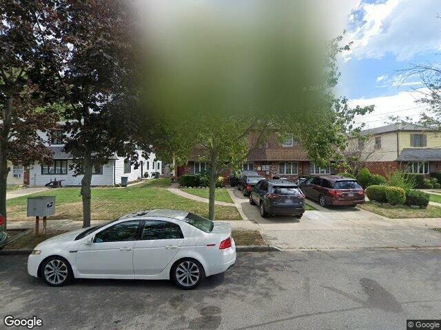
Description: 5-09 Jarvis Ave, Far Rockaway, NY 11691 is a Single Family Home built in 1985. This property was last sold for $250,000 in 1993 and currently has an estimated value of $1,632,900. According to the Far Rockaway public records, the property at 5-09 Jarvis Ave, Far Rockaway, NY 11691 has approximately 4,080 square feet, with a lot size of 4,827 square feet. Nearby schools include Ps 43, Ps 197 The Ocean School, Peninsula Preparatory Academy Charter School and Success Academy Charter School-Nyc 4.
4,080 sqft
4,827 lot size
Year Built: 1985
Pre-foreclosure
5-09 Jarvis Ave, Far Rockaway, NY 11691
Last Updated: October 26, 2023
1
Single Family Home
Town House
Estimated Market Value EMV $ 1,632,900
5-09 Jarvis Ave
bool(false)

bool(true)

bool(true)

int(0)
Estimated Market Value EMV $ 1,632,900
Foreclosure History
for 5-09 Jarvis Ave
for 5-09 Jarvis Ave
Type
Single Family Home
Town House
5-09 Jarvis Ave, Far Rockaway, NY 11691 is a Single Family Home built in 1985. This property was last sold for $250,000 in 1993 and currently has an estimated value of $1,632,900. According to the Far Rockaway public records, the property at 5-09 Jarvis Ave, Far Rockaway, NY 11691 has approximately 4,080 square feet, with a lot size of 4,827 square feet. Nearby schools include Ps 43, Ps 197 The Ocean School, Peninsula Preparatory Academy Charter School and Success Academy Charter School-Nyc 4.
Property features
Year Built:
Year Built:
1985
1985
Zoning:
Zoning:
R4-1
R4-1
Building Class:
A5
One Family Dwellings: Attached Or Semi-detached
Floors on Main Building:
2
Building Dimensions:
24'
Actual Square Footage:
4,080
Calculated Square Footage:
3,456
Residential Floor Area:
4,080
Address:
509 JARVIS AVENUE
Land Use:
01
One & Two Family Buildings
Lot Dimensions:
34'
Calculated Lot Perimeter:
357.64 ft
Irregular Lot:
An irregularly shaped lot
Zoning Districts:
R4-1
Lower-density residence district
Max Residential FAR:
0.75
Max Residential Sqft:
3,620
Buildable Residential Sqft:
0
Residential Area Distribution:
Assessed Land Value:
$16,380
Assessed Total Value:
$68,040
Exempt Total Value:
$1,400
Last Recording Date:
Jan 8, 2024
Property Assessment Data:
Tax Class:
1
One- to three-unit residential properties
Taxable Assessed Value:
$55,984
Estimated Market Value by NYC DOF :
$1,134,000
Community District (CD):
414
City Council District:
31
Document DateDocument Type Unit Amount
Year
Taxes
Land
Additions
Total Assessment
2021
$10,372
$16,380
$38,760
$55,140
2020
$9,826
$16,380
$31,440
$47,820
2019
$9,753
$16,380
$36,300
$52,680
2018
$9,665
$12,682
$34,981
$47,663
2017
$8,867
$13,416
$31,550
$44,966
2016
$8,170
$12,868
$29,553
$42,421
2015
$7,517
$13,860
$26,160
$40,020
2014
$7,362
$13,860
$26,160
$40,020
2013
$7,849
$13,860
$26,160
$40,020
2012
$7,086
$20,318
$24,404
$44,722
2011
$6,582
$22,462
$20,086
$42,548
2010
$6,634
$22,680
$17,460
$40,140
2009
$4,267
— — —
Address
Price
Built
Beds
Baths
Sqft
Lot Size
Distance
2131 Atlantic Blvd
Atlantic Beach, NY 11509SF
$1,930,000
03/11/2024
2006
4
4
3,074
-1,006difference
5,600
0.68 mi
739 Elvira Ave
Far Rockaway, NY 11691SF
$1,340,000
03/11/2024
1950
4
3
2,457
-1,623
5,568
0.25 mi
813 Meehan Ave
Far Rockaway, NY 11691SF
$650,000
12/21/2023
1925
4
3
1,280
-2,800
2,100
0.26 mi
402 Beach 9th St
Far Rockaway, NY 11691SF
$675,000
02/26/2024
1940
3
2
900
-3,180
3,982
0.31 mi
Address
Price
Built
Beds
Baths
Sqft
Lot Size
Distance
2004 Bay Blvd
Atlantic Beach, NY 11509SF
$3,485,000
139 days ago
1928
4
4
4,000
-80difference
4,000
0.56 mi
8 Sterling Pl
Lawrence, NY 11559SF
$2,795,000
40 days ago
1955
6
4
4,177
+97
9,792
1.43 mi
2345 Cornaga Ave
Far Rockaway, NY 11691SF
$818,000
223 days ago
—
6
3
4,268
+188
7,500
1.12 mi
1250 Park St
Atlantic Beach, NY 11509SF
$1,895,000
54 days ago
1980
4
4
3,860
-220
6,464
1.82 mi
198 Sage Ave
Lawrence, NY 11559SF
$3,500,000
292 days ago
1954
6
6
4,465
+385
30,549
0.81 mi
59 Lawrence Ave
Lawrence, NY 11559SF
$3,100,000
306 days ago
1959
5
5
4,480
+400
16,200
0.74 mi
Estimated values are not a substitute for professional expertise. Contact your RE agent for a market assessment.
School Name
Rating
Grades
Parent Rating
Distance
Ps 43
, Queens , NY 11691
2 / 10
K−8
1.25 mi
Ps 197 The Ocean School
, Queens , NY 11691
6 / 10
K−5
0.29 mi
Yeshiva Of Far Rockaway
, Queens , NY 11691
—
9−12
0.27 mi
Peninsula Preparatory Academy Charter School
, Queens , NY 11691
8 / 10
K−5
0.73 mi
Success Academy Charter School-Nyc 4
, Queens , NY 11691
10 / 10
K−5
—
0.68 mi
Torah Academy For Girls
, Queens , NY 11691
—
PK−8
0.10 mi
Acadey of Medical Technology - A College Board School
, Queens , NY 11691
4 / 10
6−12
1.32 mi
Frederick Douglas Academy Vi High School
, Queens , NY 11691
1 / 10
9−12
—
1.31 mi
Queens High School For Information Research And T
, Queens , NY 11691
4 / 10
9−12
—
1.31 mi
Torah Academy High School
, Queens , NY 11691
—
9−12
—
0.17 mi
Flood insurance:
Required
Flood risks are increasing as sea levels rise and weather patterns change.
This property has a
Severe Flood Factor
.
Please Log In
Please wait... If this message is not eventually replaced by the proper contents of the document, your PDF viewer may not be able to display this type of document.
You can upgrade to the latest version of Adobe Reader for Windows®, Mac, or Linux® by visiting
https://get.adobe.com/reader/ this link .
For more assistance with Adobe Reader visit
http://get.adobe.com/reader/ this link .
You can download this PDF-document from
here .