

bool(false)

bool(true)

bool(true)

int(0)
Bronx, NY 10471
Foreclosure History
Lis Pendens
Property details
The description and property data below may have been provided by a third party, the homeowner or public records.
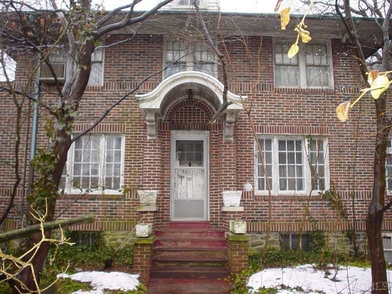
502 W 261st St, Bronx, NY 10471 is a Single Family Home built in 1920. According to the Bronx public records, the property at 502 W 261st St, Bronx, NY 10471 has approximately 2,366 square feet, with a lot size of 10,258 square feet. Nearby schools include Ps 81 Robert J Christen, Amber Charter School Kingsbridge and Ps 24 Spuyten Duyvil.
Primary Land Use and Tax Lot Information
for 502 W 261st St

Property Price History
for 502 W 261st St
| Date | Event | Price | ||
|---|---|---|---|---|
| Feb 28, 2013 | Listing removed | $450,000 | $190 | HudsonGatewayMLSEast |
| Feb 23, 2013 | Listed | $450,000 | $190 | HudsonGatewayMLSEast |
Property Tax History
for 502 W 261st St
| Year | Taxes | |
|---|---|---|
| 2024 | $12,167 | $112,740 |
| 2023 | $11,912 | $99,000 |
Sold Homes
near 502 W 261st St
| Address | Price | Beds | Baths |
|---|---|---|---|
|
Bronx, NY 10471SF
|
$1,150,000
06/11/2025
|
3
|
3
|
|
Bronx, NY 10471SF
|
$1,237,500
01/28/2025
|
5
|
4
|
|
Bronx, NY 10471SF
|
$587,000
02/03/2025
|
4
|
2
|
|
Bronx, NY 10471SF
|
$850,650
04/02/2025
|
4
|
—
|
|
Bronx, NY 10471SF
|
$2,500,000
05/09/2025
|
5
|
6
|
Homes For Sale
near 502 W 261st St
| Address | Price | Beds | Baths |
|---|---|---|---|
|
Bronx, NY 10463SF
|
$1,095,000
11 days ago
|
3
|
4
|
|
Bronx, NY 10471SF
|
$1,399,000
30 days ago
|
3
|
3
|
|
Yonkers, NY 10705SF
|
$599,999
169 days ago
|
3
|
3
|
|
Yonkers, NY 10705SF
|
$950,000
15 days ago
|
4
|
5
|
|
Yonkers, NY 10704SF
|
$999,000
78 days ago
|
4
|
3
|
Schools
serving 502 W 261st St
| School Name | Rating |
|---|---|
|
452 West 260th Street, Bronx, NY 10471
|
— |
|
503 West 259th Street, Bronx, NY 10471
|
— |
|
5550 RIVERDALE AVE, The Bronx, NY 10471
|
9 / 10 |
Data provided by
GreatSchools.org © 2025. All Rights Reserved.
School service boundaries are intended to be used as reference only.
To verify enrollment eligibility for a property, contact the school directly.
Flood Factor
for 502 W 261st St
1
|10
Minimal

FEMA Zone (Est.)
X (unshaded)
Flood insurance:
Recommended
Flood risks are increasing as sea levels rise and weather patterns change.
This property has a
Minimal Flood Factor
.
Although flood risks across the country are changing because of the environment, this property is unlikely to flood over the next 30 years.
Although flood risks across the country are changing because of the environment, this property is unlikely to flood over the next 30 years.
Flood Factor data provided by FloodFactor.