549 E 26th St, Brooklyn, NY 11210 Kings County Last Updated: March 19, 2024
Pre-Foreclosure: Lis Pendens, Estimated Market Value $1,100,500
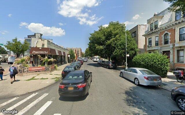
Description: 549 E 26th St, Brooklyn, NY 11210 is a Multi Family Home built in 1933. This property was last sold for $132,500 in 1997 and currently has an estimated value of $1,100,500. According to the Brooklyn public records, the property at 549 E 26th St, Brooklyn, NY 11210 has approximately 2,280 square feet, with a lot size of 2,000 square feet. Nearby schools include Central Brooklyn Ascend Charter, Ps 361 East Flatbush Early Childhood School and Ps 269 Nostrand.
2,280 sqft
2,000 lot size
Year Built: 1933
Pre-foreclosure
549 E 26th St, Brooklyn, NY 11210
Last Updated: March 19, 2024
1
Multi Family Home
Estimated Market Value EMV $ 1,100,500
549 E 26th St
bool(false)

bool(true)

bool(true)

int(0)
Estimated Market Value EMV $ 1,100,500
Foreclosure History
for 549 E 26th St
for 549 E 26th St
Last Sold
$132.5K in 1997
549 E 26th St, Brooklyn, NY 11210 is a Multi Family Home built in 1933. This property was last sold for $132,500 in 1997 and currently has an estimated value of $1,100,500. According to the Brooklyn public records, the property at 549 E 26th St, Brooklyn, NY 11210 has approximately 2,280 square feet, with a lot size of 2,000 square feet. Nearby schools include Central Brooklyn Ascend Charter, Ps 361 East Flatbush Early Childhood School and Ps 269 Nostrand.
Property features
Year Built:
Year Built:
1933
1933
Living Area:
Living Area:
2280
2280
Building Class:
B1
Two Family Dwellings: Brick
Floors on Main Building:
2
Building Dimensions:
20'
Actual Square Footage:
2,280
Calculated Square Footage:
2,280
Residential Floor Area:
2,280
Basement:
Below grade full basement
Address:
549 EAST 26 STREET
BIN
Name 549 EAST 26 STREET
Land Use:
01
One & Two Family Buildings
Calculated Lot Perimeter:
243.47 ft
Zoning Districts:
R7A
Moderate-density residence district R5B
Lower-density residence district
Commercial Overlays:
C2-4
Commercial districts that are predominantly residential in character
Max Residential Sqft:
8,000
Buildable Residential Sqft:
5,720
Residential Area Distribution:
Assessed Land Value:
$17,340
Assessed Total Value:
$57,240
Last Recording Date:
Jan 8, 2024
Property Assessment Data:
Tax Class:
1
One- to three-unit residential properties
Taxable Assessed Value:
$29,062
Estimated Market Value by NYC DOF :
$928,000
Community District (CD):
314
City Council District:
45
Document DateDocument Type Unit Amount
Recorded DateDocument Type Unit Amount
Date
Event
Price
Price/Sqft
Source
Mar 7, 1997
Sold
$132,500
$58
Public Record
Year
Taxes
Land
Additions
Total Assessment
2022
$4,269
$17,340
$31,800
$49,140
2021
$5,661
$17,340
$28,800
$46,140
2020
$5,372
$17,340
$38,640
$55,980
2019
$5,066
$17,340
$34,500
$51,840
2018
$5,066
$11,724
$12,494
$24,218
2017
$4,843
$9,280
$14,481
$23,761
2016
$4,481
$11,018
$11,399
$22,417
2015
$4,135
$9,746
$11,404
$21,150
2014
$3,866
$9,500
$10,682
$20,182
2013
$3,873
$11,391
$8,791
$20,182
2012
$3,604
$10,262
$9,539
$19,801
2010
$3,011
$10,421
$8,260
$18,681
2009
$2,874
$9,676
$7,949
$17,625
2007
$2,546
$2,456
$14,046
$16,502
Address
Price
Built
Beds
Baths
Sqft
Lot Size
Distance
3904 Avenue J
Brooklyn, NY 11210MF
$875,000
04/10/2024
1910
6
2
2,280
2,400
0.99 mi
107 Kenilworth Pl
Brooklyn, NY 11210MF
$775,000
01/09/2024
1915
—
3
2,120
-160difference
2,000
0.28 mi
2616 Avenue D
Brooklyn, NY 11226MF
$722,000
02/12/2024
1933
9
3
2,454
+174
825
0.24 mi
1339 Brooklyn Ave
Brooklyn, NY 11203MF
$990,000
01/26/2024
1920
6
2
2,560
+280
2,500
0.54 mi
162 E 32nd St
Brooklyn, NY 11226MF
$900,000
12/12/2023
1899
6
3
2,000
-280
2,000
0.69 mi
619 E 28th St
Brooklyn, NY 11210MF
$980,000
03/13/2024
—
7
3
2,828
+548
3,500
0.16 mi
672 E 21st St
Brooklyn, NY 11226MF
$1,200,000
01/24/2024
1920
9
4
3,002
+722
3,000
0.32 mi
266 E 32nd St
Brooklyn, NY 11226MF
$880,000
02/23/2024
1910
5
3
1,976
-304
1,933
0.54 mi
723 E 38th St
Brooklyn, NY 11210MF
$620,000
12/22/2023
1940
3
2
1,767
-513
2,200
0.61 mi
117 E 29th St
Brooklyn, NY 11226MF
$815,000
04/22/2024
—
4
3
1,916
-364
1,500
0.64 mi
Address
Price
Built
Beds
Baths
Sqft
Lot Size
Distance
2130 Troy Ave
Brooklyn, NY 11234MF
$1,499,000
37 days ago
2001
6
6
2,284
+4difference
3,800
1.42 mi
2130 Troy Ave
Brooklyn, NY 11234MF
$1,499,000
37 days ago
2001
6
6
2,284
+4
3,800
1.42 mi
3524 15th Ave
Brooklyn, NY 11218MF
$1,950,000
359 days ago
1920
8
4
2,300
+20
2,500
1.51 mi
647 Winthrop St
Brooklyn, NY 11203MF
$1,200,000
138 days ago
1931
5
3
2,308
+28
2,601
1.59 mi
3101 Snyder Ave
Brooklyn, NY 11226MF
$1,200,000
54 days ago
—
9
3
2,312
+32
2,000
0.85 mi
49 E 56th St
Brooklyn, NY 11203MF
$1,150,000
131 days ago
—
5
4
2,320
+40
2,620
1.93 mi
238 E 88th St
Brooklyn, NY 11236MF
$850,000
51 days ago
1925
5
3
2,228
-52
2,228
1.95 mi
4115 Hubbard
East Flatbush, NY 11203MF
$2,999,000
102 days ago
1910
3
1
2,220
-60
24,157
1.20 mi
4115 Hubbard Pl
Brooklyn, NY 11210MF
$2,999,000
116 days ago
—
—
3
2,220
-60
24,157
1.20 mi
846 E 46th St
Brooklyn, NY 11203MF
$849,999
195 days ago
1955
4
3
2,217
-63
3,000
0.99 mi
Estimated values are not a substitute for professional expertise. Contact your RE agent for a market assessment.
School Name
Rating
Grades
Parent Rating
Distance
St. Jerome School
, Brooklyn , NY 11226
—
K−8
0.22 mi
Central Brooklyn Ascend Charter
, Brooklyn , NY 11226
6 / 10
K−7
0.19 mi
Ps 361 East Flatbush Early Childhood School
, Brooklyn , NY 11210
3 / 10
K−5
0.21 mi
Ps 269 Nostrand
, Brooklyn , NY 11210
—
3−5
0.21 mi
Cortelyou Early Childhood Center
, Brooklyn , NY 11210
—
K−5
0.11 mi
Cortelyou Early Childhood Center
, Brooklyn , NY 11210
—
PK−5
0.11 mi
Midwood High School
, Brooklyn , NY 11210
7 / 10
9−12
0.31 mi
Andries Hudde School
, Brooklyn , NY 11210
5 / 10
6−8
0.97 mi
Brooklyn College Academy
, Brooklyn , NY 11218
7 / 10
9−12
1.35 mi
Brooklyn Prospect Charter School
, Brooklyn , NY 11218
8 / 10
8−12
1.60 mi
FEMA Zone (Est.)
X (unshaded)
Flood insurance:
Recommended
Flood risks are increasing as sea levels rise and weather patterns change.
This property has a
Major Flood Factor
.
Please Log In
Please wait... If this message is not eventually replaced by the proper contents of the document, your PDF viewer may not be able to display this type of document.
You can upgrade to the latest version of Adobe Reader for Windows®, Mac, or Linux® by visiting
https://get.adobe.com/reader/ this link .
For more assistance with Adobe Reader visit
http://get.adobe.com/reader/ this link .
You can download this PDF-document from
here .