591 Miller Ave, Brooklyn, NY 11207 Kings County Last Updated: March 13, 2024
Pre-Foreclosure: Lis Pendens, Estimated Market Value $955,800
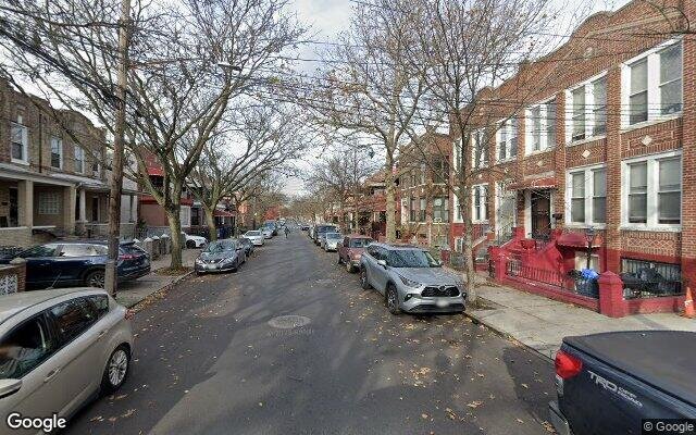
Description: 591 Miller Ave, Brooklyn, NY 11207 is a Multi Family Home built in 1930. This property was last sold for $53,500 in 1985 and currently has an estimated value of $955,800. According to the Brooklyn public records, the property at 591 Miller Ave, Brooklyn, NY 11207 has approximately 2,400 square feet, with a lot size of 2,375 square feet. Nearby schools include Ps 149 Danny Kaye, Ps 13 Roberto Clemente and Achievement First East New York Charter School.
2,400 sqft
2,375 lot size
Year Built: 1930
Pre-foreclosure
591 Miller Ave, Brooklyn, NY 11207
Last Updated: March 13, 2024
1
Multi Family Home
Estimated Market Value EMV $ 955,800
591 Miller Ave
bool(false)

bool(true)

bool(true)

int(0)
Estimated Market Value EMV $ 955,800
Foreclosure History
for 591 Miller Ave
for 591 Miller Ave
591 Miller Ave, Brooklyn, NY 11207 is a Multi Family Home built in 1930. This property was last sold for $53,500 in 1985 and currently has an estimated value of $955,800. According to the Brooklyn public records, the property at 591 Miller Ave, Brooklyn, NY 11207 has approximately 2,400 square feet, with a lot size of 2,375 square feet. Nearby schools include Ps 149 Danny Kaye, Ps 13 Roberto Clemente and Achievement First East New York Charter School.
Property features
Year Built:
Year Built:
1930
1930
Living Area:
Living Area:
2400
2400
Building Class:
C0
Walk Up Apartments: Three Families
Floors on Main Building:
2.00
Building Dimensions:
20.42'
Actual Square Footage:
2,400
Calculated Square Footage:
2,450
Residential Floor Area:
2,400
Address:
591 MILLER AVENUE
Land Use:
02
Multi-Family Walk-Up Buildings
Calculated Lot Perimeter:
255.51 ft
Zoning Districts:
R6
Moderate-density residence district
Max Residential FAR:
2.43
Max Residential Sqft:
5,771
Buildable Residential Sqft:
3,371
Residential Area Distribution:
Assessed Land Value:
$16,800
Assessed Total Value:
$46,980
Last Recording Date:
Jan 8, 2024
Property Assessment Data:
Tax Class:
1
One- to three-unit residential properties
Taxable Assessed Value:
$21,331
Estimated Market Value by NYC DOF :
$772,000
Community District (CD):
305
City Council District:
42
Document DateDocument Type Unit Amount
Date
Event
Price
Price/Sqft
Source
Oct 16, 1985
Sold
$53,500
$22
Public Record
Dec 1, 1983
Sold
$46,000
$19
Public Record
Year
Taxes
Land
Additions
Total Assessment
2022
$3,790
$16,800
$30,120
$46,920
2021
$3,770
$16,800
$27,480
$44,280
2020
$3,792
$16,800
$27,300
$44,100
2019
$3,718
$16,800
$25,620
$42,420
2018
$3,508
$7,051
$9,720
$16,771
2017
$3,225
$8,174
$7,649
$15,823
2016
$2,984
$7,049
$7,880
$14,929
2015
$2,919
$7,628
$7,301
$14,929
2014
$2,838
$6,428
$8,386
$14,814
2013
$2,383
$6,203
$7,773
$13,976
2012
$2,107
$7,713
$5,473
$13,186
2010
$1,849
$7,208
$5,233
$12,441
2009
$1,873
$6,841
$5,600
$12,441
2007
$1,496
$1,575
$9,414
$10,989
Address
Price
Built
Beds
Baths
Sqft
Lot Size
Distance
548 Pennsylvania Ave Unit 2
Brooklyn, NY 11207MF
$775,000
12/01/2023
1910
6
2
2,400
2,383
0.30 mi
385 Jerome St
Brooklyn, NY 11207MF
$932,500
12/13/2023
2004
6
5
2,532
+132difference
2,000
0.46 mi
605 Liberty Ave
Brooklyn, NY 11207MF
$1,030,000
02/21/2024
1899
6
3
2,625
+225
2,500
0.68 mi
527 Glenmore Ave
Brooklyn, NY 11207MF
$850,000
03/18/2024
1925
5
4
2,136
-264
1,950
0.55 mi
345 Shepherd Ave
Brooklyn, NY 11208MF
$720,000
11/02/2023
—
6
3
2,088
-312
2,500
0.81 mi
524 Wyona St
Brooklyn, NY 11207MF
$930,000
04/10/2024
—
7
4
3,040
+640
2,500
0.13 mi
847 Livonia Ave
Brooklyn, NY 11207MF
$382,000
03/21/2024
1901
4
3
1,320
-1,080
800
0.20 mi
358 Bradford St
Brooklyn, NY 11207MF
$1,100,000
11/15/2023
1901
6
3
1,900
-500
1,900
0.31 mi
720 Jerome St
Brooklyn, NY 11207MF
$880,000
02/27/2024
1960
6
3
1,800
-600
2,033
0.39 mi
2170 Pitkin Ave
Brooklyn, NY 11207MF
$917,000
02/16/2024
1930
12
3
3,075
+675
2,000
0.44 mi
Address
Price
Built
Beds
Baths
Sqft
Lot Size
Distance
78 Eldert St
Brooklyn, NY 11207MF
$1,480,000
108 days ago
—
8
4
2,400
2,000
1.89 mi
1140 Remsen Ave
Brooklyn, NY 11236MF
$1,299,000
83 days ago
1925
6
3
2,400
3,179
1.97 mi
10747 79th St
Ozone Park, NY 11417MF
$1,349,000
81 days ago
1955
6
3
2,400
4,000
1.79 mi
10567 Flatlands 7th St
Brooklyn, NY 11236MF
$1,095,000
45 days ago
1960
4
4
2,400
4,100
1.71 mi
1073 Clarkson Ave
Brooklyn, NY 11212MF
$798,000
90 days ago
1940
5
2
2,392
-8difference
2,300
1.81 mi
1073 Clarkson Ave
Brooklyn, NY 11212MF
$798,000
90 days ago
1940
5
2
2,392
-8
2,300
1.81 mi
304 Sheridan Ave
Brooklyn, NY 11208MF
$1,245,000
38 days ago
2016
7
5
2,340
-60
2,300
1.34 mi
49 E 56th St
Brooklyn, NY 11203MF
$1,150,000
124 days ago
—
5
4
2,320
-80
2,620
1.98 mi
174 Essex St
Brooklyn, NY 11208MF
$1,100,000
119 days ago
1901
6
3
2,314
-86
2,706
1.01 mi
125 Van Siclen Ave Unit 3947/110
Brooklyn, NY 11207MF
$950,000
75 days ago
2005
6
3
2,493
+93
1,600
0.78 mi
Estimated values are not a substitute for professional expertise. Contact your RE agent for a market assessment.
School Name
Rating
Grades
Parent Rating
Distance
Ps 149 Danny Kaye
, Brooklyn , NY 11207
7 / 10
K−5
0.29 mi
Ps 13 Roberto Clemente
, Brooklyn , NY 11207
6 / 10
K−5
0.27 mi
Captain Vernon a Richards High School-Fire
, Brooklyn , NY 11207
1 / 10
9−12
0.32 mi
Performing Arts and Technology High School
, Brooklyn , NY 11207
3 / 10
9−12
0.32 mi
Jhs 292 Margaret S Douglas
, Brooklyn , NY 11207
7 / 10
6−8
0.45 mi
Achievement First East New York Charter School
, Brooklyn , NY 11207
7 / 10
K−12
0.27 mi
New Grace Center Christian School
, Brooklyn , NY 11207
—
PK−8
0.21 mi
America Come Back To God Christian Academy
, Brooklyn , NY 11207
—
K−8
0.08 mi
St. John Cantius School
, Brooklyn , NY 11207
—
K−8
—
0.24 mi
East New York Family Academy
, Brooklyn , NY 11207
7 / 10
6−12
0.37 mi
FEMA Zone (Est.)
X (unshaded)
Flood insurance:
Recommended
Flood risks are increasing as sea levels rise and weather patterns change.
This property has a
Minimal Flood Factor
.
Please Log In
Please wait... If this message is not eventually replaced by the proper contents of the document, your PDF viewer may not be able to display this type of document.
You can upgrade to the latest version of Adobe Reader for Windows®, Mac, or Linux® by visiting
https://get.adobe.com/reader/ this link .
For more assistance with Adobe Reader visit
http://get.adobe.com/reader/ this link .
You can download this PDF-document from
here .