625 E 52nd St, Brooklyn, NY 11203 Kings County Last Updated: April 3, 2024
Pre-Foreclosure: Lis Pendens, Estimated Market Value $770,200
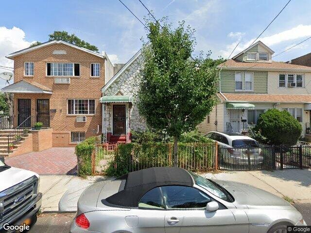
Description: 625 E 52nd St, Brooklyn, NY 11203 is a Single Family Home built in 1925. This property was last sold for $345,000 in 2005 and currently has an estimated value of $770,200. According to the Brooklyn public records, the property at 625 E 52nd St, Brooklyn, NY 11203 has approximately 1,449 square feet, with a lot size of 1,972 square feet. Nearby schools include Ps 208 Elsa Ebeling and Ps 244 Richard R Green.
1,449 sqft
1,972 lot size
Year Built: 1925
Pre-foreclosure
625 E 52nd St, Brooklyn, NY 11203
Last Updated: April 3, 2024
1
Single Family Home
Town House
Estimated Market Value EMV $ 770,200
625 E 52nd St
bool(false)

bool(true)

bool(true)

int(0)
Estimated Market Value EMV $ 770,200
Foreclosure History
for 625 E 52nd St
for 625 E 52nd St
Type
Single Family Home
Town House
625 E 52nd St, Brooklyn, NY 11203 is a Single Family Home built in 1925. This property was last sold for $345,000 in 2005 and currently has an estimated value of $770,200. According to the Brooklyn public records, the property at 625 E 52nd St, Brooklyn, NY 11203 has approximately 1,449 square feet, with a lot size of 1,972 square feet. Nearby schools include Ps 208 Elsa Ebeling and Ps 244 Richard R Green.
Property features
Year Built:
Year Built:
1925
1925
Living Area:
Living Area:
1449
1449
Building Class:
A2
One Family Dwellings: One Story (Permanent Living Quarters)
Floors on Main Building:
1.50
Building Dimensions:
20.67'
Actual Square Footage:
1,449
Calculated Square Footage:
1,426
Residential Floor Area:
1,449
Basement:
Below grade full basement
Address:
625 EAST 52 STREET
Land Use:
01
One & Two Family Buildings
Lot Dimensions:
25.70'
Calculated Lot Perimeter:
268.90 ft
Irregular Lot:
An irregularly shaped lot
Zoning Districts:
R4
Lower-density residence district
Max Residential FAR:
0.75
Max Residential Sqft:
1,479
Buildable Residential Sqft:
30
Residential Area Distribution:
Assessed Land Value:
$11,220
Assessed Total Value:
$46,260
Last Recording Date:
Jan 8, 2024
Property Assessment Data:
Tax Class:
1
One- to three-unit residential properties
Taxable Assessed Value:
$24,719
Estimated Market Value by NYC DOF :
$771,000
Community District (CD):
317
City Council District:
45
Document DateDocument Type Unit Amount
Date
Event
Price
Price/Sqft
Source
Jul 19, 2005
Sold
$345,000
$238
Public Record
Jul 9, 2004
Sold
$315,000
$217
Public Record
Year
Taxes
Land
Additions
Total Assessment
2022
$4,480
$11,220
$29,640
$40,860
2021
$4,723
$11,220
$24,480
$35,700
2020
$4,621
$11,220
$19,320
$30,540
2019
$4,309
$11,220
$22,080
$33,300
2018
$4,065
$7,987
$11,447
$19,434
2017
$3,813
$8,679
$10,026
$18,705
2016
$3,739
$9,015
$9,690
$18,705
2015
$3,557
$12,014
$6,181
$18,195
2014
$3,289
$10,290
$6,876
$17,166
2013
$2,808
$10,660
$5,535
$16,195
2012
$2,544
$10,038
$5,550
$15,588
2010
$2,314
$8,532
$7,056
$15,588
2009
$2,208
$10,297
$4,866
$15,163
2007
$2,004
$1,986
$11,004
$12,990
Address
Price
Built
Beds
Baths
Sqft
Lot Size
Distance
840 E 40th St
East Flatbush, NY 11203SF
$670,000
03/14/2024
1920
3
2
1,522
+73difference
2,300
0.91 mi
642 E 40th St
Brooklyn, NY 11203SF
$674,650
11/13/2023
1930
3
3
1,536
+87
2,000
0.71 mi
651 E 53rd St
Brooklyn, NY 11203SF
$525,000
03/19/2024
1925
3
2
1,344
-105
2,300
0.13 mi
882 Albany Ave
Brooklyn, NY 11203SF
$430,000
03/25/2024
1920
3
1
1,328
-121
1,925
0.80 mi
703 E 39th St
Brooklyn, NY 11203SF
$550,000
11/16/2023
1930
3
2
1,280
-169
2,000
0.73 mi
635 E 52nd St
Brooklyn, NY 11203SF
$699,600
11/30/2023
1925
3
2
1,232
-217
1,800
0.01 mi
664 E 49th St
Brooklyn, NY 11203SF
$810,000
12/20/2023
1930
3
2
2,800
+1,351
3,383
0.19 mi
143 Branton St
Brooklyn, NY 11236SF
$400,000
12/18/2023
1940
2
2
1,020
-429
1,530
0.45 mi
442 E 43rd St
Brooklyn, NY 11203SF
$475,000
04/12/2024
1945
2
2
1,216
-233
1,600
0.49 mi
256 E 43rd St
Brooklyn, NY 11203SF
$407,986
03/12/2024
1920
4
1
1,120
-329
940
0.58 mi
Address
Price
Built
Beds
Baths
Sqft
Lot Size
Distance
1315 E 64th St
Brooklyn, NY 11234SF
$830,000
134 days ago
1935
3
2
1,450
+1difference
4,000
1.76 mi
1548 Schenectady Ave
Brooklyn, NY 11234SF
$582,000
182 days ago
1950
2
2
1,452
+3
1,600
0.76 mi
19 Georgetown Ln
Brooklyn, NY 11234SF
$820,000
122 days ago
1996
5
4
1,442
-7
2,455
1.70 mi
682 E 37th St
Brooklyn, NY 11203SF
$949,000
40 days ago
1925
4
3
1,460
+11
4,000
0.83 mi
3915 Avenue I
Brooklyn, NY 11210SF
$749,000
17 days ago
1910
3
2
1,430
-19
1,950
1.18 mi
774 E 35th St
Brooklyn, NY 11210SF
$950,000
36 days ago
—
—
—
1,470
+21
4,000
1.05 mi
1425 E 52nd St
Brooklyn, NY 11234SF
$599,000
248 days ago
1940
3
2
1,419
-30
2,100
1.41 mi
1425 E 52nd St
Brooklyn, NY 11234SF
$599,000
248 days ago
1940
3
2
1,419
-30
2,100
1.41 mi
954 Brooklyn Ave
Brooklyn, NY 11203SF
$650,000
137 days ago
1910
4
2
1,482
+33
2,000
0.94 mi
4412 Snyder Ave
Brooklyn, NY 11203SF
$675,000
271 days ago
1920
3
1
1,482
+33
2,000
0.52 mi
Estimated values are not a substitute for professional expertise. Contact your RE agent for a market assessment.
School Name
Rating
Grades
Parent Rating
Distance
Parkway Elementary & Preschool
, Brooklyn , NY 11203
—
K−8
0.19 mi
Parkway Elementary School
, Brooklyn , NY 11203
—
PK−K
0.24 mi
Ps 208 Elsa Ebeling
, Brooklyn , NY 11203
6 / 10
K−5
0.27 mi
Ps 244 Richard R Green
, Brooklyn , NY 11203
5 / 10
K−5
0.23 mi
Is 285 Meyer Levin
, Brooklyn , NY 11203
7 / 10
6−8
0.38 mi
BROOKLYN SCIENCE AND ENGINEERING ACADEMY
, Brooklyn , NY 11203
6 / 10
6−8
0.23 mi
Ebenezer Preparatory School
, Brooklyn , NY 11203
—
PK−8
0.24 mi
It Takes A Village Academy
, Brooklyn , NY 11203
3 / 10
9−12
0.35 mi
Middle School Of Marketing And Legal Studies
, Brooklyn , NY 11203
—
6−8
0.93 mi
Middle School of Media Law and Fine Arts (The)
, Brooklyn , NY 11203
4 / 10
6−8
0.93 mi
FEMA Zone (Est.)
X (unshaded)
Flood insurance:
Recommended
Flood risks are increasing as sea levels rise and weather patterns change.
This property has a
Minimal Flood Factor
.
Please Log In
Please wait... If this message is not eventually replaced by the proper contents of the document, your PDF viewer may not be able to display this type of document.
You can upgrade to the latest version of Adobe Reader for Windows®, Mac, or Linux® by visiting
https://get.adobe.com/reader/ this link .
For more assistance with Adobe Reader visit
http://get.adobe.com/reader/ this link .
You can download this PDF-document from
here .