634 E 81st St, Brooklyn, NY 11236 Kings County Last Updated: March 13, 2024
Pre-Foreclosure: Lis Pendens, Estimated Market Value $903,400
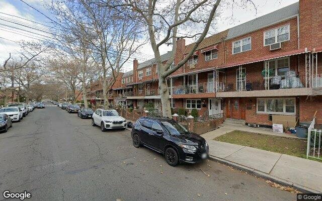
Description: 634 E 81st St, Brooklyn, NY 11236 is a Multi Family Home built in 1960. This property was last sold for $266,000 in 1989 and currently has an estimated value of $903,400. According to the Brooklyn public records, the property at 634 E 81st St, Brooklyn, NY 11236 has approximately 2,250 square feet, with a lot size of 1,800 square feet. Nearby schools include Ps 114 Ryder Elementary School, Explore Excel Charter School and Ps 276 Louis Marshall.
2,250 sqft
1,800 lot size
Year Built: 1960
Pre-foreclosure
634 E 81st St, Brooklyn, NY 11236
Last Updated: March 13, 2024
1
Multi Family Home
Estimated Market Value EMV $ 903,400
634 E 81st St
bool(false)

bool(true)

bool(true)

int(0)
Estimated Market Value EMV $ 903,400
Foreclosure History
for 634 E 81st St
for 634 E 81st St
634 E 81st St, Brooklyn, NY 11236 is a Multi Family Home built in 1960. This property was last sold for $266,000 in 1989 and currently has an estimated value of $903,400. According to the Brooklyn public records, the property at 634 E 81st St, Brooklyn, NY 11236 has approximately 2,250 square feet, with a lot size of 1,800 square feet. Nearby schools include Ps 114 Ryder Elementary School, Explore Excel Charter School and Ps 276 Louis Marshall.
Property features
Year Built:
Year Built:
1960
1960
Living Area:
Living Area:
2250
2250
Building Class:
B1
Two Family Dwellings: Brick
Floors on Main Building:
3
Building Dimensions:
18'
Actual Square Footage:
2,250
Calculated Square Footage:
2,106
Residential Floor Area:
2,250
Basement:
Below grade full basement
Address:
634 EAST 81 STREET
BIN
Name 634 EAST 81 STREET
Land Use:
01
One & Two Family Buildings
Calculated Lot Perimeter:
233.07 ft
Zoning Districts:
R5B
Lower-density residence district
Max Residential FAR:
1.35
Max Residential Sqft:
2,430
Buildable Residential Sqft:
180
Residential Area Distribution:
Assessed Land Value:
$9,720
Assessed Total Value:
$50,220
Last Recording Date:
Jan 8, 2024
Property Assessment Data:
Tax Class:
1
One- to three-unit residential properties
Taxable Assessed Value:
$40,662
Estimated Market Value by NYC DOF :
$837,000
Community District (CD):
318
City Council District:
46
Document DateDocument Type Unit Amount
Date
Event
Price
Price/Sqft
Source
Aug 22, 1989
Sold
$266,000
$118
Public Record
Year
Taxes
Land
Additions
Total Assessment
2022
$7,658
$9,720
$40,980
$50,700
2021
$8,012
$9,720
$31,500
$41,220
2020
$7,602
$9,720
$32,100
$41,820
2019
$7,088
$9,720
$28,380
$38,100
2018
$6,687
$8,960
$23,008
$31,968
2017
$6,516
$9,118
$22,850
$31,968
2016
$6,342
$9,643
$22,084
$31,727
2015
$5,852
$9,049
$20,883
$29,932
2014
$5,410
$10,026
$18,212
$28,238
2013
$5,112
$10,140
$16,500
$26,640
2012
$4,856
$19,580
$7,099
$26,679
2010
$4,524
$18,552
$8,127
$26,679
2009
$4,268
$18,182
$8,294
$26,476
2007
$3,431
$3,095
$19,138
$22,233
Address
Price
Built
Beds
Baths
Sqft
Lot Size
Distance
612 E 54th St
Brooklyn, NY 11203MF
$1,335,000
01/16/2024
—
5
6
2,295
+45difference
1,810
0.64 mi
941 E 46th St
Brooklyn, NY 11203MF
$789,000
04/03/2024
1945
4
2
2,096
-154
3,000
0.89 mi
1139 E 86th St
Brooklyn, NY 11236MF
$875,000
03/11/2024
1950
4
3
1,892
-358
2,150
0.66 mi
5704 Avenue H
Brooklyn, NY 11234MF
$815,000
03/18/2024
1945
4
3
1,880
-370
1,900
0.48 mi
1384 Remsen Ave
Brooklyn, NY 11236MF
$925,000
11/16/2023
1960
5
3
2,650
+400
1,900
0.71 mi
8424 Glenwood Rd
Brooklyn, NY 11236MF
$680,000
03/06/2024
1920
3
3
1,800
-450
2,000
0.23 mi
978 E 81st St
Brooklyn, NY 11236MF
$1,175,000
04/10/2024
1975
8
5
2,760
+510
2,000
0.36 mi
1030 E 86th St
Brooklyn, NY 11236MF
$999,999
02/22/2024
2000
6
4
3,160
+910
4,833
0.50 mi
1082 E 54th St
Brooklyn, NY 11234MF
$795,000
11/09/2023
—
3
2
1,571
-679
2,000
0.67 mi
1214 E 93rd St
Brooklyn, NY 11236MF
$860,000
04/30/2024
1920
4
4
1,584
-666
1,908
0.68 mi
Address
Price
Built
Beds
Baths
Sqft
Lot Size
Distance
1922 Rockaway Pkwy
Brooklyn, NY 11236MF
$1,199,995
66 days ago
2002
6
4
2,236
-14difference
2,360
1.25 mi
1016 E 102nd St
Brooklyn, NY 11236MF
$692,180
11 days ago
1960
6
5
2,235
-15
3,533
1.15 mi
238 E 88th St
Brooklyn, NY 11236MF
$850,000
50 days ago
1925
5
3
2,228
-22
2,228
0.65 mi
4115 Hubbard
East Flatbush, NY 11203MF
$2,999,000
101 days ago
1910
3
1
2,220
-30
24,157
1.35 mi
4115 Hubbard Pl
Brooklyn, NY 11210MF
$2,999,000
115 days ago
—
—
3
2,220
-30
24,157
1.35 mi
2130 Troy Ave
Brooklyn, NY 11234MF
$1,499,000
36 days ago
2001
6
6
2,284
+34
3,800
1.46 mi
2130 Troy Ave
Brooklyn, NY 11234MF
$1,499,000
36 days ago
2001
6
6
2,284
+34
3,800
1.46 mi
9419 Avenue J
Brooklyn, NY 11236MF
$989,000
13 days ago
1965
6
3
2,200
-50
2,974
0.79 mi
3101 Snyder Ave
Brooklyn, NY 11226MF
$1,200,000
53 days ago
—
9
3
2,312
+62
2,000
1.87 mi
1305 E 59th St
Brooklyn, NY 11234MF
$949,000
100 days ago
1955
5
3
2,178
-72
2,383
1.16 mi
Estimated values are not a substitute for professional expertise. Contact your RE agent for a market assessment.
School Name
Rating
Grades
Parent Rating
Distance
Our Lady Of Trust School
, Brooklyn , NY 11236
—
K−8
0.34 mi
Nazareth Regional High School
, Brooklyn , NY 11203
—
9−12
—
0.51 mi
Nazareth Regional High School
, Brooklyn , NY 11203
—
9−12
0.51 mi
Ps 114 Ryder Elementary School
, Brooklyn , NY 11236
8 / 10
K−5
0.49 mi
Is 285 Meyer Levin
, Brooklyn , NY 11203
7 / 10
6−8
0.67 mi
Academy for Conservation and the Environment
, Brooklyn , NY 11236
5 / 10
9−12
0.36 mi
Brooklyn Community High School for Excellence and Equity
, Brooklyn , NY 11236
2 / 10
9−12
0.36 mi
Brooklyn Bridge Academy
, Brooklyn , NY 11236
1 / 10
9−12
—
0.36 mi
Explore Excel Charter School
, Brooklyn , NY 11236
6 / 10
K−8
—
0.49 mi
Ps 276 Louis Marshall
, Brooklyn , NY 11236
5 / 10
K−5
0.48 mi
FEMA Zone (Est.)
X (unshaded)
Flood insurance:
Recommended
Flood risks are increasing as sea levels rise and weather patterns change.
This property has a
Minimal Flood Factor
.
Please Log In
Please wait... If this message is not eventually replaced by the proper contents of the document, your PDF viewer may not be able to display this type of document.
You can upgrade to the latest version of Adobe Reader for Windows®, Mac, or Linux® by visiting
https://get.adobe.com/reader/ this link .
For more assistance with Adobe Reader visit
http://get.adobe.com/reader/ this link .
You can download this PDF-document from
here .