639 Dahill Rd, Brooklyn, NY 11218 Kings County Last Updated: March 13, 2024
Pre-Foreclosure: Lis Pendens, Estimated Market Value $1,535,600
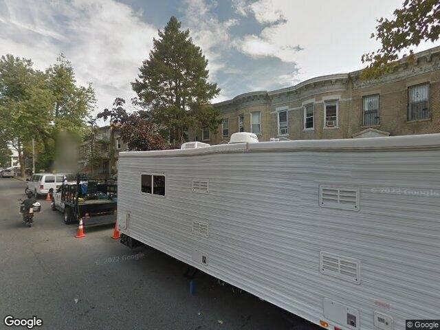
Description: 639 Dahill Rd, Brooklyn, NY 11218 is a Multi Family Home built in 1901. This property was last sold for $440,000 in 2002 and currently has an estimated value of $1,535,600. According to the Brooklyn public records, the property at 639 Dahill Rd, Brooklyn, NY 11218 has approximately 2,060 square feet, with a lot size of 2,000 square feet. Nearby schools include Brooklyn Dreams Charter School, Ps 192 Magnet School For Math And Science Inquiry and Ps 164 Caesar Rodney.
2,060 sqft
2,000 lot size
Year Built: 1901
Pre-foreclosure
639 Dahill Rd, Brooklyn, NY 11218
Last Updated: March 13, 2024
1
Multi Family Home
Estimated Market Value EMV $ 1,535,600
639 Dahill Rd
bool(false)

bool(true)

bool(true)

int(0)
Estimated Market Value EMV $ 1,535,600
Foreclosure History
for 639 Dahill Rd
for 639 Dahill Rd
639 Dahill Rd, Brooklyn, NY 11218 is a Multi Family Home built in 1901. This property was last sold for $440,000 in 2002 and currently has an estimated value of $1,535,600. According to the Brooklyn public records, the property at 639 Dahill Rd, Brooklyn, NY 11218 has approximately 2,060 square feet, with a lot size of 2,000 square feet. Nearby schools include Brooklyn Dreams Charter School, Ps 192 Magnet School For Math And Science Inquiry and Ps 164 Caesar Rodney.
Property features
Year Built:
Year Built:
1901
1901
Living Area:
Living Area:
2060
2060
Building Class:
B1
Two Family Dwellings: Brick
Floors on Main Building:
2
Building Dimensions:
20'
Actual Square Footage:
2,060
Calculated Square Footage:
2,000
Residential Floor Area:
2,060
Basement:
Below grade full basement
Land Use:
01
One & Two Family Buildings
Calculated Lot Perimeter:
242.16 ft
Zoning Districts:
R5
Lower-density residence district
Max Residential FAR:
1.25
Max Residential Sqft:
2,500
Buildable Residential Sqft:
440
Residential Area Distribution:
Assessed Land Value:
$26,460
Assessed Total Value:
$73,440
Last Recording Date:
Jan 8, 2024
Property Assessment Data:
Tax Class:
1
One- to three-unit residential properties
Taxable Assessed Value:
$37,404
Estimated Market Value by NYC DOF :
$1,160,000
Community District (CD):
312
City Council District:
44
Document DateDocument Type Unit Amount
Recorded DateDocument Type Unit Amount
Date
Event
Price
Price/Sqft
Source
May 7, 2002
Sold
$440,000
$214
Public Record
Year
Taxes
Land
Additions
Total Assessment
2022
$7,124
$26,460
$42,720
$69,180
2021
$7,366
$26,460
$38,040
$64,500
2020
$6,990
$26,460
$36,660
$63,120
2019
$6,520
$26,460
$37,320
$63,780
2018
$6,520
$15,728
$15,442
$31,170
2017
$6,062
$12,109
$17,629
$29,738
2016
$5,830
$14,308
$14,860
$29,168
2015
$5,381
$15,185
$12,334
$27,519
2014
$4,976
$16,769
$9,206
$25,975
2013
$4,685
$16,551
$9,424
$25,975
2012
$4,218
$16,256
$8,526
$24,782
2010
$3,641
$17,645
$6,662
$24,307
2009
$3,463
$14,153
$8,780
$22,933
2007
$2,988
$3,419
$17,233
$20,652
Address
Price
Built
Beds
Baths
Sqft
Lot Size
Distance
1097 E 3rd St
Brooklyn, NY 11230MF
$1,950,000
04/13/2024
—
—
2
2,048
-12difference
3,333
0.58 mi
3538 12th Ave
Brooklyn, NY 11218MF
$1,525,000
03/11/2024
1920
5
3
2,106
+46
2,100
0.93 mi
1771 62nd St
Brooklyn, NY 11204MF
$1,470,000
03/18/2024
1920
6
2
2,166
+106
1,942
0.93 mi
56 Louisa St
Brooklyn, NY 11218MF
$1,260,000
11/10/2023
1920
5
2
1,872
-188
2,192
0.80 mi
1217 37th St
Brooklyn, NY 11218MF
$1,550,000
12/28/2023
1920
—
4
1,815
-245
2,550
0.87 mi
1822 50th St
Brooklyn, NY 11204MF
$2,570,000
03/21/2024
1920
4
2
2,320
+260
3,005
0.37 mi
3617 15th Ave
Brooklyn, NY 11218MF
$1,175,000
02/28/2024
1930
11
6
5,250
+3,190
2,125
0.50 mi
430 E 5th St
Brooklyn, NY 11218MF
$1,300,000
12/26/2023
1910
8
5
3,053
+993
3,400
0.68 mi
553-555 Argyle Rd
Ditmas Park, NY 11226MF
$1,600,000
01/31/2024
1910
6
3
3,262
+1,202
4,000
0.73 mi
1264 38th St
Brooklyn, NY 11218MF
$1,700,000
02/13/2024
1901
—
3
1,568
-492
2,284
0.78 mi
Address
Price
Built
Beds
Baths
Sqft
Lot Size
Distance
722 68th St
Brooklyn, NY 11220MF
$1,600,000
92 days ago
1925
—
2
2,080
+20difference
2,000
1.95 mi
1316 57th St
Brooklyn, NY 11219MF
$1,200,000
67 days ago
1910
—
2
2,032
-28
2,003
0.97 mi
1462 New York Ave
Brooklyn, NY 11210MF
$949,000
23 days ago
—
4
3
2,028
-32
2,050
1.75 mi
1429 65th St
Brooklyn, NY 11219MF
$1,559,900
12 days ago
1910
7
4
2,004
-56
2,000
1.18 mi
853 53rd St
Brooklyn, NY 11220MF
$1,700,000
11 days ago
1910
—
2
2,000
-60
2,003
1.43 mi
1334 66th St
Brooklyn, NY 11219MF
$1,789,000
24 days ago
1920
5
3
2,000
-60
4,000
1.32 mi
855 53rd St
Brooklyn, NY 11220MF
$2,100,000
11 days ago
—
—
2
2,000
-60
2,003
1.42 mi
1061 59th St
Brooklyn, NY 11219MF
$1,899,000
5 days ago
—
—
3
2,125
+65
2,000
1.29 mi
1440 W 5th St
Brooklyn, NY 11204MF
$1,399,000
43 days ago
1930
6
3
2,132
+72
4,000
1.41 mi
1070 62nd St
Brooklyn, NY 11219MF
$1,900,000
105 days ago
2018
8
4
2,152
+92
1,600
1.40 mi
Estimated values are not a substitute for professional expertise. Contact your RE agent for a market assessment.
School Name
Rating
Grades
Parent Rating
Distance
The Pathway Study Center Inc
, Brooklyn , NY 11204
—
1−1
—
0.11 mi
Yeshiva Gedolah of Midwood
, Brooklyn , NY 11218
—
9−12
—
0.12 mi
Machon Bais Yaakov Hilda Birn High School
, Brooklyn , NY 11204
—
10−12
—
0.12 mi
Brooklyn Dreams Charter School
, Brooklyn , NY 11230
5 / 10
K−8
0.44 mi
Urban Assembly School for Leadership and Empowerment
, Brooklyn , NY 11204
7 / 10
6−12
0.27 mi
Ps 192 Magnet School For Math And Science Inquiry
, Brooklyn , NY 11204
9 / 10
K−8
0.23 mi
Jhs 223 The Montauk
, Brooklyn , NY 11204
8 / 10
6−8
0.27 mi
Ps 164 Caesar Rodney
, Brooklyn , NY 11219
8 / 10
K−5
0.53 mi
Franklin Delano Roosevelt High School
, Brooklyn , NY 11204
3 / 10
9−12
0.78 mi
Brooklyn Prospect Charter School
, Brooklyn , NY 11218
8 / 10
8−12
1.10 mi
FEMA Zone (Est.)
X (unshaded)
Flood insurance:
Recommended
Flood risks are increasing as sea levels rise and weather patterns change.
This property has a
Minimal Flood Factor
.
Please Log In
Please wait... If this message is not eventually replaced by the proper contents of the document, your PDF viewer may not be able to display this type of document.
You can upgrade to the latest version of Adobe Reader for Windows®, Mac, or Linux® by visiting
https://get.adobe.com/reader/ this link .
For more assistance with Adobe Reader visit
http://get.adobe.com/reader/ this link .
You can download this PDF-document from
here .