703 E 2nd St, Brooklyn, NY 11218 Kings County Last Updated: March 13, 2024
Pre-Foreclosure: Lis Pendens, Estimated Market Value $1,907,700
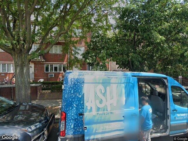
Description: 703 E 2nd St, Brooklyn, NY 11218 is a Multi Family Home built in 1990. This property was last sold for $290,000 in 1990 and currently has an estimated value of $1,907,700. According to the Brooklyn public records, the property at 703 E 2nd St, Brooklyn, NY 11218 has approximately 3,867 square feet, with a lot size of 2,142 square feet. Nearby schools include Brooklyn Dreams Charter School, Ps 192 Magnet School For Math And Science Inquiry and Ps 179 Kensington.
3,867 sqft
2,142 lot size
Year Built: 1990
Pre-foreclosure
703 E 2nd St, Brooklyn, NY 11218
Last Updated: March 13, 2024
1
Multi Family Home
Estimated Market Value EMV $ 1,907,700
703 E 2nd St
bool(false)

bool(true)

bool(true)

int(0)
Estimated Market Value EMV $ 1,907,700
Foreclosure History
for 703 E 2nd St
for 703 E 2nd St
703 E 2nd St, Brooklyn, NY 11218 is a Multi Family Home built in 1990. This property was last sold for $290,000 in 1990 and currently has an estimated value of $1,907,700. According to the Brooklyn public records, the property at 703 E 2nd St, Brooklyn, NY 11218 has approximately 3,867 square feet, with a lot size of 2,142 square feet. Nearby schools include Brooklyn Dreams Charter School, Ps 192 Magnet School For Math And Science Inquiry and Ps 179 Kensington.
Property features
Year Built:
Year Built:
1990
1990
Living Area:
Living Area:
3867
3867
Building Class:
C0
Walk Up Apartments: Three Families
Floors on Main Building:
3.50
Building Dimensions:
21.42'
Actual Square Footage:
3,867
Calculated Square Footage:
3,898
Residential Floor Area:
3,867
Basement:
Below grade full basement
Address:
701 EAST 2 STREET
Land Use:
02
Multi-Family Walk-Up Buildings
Lot Dimensions:
21.42'
Calculated Lot Perimeter:
243.37 ft
Zoning Districts:
R5
Lower-density residence district
Special Purpose Districts:
OP
Special Ocean Parkway District
Max Residential FAR:
1.25
Max Residential Sqft:
2,678
Buildable Residential Sqft:
0
Residential Area Distribution:
Assessed Land Value:
$28,860
Assessed Total Value:
$104,640
Last Recording Date:
Jan 8, 2024
Property Assessment Data:
Tax Class:
1
One- to three-unit residential properties
Taxable Assessed Value:
$57,528
Estimated Market Value by NYC DOF :
$1,744,000
Community District (CD):
312
City Council District:
40
Document DateDocument Type Unit Amount
Date
Event
Price
Price/Sqft
Source
Mar 15, 1990
Sold
$290,000
$75
Public Record
Nov 13, 1986
Sold
$190,000
$49
Public Record
Year
Taxes
Land
Additions
Total Assessment
2022
$11,524
$30,780
$41,880
$72,660
2021
$11,806
$30,780
$25,320
$56,100
2020
$11,441
$30,780
$37,260
$68,040
2019
$10,667
$30,780
$23,340
$54,120
2018
$10,063
$20,429
$27,677
$48,106
2017
$9,806
$20,295
$27,811
$48,106
2016
$9,544
$20,916
$26,828
$47,744
2015
$8,807
$25,674
$19,369
$45,043
2014
$7,179
$29,077
$13,417
$42,494
2013
$5,912
$26,205
$13,884
$40,089
2012
$4,764
$25,194
$14,895
$40,089
2010
$2,796
$28,562
$11,225
$39,787
2009
$2,721
$21,546
$15,990
$37,536
2007
$2,393
$6,934
$26,474
$33,408
Address
Price
Built
Beds
Baths
Sqft
Lot Size
Distance
553-555 Argyle Rd
Ditmas Park, NY 11226MF
$1,600,000
01/31/2024
1910
6
3
3,262
-605difference
4,000
0.60 mi
430 E 5th St
Brooklyn, NY 11218MF
$1,300,000
12/26/2023
1910
8
5
3,053
-814
3,400
0.54 mi
672 E 21st St
Brooklyn, NY 11226MF
$1,200,000
01/24/2024
1920
9
4
3,002
-865
3,000
0.99 mi
1811 60th St
Brooklyn, NY 11204MF
$1,515,000
01/05/2024
1931
7
4
2,800
-1,067
2,003
0.99 mi
3617 15th Ave
Brooklyn, NY 11218MF
$1,175,000
02/28/2024
1930
11
6
5,250
+1,383
2,125
0.42 mi
1822 50th St
Brooklyn, NY 11204MF
$2,570,000
03/21/2024
1920
4
2
2,320
-1,547
3,005
0.53 mi
1097 E 3rd St
Brooklyn, NY 11230MF
$1,950,000
04/13/2024
—
—
2
2,048
-1,819
3,333
0.67 mi
56 Louisa St
Brooklyn, NY 11218MF
$1,260,000
11/10/2023
1920
5
2
1,872
-1,995
2,192
0.71 mi
1264 38th St
Brooklyn, NY 11218MF
$1,700,000
02/13/2024
1901
—
3
1,568
-2,299
2,284
0.74 mi
1217 37th St
Brooklyn, NY 11218MF
$1,550,000
12/28/2023
1920
—
4
1,815
-2,052
2,550
0.83 mi
Address
Price
Built
Beds
Baths
Sqft
Lot Size
Distance
1006 71st St
Brooklyn, NY 11228MF
$2,590,000
194 days ago
1965
7
5
3,878
+11difference
3,367
1.92 mi
408 Beverley Rd
Kensington, NY 11218MF
$3,800,000
333 days ago
1910
11
4
4,000
+133
4,000
0.61 mi
1823 Avenue O
Brooklyn, NY 11230MF
$1,879,000
154 days ago
1925
7
6
4,000
+133
2,400
1.78 mi
826 52nd St
Brooklyn, NY 11220MF
$2,520,000
98 days ago
—
15
6
3,703
-164
2,000
1.52 mi
4019 10th Ave
Brooklyn, NY 11219MF
$1,299,999
49 days ago
1930
—
5
3,700
-167
1,550
1.13 mi
1709 W 5th St
Brooklyn, NY 11223MF
$1,750,000
43 days ago
1920
—
4
4,080
+213
2,567
1.95 mi
1355 52nd St
Brooklyn, NY 11219MF
$2,400,000
206 days ago
1965
9
4
4,100
+233
2,204
0.85 mi
1302 Foster Ave
Brooklyn, NY 11230MF
$1,850,000
115 days ago
1910
6
4
4,100
+233
—
0.62 mi
945 E 10th St
Brooklyn, NY 11230MF
$4,200,000
36 days ago
1930
6
6
3,624
-243
4,000
0.77 mi
945 E 10th St
Brooklyn, NY 11230MF
$4,200,000
36 days ago
1930
6
6
3,624
-243
4,000
0.77 mi
Estimated values are not a substitute for professional expertise. Contact your RE agent for a market assessment.
School Name
Rating
Grades
Parent Rating
Distance
Yeshiva Gedolah of Midwood
, Brooklyn , NY 11218
—
9−12
—
0.05 mi
Yeshiva Nesivas Chaim
, Brooklyn , NY 11218
—
9−12
—
0.05 mi
Machon Bais Yaakov Hilda Birn High School
, Brooklyn , NY 11204
—
10−12
—
0.15 mi
Brooklyn Dreams Charter School
, Brooklyn , NY 11230
5 / 10
K−8
0.36 mi
Urban Assembly School for Leadership and Empowerment
, Brooklyn , NY 11204
7 / 10
6−12
0.30 mi
Ps 192 Magnet School For Math And Science Inquiry
, Brooklyn , NY 11204
9 / 10
K−8
0.39 mi
Jhs 223 The Montauk
, Brooklyn , NY 11204
8 / 10
6−8
0.30 mi
Ps 179 Kensington
, Brooklyn , NY 11218
7 / 10
K−5
0.44 mi
Franklin Delano Roosevelt High School
, Brooklyn , NY 11204
3 / 10
9−12
0.93 mi
Brooklyn Prospect Charter School
, Brooklyn , NY 11218
8 / 10
8−12
0.97 mi
FEMA Zone (Est.)
X (unshaded)
Flood insurance:
Recommended
Flood risks are increasing as sea levels rise and weather patterns change.
This property has a
Minimal Flood Factor
.
Please Log In
Please wait... If this message is not eventually replaced by the proper contents of the document, your PDF viewer may not be able to display this type of document.
You can upgrade to the latest version of Adobe Reader for Windows®, Mac, or Linux® by visiting
https://get.adobe.com/reader/ this link .
For more assistance with Adobe Reader visit
http://get.adobe.com/reader/ this link .
You can download this PDF-document from
here .