7218 Avenue N, Brooklyn, NY 11234 Kings County Last Updated: April 15, 2024
Auction: Estimated Market Value $970,100
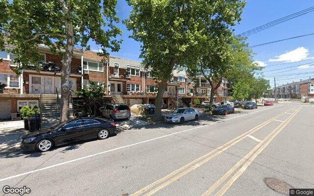
Description: 7218 Avenue N, Brooklyn, NY 11234 is a Multi Family Home built in 2004. This property was last sold for $609,931 in 2005 and currently has an estimated value of $970,100. According to the Brooklyn public records, the property at 7218 Avenue N, Brooklyn, NY 11234 has approximately 1,585 square feet, with a lot size of 2,548 square feet. Nearby schools include Kings Collegiate Charter School, Success Academy Bergen Beach, Ps 236 Mill Basin, Ps 312 Bergen Beach and Hebrew Language Academy.
1,585 sqft
2,548 lot size
Year Built: 2004
Auction
7218 Avenue N, Brooklyn, NY 11234
Last Updated: April 15, 2024
1
Multi Family Home
Estimated Market Value EMV $ 970,100
7218 Avenue N
bool(false)

bool(true)

bool(true)

int(0)
Estimated Market Value EMV $ 970,100
for 7218 Avenue N
Thursday
18
April
2024
2:30 PM
Auction Date
Apr 18, 2024
Auction Time
2:30 PM
Auction Location
360 ADAMS STREET
for 7218 Avenue N
Last Sold
$609.9K in 2005
7218 Avenue N, Brooklyn, NY 11234 is a Multi Family Home built in 2004. This property was last sold for $609,931 in 2005 and currently has an estimated value of $970,100. According to the Brooklyn public records, the property at 7218 Avenue N, Brooklyn, NY 11234 has approximately 1,585 square feet, with a lot size of 2,548 square feet. Nearby schools include Kings Collegiate Charter School, Success Academy Bergen Beach, Ps 236 Mill Basin, Ps 312 Bergen Beach and Hebrew Language Academy.
Property features
Year Built:
Year Built:
2004
2004
Zoning:
Zoning:
R3-1
R3-1
Living Area:
Living Area:
1585
1585
Building Class:
B1
Two Family Dwellings: Brick
Floors on Main Building:
2.00
Building Dimensions:
16.50'
Actual Square Footage:
1,585
Calculated Square Footage:
1,766
Residential Floor Area:
1,585
Basement:
Below grade full basement
Land Use:
01
One & Two Family Buildings
Calculated Lot Perimeter:
245.41 ft
Zoning Districts:
R3-1
Lower-density residence district
Max Residential FAR:
0.50
Max Residential Sqft:
1,274
Buildable Residential Sqft:
0
Residential Area Distribution:
Assessed Land Value:
$11,100
Assessed Total Value:
$51,360
Exempt Total Value:
$1,400
Last Recording Date:
Jan 8, 2024
Property Assessment Data:
Tax Class:
1
One- to three-unit residential properties
Taxable Assessed Value:
$44,824
Estimated Market Value by NYC DOF :
$856,000
Community District (CD):
318
City Council District:
46
Document DateDocument Type Unit Amount
Date
Event
Price
Price/Sqft
Source
Sep 6, 2005
Sold
$609,931
$385
Public Record
Year
Taxes
Land
Additions
Total Assessment
2022
$7,366
$11,100
$41,160
$52,260
2021
$7,309
$11,100
$32,280
$43,380
2020
$6,870
$11,100
$37,740
$48,840
2019
$6,778
$11,100
$36,060
$47,160
2018
$7,692
$9,103
$29,128
$38,231
2017
$7,052
$8,920
$27,147
$36,067
2016
$6,492
$9,509
$24,517
$34,026
2015
$5,967
$12,360
$19,740
$32,100
2014
$5,844
$12,360
$19,740
$32,100
2013
$5,395
$12,360
$19,740
$32,100
2012
$5,031
$21,780
$15,000
$36,780
2010
$3,093
$21,278
$16,882
$38,160
2009
$2,358
$21,780
$14,220
$36,000
2007
$31
$6,120
$29,400
$35,520
Address
Price
Built
Beds
Baths
Sqft
Lot Size
Distance
1082 E 54th St
Brooklyn, NY 11234MF
$795,000
11/09/2023
—
3
2
1,571
-14difference
2,000
0.97 mi
1222 E 89th St
Brooklyn, NY 11236MF
$800,000
11/02/2023
—
4
3
1,600
+15
2,000
0.86 mi
1343 E 54th St
Brooklyn, NY 11234MF
$789,000
03/21/2024
1940
4
2
1,540
-45
2,225
0.73 mi
1601 E 49th St
Brooklyn, NY 11234MF
$735,000
11/20/2023
1925
—
2
1,536
-49
3,000
0.97 mi
2054 E 61st St
Brooklyn, NY 11234MF
$795,000
03/12/2024
1960
3
2
1,510
-75
1,967
0.65 mi
7322 Avenue M
Brooklyn, NY 11234MF
$1,100,000
01/26/2024
1970
—
5
2,860
+1,275
2,092
0.18 mi
1331 E 69th St
Brooklyn, NY 11234MF
$1,070,000
11/28/2023
—
5
5
2,720
+1,135
3,450
0.20 mi
2051 E 73rd St
Brooklyn, NY 11234MF
$635,000
04/05/2024
1925
3
2
1,064
-521
2,000
0.21 mi
1272 E 70th St
Brooklyn, NY 11234MF
$1,380,000
03/26/2024
1975
7
7
3,980
+2,395
4,625
0.23 mi
1231 E 70th St
Brooklyn, NY 11234MF
$1,135,000
12/18/2023
1970
8
6
3,400
+1,815
4,743
0.27 mi
Address
Price
Built
Beds
Baths
Sqft
Lot Size
Distance
1410 E 100th St
Brooklyn, NY 11236MF
$549,200
236 days ago
1960
6
2
1,600
+15difference
2,000
1.40 mi
1644 E 33rd St
Brooklyn, NY 11234MF
$849,000
60 days ago
1925
4
2
1,600
+15
2,500
1.74 mi
10120 Flatlands Ave
Brooklyn, NY 11236MF
$750,000
11 days ago
1960
3
2
1,560
-25
1,953
1.67 mi
1498 E 95th St
Brooklyn, NY 11236MF
$525,000
185 days ago
1930
4
2
1,560
-25
2,158
1.13 mi
1170 E 102nd St
Brooklyn, NY 11236MF
$769,000
75 days ago
1955
4
3
1,540
-45
2,000
1.54 mi
1465 E 69th St
Brooklyn, NY 11234MF
$245,000
1592 days ago
—
3
3
1,540
-45
4,000
0.19 mi
10009 Avenue L
Brooklyn, NY 11236MF
$850,000
48 days ago
1955
4
2
1,540
-45
1,921
1.47 mi
1355 E 100th St
Brooklyn, NY 11236MF
$820,000
581 days ago
1955
3
3
1,540
-45
2,000
1.43 mi
1795 Albany Ave
Brooklyn, NY 11210MF
$891,000
75 days ago
1920
3
2
1,632
+47
4,000
1.46 mi
9116 Bedell Ln
Brooklyn, NY 11236MF
$859,000
11 days ago
1920
4
3
1,536
-49
5,680
1.42 mi
Estimated values are not a substitute for professional expertise. Contact your RE agent for a market assessment.
School Name
Rating
Grades
Parent Rating
Distance
St Bernard Elementary School
, Brooklyn , NY 11234
—
PK−8
0.29 mi
Kings Collegiate Charter School
, Brooklyn , NY 11203
7 / 10
K−12
2.44 mi
Jhs 78 Roy H Mann
, Brooklyn , NY 11234
5 / 10
6−8
0.27 mi
Success Academy Bergen Beach
, Brooklyn , NY 11234
8 / 10
K−7
0.27 mi
Brooklyn Kids Preparatory School
, Brooklyn , NY 11234
—
K−7
—
0.48 mi
Yeshivah of Crown Heights
, Brooklyn , NY 11234
—
PK−8
0.53 mi
Ps 236 Mill Basin
, Brooklyn , NY 11234
6 / 10
K−5
0.57 mi
Ps 312 Bergen Beach
, Brooklyn , NY 11234
6 / 10
K−5
0.13 mi
Hebrew Language Academy
, Brooklyn , NY 11234
6 / 10
K−8
0.87 mi
Midwood High School
, Brooklyn , NY 11210
7 / 10
9−12
2.34 mi
FEMA Zone (Est.)
X (unshaded)
Flood insurance:
Recommended
Flood risks are increasing as sea levels rise and weather patterns change.
This property has a
Moderate Flood Factor
.
Please Log In
Please wait... If this message is not eventually replaced by the proper contents of the document, your PDF viewer may not be able to display this type of document.
You can upgrade to the latest version of Adobe Reader for Windows®, Mac, or Linux® by visiting
https://get.adobe.com/reader/ this link .
For more assistance with Adobe Reader visit
http://get.adobe.com/reader/ this link .
You can download this PDF-document from
here .