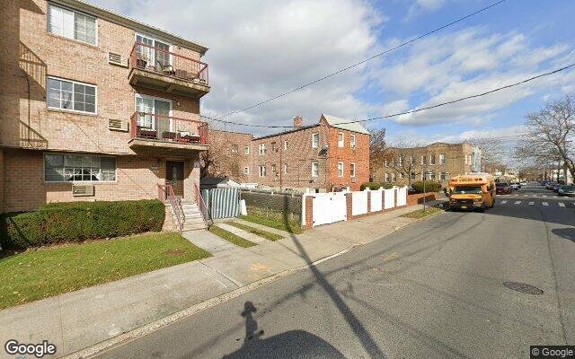
8714 Bedell Ln, Brooklyn, NY 11236 Kings County Last Updated: March 13, 2024
Pre-Foreclosure: Lis Pendens, Estimated Market Value $941,200
Description: 8714 Bedell Ln, Brooklyn, NY 11236 is a Multi Family Home built in 1950. This property was last sold for $257,000 in 1998 and currently has an estimated value of $941,200. According to the Brooklyn public records, the property at 8714 Bedell Ln, Brooklyn, NY 11236 has approximately 2,205 square feet, with a lot size of 2,508 square feet. Nearby schools include Ps 66, Explore Excel Charter School and Ps 114 Ryder Elementary School.
2,205 sqft
2,508 lot size
Year Built: 1950
Pre-foreclosure
8714 Bedell Ln, Brooklyn, NY 11236
Last Updated: March 13, 2024
1
Multi Family Home
Estimated Market Value EMV $ 941,200
8714 Bedell Ln
bool(false)

bool(true)

bool(true)

int(0)
Estimated Market Value EMV $ 941,200
Foreclosure History
for 8714 Bedell Ln
for 8714 Bedell Ln
8714 Bedell Ln, Brooklyn, NY 11236 is a Multi Family Home built in 1950. This property was last sold for $257,000 in 1998 and currently has an estimated value of $941,200. According to the Brooklyn public records, the property at 8714 Bedell Ln, Brooklyn, NY 11236 has approximately 2,205 square feet, with a lot size of 2,508 square feet. Nearby schools include Ps 66, Explore Excel Charter School and Ps 114 Ryder Elementary School.
Property features
Year Built:
Year Built:
1950
1950
Living Area:
Living Area:
2205
2205
Building Class:
B1
Two Family Dwellings: Brick
Floors on Main Building:
2.00
Building Dimensions:
19.83'
Actual Square Footage:
2,205
Calculated Square Footage:
1,686
Residential Floor Area:
1,764
Basement:
Above grade full basement
Address:
8714 BEDELL LANE
Land Use:
01
One & Two Family Buildings
Lot Dimensions:
25.25'
Calculated Lot Perimeter:
258.27 ft
Zoning Districts:
R5B
Lower-density residence district
Max Residential FAR:
1.35
Max Residential Sqft:
3,386
Buildable Residential Sqft:
1,181
Residential Area Distribution:
Assessed Land Value:
$12,840
Assessed Total Value:
$64,020
Last Recording Date:
Jan 8, 2024
Property Assessment Data:
Tax Class:
1
One- to three-unit residential properties
Taxable Assessed Value:
$39,839
Estimated Market Value by NYC DOF :
$897,000
Community District (CD):
318
City Council District:
46
Document DateDocument Type Unit Amount
Date
Event
Price
Price/Sqft
Source
Feb 19, 1998
Sold
$257,000
$117
Public Record
Feb 8, 1994
Sold
$232,000
$105
Public Record
Year
Taxes
Land
Additions
Total Assessment
2022
$7,502
$12,840
$47,340
$60,180
2021
$7,850
$12,840
$37,440
$50,280
2020
$7,448
$12,840
$33,420
$46,260
2019
$6,944
$12,840
$38,340
$51,180
2018
$6,551
$9,194
$22,126
$31,320
2017
$6,384
$10,952
$20,368
$31,320
2016
$6,213
$10,851
$20,233
$31,084
2015
$5,734
$8,338
$20,987
$29,325
2014
$5,300
$9,434
$18,232
$27,666
2013
$5,008
$10,680
$15,420
$26,100
2012
$5,284
$19,195
$9,835
$29,030
2010
$4,923
$16,301
$12,729
$29,030
2009
$4,644
$17,916
$10,894
$28,810
2007
$3,733
$4,025
$20,167
$24,192
Address
Price
Built
Beds
Baths
Sqft
Lot Size
Distance
577 Bristol St
Brownville, NY 11212MF
$750,000
03/08/2024
1930
6
3
2,240
+35difference
2,500
0.99 mi
969 E 101st St
Brooklyn, NY 11236MF
$600,000
02/02/2024
1960
3
3
2,160
-45
2,000
0.84 mi
615 E 102nd St
Brooklyn, NY 11236MF
$940,000
12/22/2023
1999
6
4
2,140
-65
2,058
0.77 mi
612 E 54th St
Brooklyn, NY 11203MF
$1,335,000
01/16/2024
—
5
6
2,295
+90
1,810
0.74 mi
1139 E 86th St
Brooklyn, NY 11236MF
$875,000
03/11/2024
1950
4
3
1,892
-313
2,150
0.69 mi
8424 Glenwood Rd
Brooklyn, NY 11236MF
$680,000
03/06/2024
1920
3
3
1,800
-405
2,000
0.24 mi
228 E 89th St
Brooklyn, NY 11236MF
$750,000
04/15/2024
—
—
—
2,980
+775
2,000
0.48 mi
1030 E 86th St
Brooklyn, NY 11236MF
$999,999
02/22/2024
2000
6
4
3,160
+955
4,833
0.54 mi
978 E 81st St
Brooklyn, NY 11236MF
$1,175,000
04/10/2024
1975
8
5
2,760
+555
2,000
0.57 mi
1384 Remsen Ave
Brooklyn, NY 11236MF
$925,000
11/16/2023
1960
5
3
2,650
+445
1,900
0.65 mi
Address
Price
Built
Beds
Baths
Sqft
Lot Size
Distance
532 Bradford St
Brooklyn, NY 11207MF
$899,000
8 days ago
1901
5
2
2,208
+3difference
2,725
1.94 mi
9419 Avenue J
Brooklyn, NY 11236MF
$989,000
5 days ago
1965
6
3
2,200
-5
2,974
0.58 mi
238 E 88th St
Brooklyn, NY 11236MF
$850,000
42 days ago
1925
5
3
2,228
+23
2,228
0.45 mi
1016 E 102nd St
Brooklyn, NY 11236MF
$692,180
3 days ago
1960
6
5
2,235
+30
3,533
0.89 mi
1922 Rockaway Pkwy
Brooklyn, NY 11236MF
$1,199,995
58 days ago
2002
6
4
2,236
+31
2,360
1.14 mi
964 E 102nd St
Brooklyn, NY 11236MF
$999,000
77 days ago
1960
5
4
2,160
-45
2,000
0.85 mi
305 E 38th St
Brooklyn, NY 11203MF
$1,250,000
43 days ago
—
9
5
2,160
-45
3,000
1.63 mi
1391 Remsen Ave
Brooklyn, NY 11236MF
$996,000
39 days ago
2012
6
4
2,146
-59
2,794
0.67 mi
2130 Troy Ave
Brooklyn, NY 11234MF
$1,499,000
29 days ago
2001
6
6
2,284
+79
3,800
1.82 mi
2130 Troy Ave
Brooklyn, NY 11234MF
$1,499,000
29 days ago
2001
6
6
2,284
+79
3,800
1.82 mi
Estimated values are not a substitute for professional expertise. Contact your RE agent for a market assessment.
School Name
Rating
Grades
Parent Rating
Distance
Our Lady Of Trust School
, Brooklyn , NY 11236
—
K−8
0.26 mi
Ps 66
, Brooklyn , NY 11236
5 / 10
K−8
0.49 mi
Great Commission Christian School
, Brooklyn , NY 11236
—
K−7
0.43 mi
Explore Excel Charter School
, Brooklyn , NY 11236
6 / 10
K−8
—
0.20 mi
Ps 114 Ryder Elementary School
, Brooklyn , NY 11236
8 / 10
K−5
0.19 mi
First Impression Day Care Center
, Brooklyn , NY 11236
—
K−K
—
0.22 mi
Kurt Hahn Expeditionary Learning School
, Brooklyn , NY 11203
1 / 10
9−12
—
0.67 mi
Cultural Academy For The Arts And Sciences
, Brooklyn , NY 11203
3 / 10
9−12
—
0.67 mi
It Takes A Village Academy
, Brooklyn , NY 11203
3 / 10
9−12
0.67 mi
Is 68 Isaac Bildersee
, Brooklyn , NY 11236
6 / 10
6−8
0.51 mi
FEMA Zone (Est.)
X (unshaded)
Flood insurance:
Recommended
Flood risks are increasing as sea levels rise and weather patterns change.
This property has a
Minimal Flood Factor
.
Please Log In
Please wait... If this message is not eventually replaced by the proper contents of the document, your PDF viewer may not be able to display this type of document.
You can upgrade to the latest version of Adobe Reader for Windows®, Mac, or Linux® by visiting
https://get.adobe.com/reader/ this link .
For more assistance with Adobe Reader visit
http://get.adobe.com/reader/ this link .
You can download this PDF-document from
here .