88 Fenimore St, Brooklyn, NY 11225 Kings County Last Updated: April 11, 2024
Pre-Foreclosure: Lis Pendens, Estimated Market Value $2,276,100
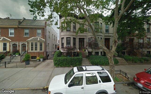
Description: 88 Fenimore St, Brooklyn, NY 11225 is a Multi Family Home built in 1905. This property was last sold for $211,000 in 1992 and currently has an estimated value of $2,276,100. According to the Brooklyn public records, the property at 88 Fenimore St, Brooklyn, NY 11225 has approximately 3,121 square feet, with a lot size of 2,520 square feet. Nearby schools include Ps 92 Adrian Hegeman, Achievement First Voyager Charter, Explore Charter School and Ps 375 Jackie Robinson School.
3,121 sqft
2,520 lot size
Year Built: 1905
Pre-foreclosure
88 Fenimore St, Brooklyn, NY 11225
Last Updated: April 11, 2024
1
Multi Family Home
Estimated Market Value EMV $ 2,276,100
88 Fenimore St
bool(false)

bool(true)

bool(true)

int(0)
Estimated Market Value EMV $ 2,276,100
Foreclosure History
for 88 Fenimore St
for 88 Fenimore St
88 Fenimore St, Brooklyn, NY 11225 is a Multi Family Home built in 1905. This property was last sold for $211,000 in 1992 and currently has an estimated value of $2,276,100. According to the Brooklyn public records, the property at 88 Fenimore St, Brooklyn, NY 11225 has approximately 3,121 square feet, with a lot size of 2,520 square feet. Nearby schools include Ps 92 Adrian Hegeman, Achievement First Voyager Charter, Explore Charter School and Ps 375 Jackie Robinson School.
Property features
Year Built:
Year Built:
1905
1905
Living Area:
Living Area:
3121
3121
Building Class:
B1
Two Family Dwellings: Brick
Floors on Main Building:
2
Building Dimensions:
20'
Actual Square Footage:
3,121
Calculated Square Footage:
1,920
Residential Floor Area:
2,053
Basement:
Above grade full basement
Address:
88 FENIMORE STREET
BIN
Name 88 FENIMORE STREET
Land Use:
01
One & Two Family Buildings
Lot Dimensions:
20'
Calculated Lot Perimeter:
291.99 ft
Irregular Lot:
An irregularly shaped lot
Zoning Districts:
R6
Moderate-density residence district
Max Residential FAR:
2.43
Max Residential Sqft:
6,124
Buildable Residential Sqft:
3,003
Residential Area Distribution:
Assessed Land Value:
$25,380
Assessed Total Value:
$132,360
Exempt Total Value:
$3,800
Last Recording Date:
Jan 8, 2024
Property Assessment Data:
Tax Class:
1
One- to three-unit residential properties
Taxable Assessed Value:
$35,016
Estimated Market Value by NYC DOF :
$2,206,000
Community District (CD):
309
City Council District:
40
Document DateDocument Type Unit Amount
Date
Event
Price
Price/Sqft
Source
Oct 29, 1992
Sold
$211,000
$68
Public Record
Year
Taxes
Land
Additions
Total Assessment
2022
$7,031
$25,380
$70,380
$95,760
2021
$6,989
$25,380
$67,860
$93,240
2020
$6,598
$25,380
$86,100
$111,480
2019
$6,107
$25,380
$74,040
$99,420
2018
$6,107
$8,011
$24,336
$32,347
2017
$5,897
$9,790
$22,312
$32,102
2016
$2,406
$12,074
$18,212
$30,286
2015
$2,172
$15,850
$12,723
$28,573
2014
$1,973
$13,603
$13,353
$26,956
2013
$1,989
$12,307
$14,649
$26,956
2012
$1,850
$12,719
$14,033
$26,752
2010
$1,480
$11,620
$13,619
$25,239
2009
$1,445
$12,833
$10,978
$23,811
2007
$1,282
$4,405
$17,889
$22,294
Address
Price
Built
Beds
Baths
Sqft
Lot Size
Distance
158 Martense St
Brooklyn, NY 11226MF
$1,262,500
11/16/2023
—
6
5
3,219
+98difference
2,380
0.54 mi
156 Martense St
Brooklyn, NY 11226MF
$1,262,500
11/16/2023
—
8
3
3,282
+161
2,400
0.54 mi
217 Lincoln Rd
Brooklyn, NY 11225MF
$1,900,000
02/21/2024
1905
5
3
2,704
-417
2,050
0.32 mi
203 Sterling St
Brooklyn, NY 11225MF
$1,300,000
02/27/2024
1910
5
2
2,128
-993
2,000
0.44 mi
293 Lefferts Ave
Brooklyn, NY 11225MF
$1,400,000
12/26/2023
1905
5
3
2,108
-1,013
2,000
0.52 mi
39 Argyle Rd Apt 4A
Brooklyn, NY 11218MF
$875,000
03/12/2024
2023
3
1
16,640
+13,519
5,250
0.77 mi
39 Argyle Rd Apt 4D
Brooklyn, NY 11218MF
$875,000
03/28/2024
2023
3
1
16,640
+13,519
5,250
0.77 mi
39 Argyle Rd Apt 2B
Brooklyn, NY 11218MF
$665,000
03/28/2024
2023
2
1
16,640
+13,519
5,250
0.77 mi
39 Argyle Rd Apt 1B
Brooklyn, NY 11218MF
$625,000
04/15/2024
2023
2
—
16,640
+13,519
5,250
0.77 mi
117 E 29th St
Brooklyn, NY 11226MF
$815,000
04/22/2024
—
4
3
1,916
-1,205
1,500
0.94 mi
Address
Price
Built
Beds
Baths
Sqft
Lot Size
Distance
386 E 31st St
Brooklyn, NY 11226MF
$1,195,000
60 days ago
1920
8
3
3,135
+14difference
2,333
1.30 mi
1601 Nostrand Ave
Brooklyn, NY 11226MF
$1,349,999
115 days ago
1910
8
3
3,135
+14
1,950
0.92 mi
19 Denton Pl
Brooklyn, NY 11215MF
$2,599,000
103 days ago
1920
6
5
3,105
-16
1,800
1.83 mi
19 Denton Pl
Brooklyn, NY 11215MF
$2,599,000
103 days ago
1920
6
5
3,105
-16
1,800
1.83 mi
186 Dahill Rd
Brooklyn, NY 11218MF
$1,999,999
117 days ago
1930
9
4
3,084
-37
2,514
1.54 mi
627 E 32nd St
Brooklyn, NY 11210MF
$1,969,000
6 days ago
1920
—
4
3,065
-56
4,100
1.69 mi
14 Sterling Pl
Brooklyn, NY 11217MF
$2,995,000
80 days ago
1901
5
3
3,060
-61
1,700
1.75 mi
792 Bergen St
Brooklyn, NY 11238MF
$2,500,000
93 days ago
1910
5
3
3,182
+61
—
1.38 mi
246 Lefferts Ave
Brooklyn, NY 11225MF
$1,699,999
91 days ago
1905
4
3
3,192
+71
2,050
0.43 mi
123 Lincoln Pl
Brooklyn, NY 11217MF
$4,200,000
26 days ago
1901
5
3
3,200
+79
2,392
1.55 mi
Estimated values are not a substitute for professional expertise. Contact your RE agent for a market assessment.
School Name
Rating
Grades
Parent Rating
Distance
Under The Learning Tree
, Brooklyn , NY 11225
—
K−6
—
0.33 mi
Lefferts Garden Montessori
, Brooklyn , NY 11225
—
—
—
0.33 mi
David Foster Preschool Academy
, Brooklyn , NY 11225
—
K−1
—
0.32 mi
Ps 92 Adrian Hegeman
, Brooklyn , NY 11226
3 / 10
K−5
0.31 mi
Achievement First Voyager Charter
, Brooklyn , NY 11226
9 / 10
1−8
—
0.29 mi
Explore Charter School
, Brooklyn , NY 11226
8 / 10
K−8
0.41 mi
Ps 375 Jackie Robinson School
, Brooklyn , NY 11225
2 / 10
K−5
0.50 mi
Ebbetts Field Middle School
, Brooklyn , NY 11225
7 / 10
6−8
0.48 mi
Science Tech And Research High School At Erasmus
, Brooklyn , NY 11226
8 / 10
6−12
0.57 mi
Acad for College Prep & Career Exploration: A College Board School
, Brooklyn , NY 11226
2 / 10
6−12
0.57 mi
FEMA Zone (Est.)
X (unshaded)
Flood insurance:
Recommended
Flood risks are increasing as sea levels rise and weather patterns change.
This property has a
Minimal Flood Factor
.
Please Log In
Please wait... If this message is not eventually replaced by the proper contents of the document, your PDF viewer may not be able to display this type of document.
You can upgrade to the latest version of Adobe Reader for Windows®, Mac, or Linux® by visiting
https://get.adobe.com/reader/ this link .
For more assistance with Adobe Reader visit
http://get.adobe.com/reader/ this link .
You can download this PDF-document from
here .