947 Ralph Ave, Brooklyn, NY 11236 Kings County Last Updated: March 13, 2024
Pre-Foreclosure: Lis Pendens, Estimated Market Value $863,300
Description: 947 Ralph Ave, Brooklyn, NY 11236 is a Multi Family Home built in 1940. This property was last sold for $145,000 in 1988 and currently has an estimated value of $863,300. According to the Brooklyn public records, the property at 947 Ralph Ave, Brooklyn, NY 11236 has approximately 2,210 square feet, with a lot size of 2,000 square feet. Nearby schools include New American Acad Charter School (The), Ps 233 Langston Hughes and Ps 244 Richard R Green.
2,210 sqft
2,000 lot size
Year Built: 1940
Pre-foreclosure
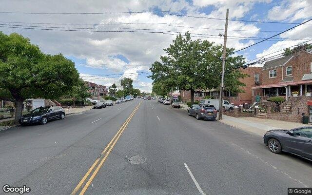
947 Ralph Ave, Brooklyn, NY 11236
Last Updated: March 13, 2024
1
Multi Family Home
Estimated Market Value EMV $ 863,300
947 Ralph Ave
bool(false)

bool(true)

bool(true)

int(0)
Estimated Market Value EMV $ 863,300
Foreclosure History
for 947 Ralph Ave
for 947 Ralph Ave
947 Ralph Ave, Brooklyn, NY 11236 is a Multi Family Home built in 1940. This property was last sold for $145,000 in 1988 and currently has an estimated value of $863,300. According to the Brooklyn public records, the property at 947 Ralph Ave, Brooklyn, NY 11236 has approximately 2,210 square feet, with a lot size of 2,000 square feet. Nearby schools include New American Acad Charter School (The), Ps 233 Langston Hughes and Ps 244 Richard R Green.
Property features
Year Built:
Year Built:
1940
1940
Living Area:
Living Area:
2210
2210
Building Class:
B3
Two Family Dwellings: Converted From One Family
Floors on Main Building:
2
Building Dimensions:
20'
Actual Square Footage:
2,210
Calculated Square Footage:
1,867
Residential Floor Area:
1,520
Basement:
Above grade full basement
Address:
947 RALPH AVENUE
Land Use:
01
One & Two Family Buildings
Calculated Lot Perimeter:
241.17 ft
Zoning Districts:
R5
Lower-density residence district
Max Residential FAR:
1.25
Max Residential Sqft:
2,500
Buildable Residential Sqft:
290
Residential Area Distribution:
Assessed Land Value:
$16,380
Assessed Total Value:
$48,240
Last Recording Date:
Jan 8, 2024
Property Assessment Data:
Tax Class:
1
One- to three-unit residential properties
Taxable Assessed Value:
$33,546
Estimated Market Value by NYC DOF :
$804,000
Community District (CD):
317
City Council District:
42
Document DateDocument Type Unit Amount
Recorded DateDocument Type Unit Amount
Date
Event
Price
Price/Sqft
Source
Nov 3, 1988
Sold
$145,000
$66
Public Record
Year
Taxes
Land
Additions
Total Assessment
2022
$6,318
$16,380
$24,060
$40,440
2021
$6,610
$16,380
$16,500
$32,880
2020
$6,272
$16,380
$23,520
$39,900
2019
$5,847
$16,380
$24,480
$40,860
2018
$5,517
$11,250
$15,124
$26,374
2017
$5,376
$14,605
$11,769
$26,374
2016
$5,232
$13,610
$12,564
$26,174
2015
$4,828
$18,072
$6,621
$24,693
2014
$4,463
$15,686
$7,610
$23,296
2013
$4,217
$15,033
$6,946
$21,979
2012
$4,001
$15,932
$6,047
$21,979
2010
$3,239
$14,986
$6,826
$21,812
2009
$3,081
$11,316
$9,262
$20,578
2007
$2,627
$2,804
$15,512
$18,316
Address
Price
Built
Beds
Baths
Sqft
Lot Size
Distance
577 Bristol St
Brownville, NY 11212MF
$750,000
03/08/2024
1930
6
3
2,240
+30difference
2,500
0.70 mi
612 E 54th St
Brooklyn, NY 11203MF
$1,335,000
01/16/2024
—
5
6
2,295
+85
1,810
0.63 mi
178 E 51st St
Brooklyn, NY 11203MF
$1,040,000
11/20/2023
1925
6
3
2,484
+274
2,000
0.68 mi
41 E 52nd St
Brooklyn, NY 11203MF
$750,000
04/05/2024
1925
4
3
1,824
-386
2,000
0.76 mi
8424 Glenwood Rd
Brooklyn, NY 11236MF
$680,000
03/06/2024
1920
3
3
1,800
-410
2,000
0.98 mi
159 E 59th St
Brooklyn, NY 11203MF
$900,000
01/31/2024
—
—
3
1,768
-442
2,000
0.10 mi
228 E 89th St
Brooklyn, NY 11236MF
$750,000
04/15/2024
—
—
—
2,980
+770
2,000
0.28 mi
5514 Tilden Ave
Brooklyn, NY 11203MF
$690,000
03/21/2024
1940
3
2
1,690
-520
2,150
0.32 mi
5221 Snyder Ave
Brooklyn, NY 11203MF
$1,050,000
01/05/2024
1920
8
3
2,720
+510
2,467
0.39 mi
470 E 96th St
Brooklyn, NY 11212MF
$1,100,000
11/07/2023
1930
7
4
4,125
+1,915
3,445
0.39 mi
Address
Price
Built
Beds
Baths
Sqft
Lot Size
Distance
532 Bradford St
Brooklyn, NY 11207MF
$899,000
14 days ago
1901
5
2
2,208
-2difference
2,725
1.84 mi
9419 Avenue J
Brooklyn, NY 11236MF
$989,000
11 days ago
1965
6
3
2,200
-10
2,974
1.25 mi
4115 Hubbard
East Flatbush, NY 11203MF
$2,999,000
100 days ago
1910
3
1
2,220
+10
24,157
1.95 mi
4115 Hubbard Pl
Brooklyn, NY 11210MF
$2,999,000
114 days ago
—
—
3
2,220
+10
24,157
1.95 mi
238 E 88th St
Brooklyn, NY 11236MF
$850,000
49 days ago
1925
5
3
2,228
+18
2,228
0.30 mi
1016 E 102nd St
Brooklyn, NY 11236MF
$692,180
10 days ago
1960
6
5
2,235
+25
3,533
1.43 mi
84 Macdougal St # 2
Brooklyn, NY 11233MF
$1,300,000
44 days ago
2014
2
3
2,236
+26
1,900
1.93 mi
1922 Rockaway Pkwy
Brooklyn, NY 11236MF
$1,199,995
64 days ago
2002
6
4
2,236
+26
2,360
1.84 mi
964 E 102nd St
Brooklyn, NY 11236MF
$999,000
83 days ago
1960
5
4
2,160
-50
2,000
1.36 mi
305 E 38th St
Brooklyn, NY 11203MF
$1,250,000
49 days ago
—
9
5
2,160
-50
3,000
1.11 mi
Estimated values are not a substitute for professional expertise. Contact your RE agent for a market assessment.
School Name
Rating
Grades
Parent Rating
Distance
Middle School For Art And Philosphy
, Brooklyn , NY 11212
7 / 10
6−8
0.45 mi
Happy Home Daycare
, Brooklyn , NY 11236
—
PK−3
0.16 mi
New American Acad Charter School (The)
, Brooklyn , NY 11236
6 / 10
K−5
—
0.33 mi
Ps 233 Langston Hughes
, Brooklyn , NY 11236
4 / 10
K−5
0.33 mi
Flatbush Sda School
, Brooklyn , NY 11203
—
PK−5
0.11 mi
Ps 244 Richard R Green
, Brooklyn , NY 11203
5 / 10
K−5
0.36 mi
BROOKLYN SCIENCE AND ENGINEERING ACADEMY
, Brooklyn , NY 11203
6 / 10
6−8
0.36 mi
Is 285 Meyer Levin
, Brooklyn , NY 11203
7 / 10
6−8
0.28 mi
It Takes A Village Academy
, Brooklyn , NY 11203
3 / 10
9−12
0.25 mi
Cultural Academy For The Arts And Sciences
, Brooklyn , NY 11203
3 / 10
9−12
—
0.25 mi
FEMA Zone (Est.)
X (unshaded)
Flood insurance:
Recommended
Flood risks are increasing as sea levels rise and weather patterns change.
This property has a
Minimal Flood Factor
.
Please Log In
Please wait... If this message is not eventually replaced by the proper contents of the document, your PDF viewer may not be able to display this type of document.
You can upgrade to the latest version of Adobe Reader for Windows®, Mac, or Linux® by visiting
https://get.adobe.com/reader/ this link .
For more assistance with Adobe Reader visit
http://get.adobe.com/reader/ this link .
You can download this PDF-document from
here .