975 E 178th St, Bronx, NY 10460 Bronx County Last Updated: March 5, 2024
Pre-Foreclosure: Lis Pendens, Estimated Market Value $822,700
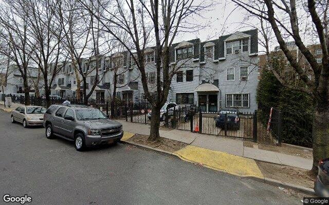
Description: 975 E 178th St, Bronx, NY 10460 is a Multi Family Home built in 1992. This property was last sold for $209,000 in 1992 and currently has an estimated value of $822,700. According to the Bronx public records, the property at 975 E 178th St, Bronx, NY 10460 has approximately 2,205 square feet, with a lot size of 2,401 square feet. Nearby schools include Ps 6 West Farms, Ps 67 Mohegan School and Ps 214.
2,205 sqft
2,401 lot size
Year Built: 1992
Pre-foreclosure
975 E 178th St, Bronx, NY 10460
Last Updated: March 5, 2024
1
Multi Family Home
Estimated Market Value EMV $ 822,700
975 E 178th St
bool(false)

bool(true)

bool(true)

int(0)
Estimated Market Value EMV $ 822,700
Foreclosure History
for 975 E 178th St
for 975 E 178th St
975 E 178th St, Bronx, NY 10460 is a Multi Family Home built in 1992. This property was last sold for $209,000 in 1992 and currently has an estimated value of $822,700. According to the Bronx public records, the property at 975 E 178th St, Bronx, NY 10460 has approximately 2,205 square feet, with a lot size of 2,401 square feet. Nearby schools include Ps 6 West Farms, Ps 67 Mohegan School and Ps 214.
Property features
Year Built:
Year Built:
1992
1992
Zoning:
Zoning:
R7-1
R7-1
Living Area:
Living Area:
2205
2205
Building Class:
B2
Two Family Dwellings: Frame
Floors on Main Building:
3.00
Building Dimensions:
20.67'
Actual Square Footage:
2,205
Calculated Square Footage:
2,170
Residential Floor Area:
2,205
Address:
975 EAST 178 STREET
BIN
Name 975 EAST 178 STREET
Land Use:
01
One & Two Family Buildings
Lot Dimensions:
20.67'
Calculated Lot Perimeter:
281.30 ft
Irregular Lot:
An irregularly shaped lot
Zoning Districts:
R7-1
Moderate-density residence district
Max Residential FAR:
3.44
Max Residential Sqft:
8,259
Buildable Residential Sqft:
6,054
Residential Area Distribution:
Assessed Land Value:
$11,280
Assessed Total Value:
$43,740
Last Recording Date:
Jan 8, 2024
Property Assessment Data:
Tax Class:
1
One- to three-unit residential properties
Taxable Assessed Value:
$31,840
Estimated Market Value by NYC DOF :
$729,000
Community District (CD):
206
City Council District:
15
Document DateDocument Type Unit Amount
Recorded DateDocument Type Unit Amount
Date
Event
Price
Price/Sqft
Source
Jun 23, 1992
Sold
$209,000
$95
Public Record
Sep 14, 1990
Sold
$275,000
$125
Public Record
Year
Taxes
Land
Additions
Total Assessment
2022
$5,652
$11,280
$31,440
$42,720
2021
$5,963
$11,280
$23,400
$34,680
2020
$5,776
$11,280
$27,000
$38,280
2019
$5,550
$11,280
$19,620
$30,900
2018
$5,236
$8,998
$16,034
$25,032
2017
$4,814
$11,268
$12,348
$23,616
2016
$4,721
$10,521
$13,095
$23,616
2015
$4,446
$9,420
$13,320
$22,740
2015
$4,235
$9,017
$13,094
$22,111
2014
$4,003
$13,414
$7,446
$20,860
2011
$3,702
$13,620
$6,720
$20,340
2010
$3,649
$13,620
$6,720
$20,340
2009
$3,413
$12,910
$9,726
$22,636
2007
$2,734
$2,887
$16,121
$19,008
Address
Price
Built
Beds
Baths
Sqft
Lot Size
Distance
969 E 179th St
Bronx, NY 10460MF
$799,999
149 days ago
1992
5
3
2,205
2,348
0.06 mi
1522 Overing St
Bronx, NY 10461MF
$1,300,000
158 days ago
1925
6
4
2,200
-5difference
—
1.83 mi
1377 Teller Ave
Bronx, NY 10456MF
$1,150,000
26 days ago
2001
6
5
2,200
-5
3,442
1.54 mi
362 E 198th St
Bronx, NY 10458MF
$688,000
142 days ago
1935
6
4
2,200
-5
1,500
1.74 mi
1711 Mansion St
Bronx, NY 10460MF
$399,999
77 days ago
1940
4
3
2,180
-25
2,919
0.57 mi
2066 Ryer Ave
Bronx, NY 10457MF
$1,200,000
70 days ago
1901
—
—
2,160
-45
2,465
1.26 mi
1032 Rhinelander Ave
Bronx, NY 10461MF
$859,000
64 days ago
1920
7
3
2,250
+45
2,252
1.41 mi
2359 Valentine Ave
Bronx, NY 10458MF
$935,000
27 days ago
1992
5
3
2,280
+75
2,801
1.44 mi
741 E 178th St
Bronx, NY 10457MF
$499,000
95 days ago
1920
5
2
2,280
+75
2,036
0.49 mi
1241 Intervale Ave
Bronx, NY 10459MF
$799,000
159 days ago
1991
—
—
2,280
+75
1,899
1.15 mi
Estimated values are not a substitute for professional expertise. Contact your RE agent for a market assessment.
School Name
Rating
Grades
Parent Rating
Distance
Ps 6 West Farms
, The Bronx , NY 10460
2 / 10
K−5
0.11 mi
Ps 67 Mohegan School
, The Bronx , NY 10460
4 / 10
K−5
0.23 mi
Emolior Academy
, The Bronx , NY 10460
6 / 10
6−8
—
0.19 mi
St. Thomas Aquinas Elementary School
, The Bronx , NY 10460
—
PK−8
0.23 mi
St Anthony School
, Bronx , NY 10460
—
K−8
0.71 mi
Urban Assembly School For Wildlife Conservation
, Bronx , NY 10460
—
6−12
0.23 mi
St. Joseph School
, Bronx , NY 10457
—
PK−8
0.91 mi
Ps 214
, The Bronx , NY 10460
4 / 10
K−8
0.19 mi
Wings Academy
, The Bronx , NY 10460
1 / 10
9−12
0.31 mi
East Bronx Academy For The Future
, The Bronx , NY 10460
4 / 10
6−12
0.50 mi
FEMA Zone (Est.)
X (unshaded)
Flood insurance:
Recommended
Flood risks are increasing as sea levels rise and weather patterns change.
This property has a
Major Flood Factor
.
Please Log In
Please wait... If this message is not eventually replaced by the proper contents of the document, your PDF viewer may not be able to display this type of document.
You can upgrade to the latest version of Adobe Reader for Windows®, Mac, or Linux® by visiting
https://get.adobe.com/reader/ this link .
For more assistance with Adobe Reader visit
http://get.adobe.com/reader/ this link .
You can download this PDF-document from
here .