995 Westwood Ave, Staten Island, NY 10314 Richmond County Last Updated: February 28, 2024
Pre-Foreclosure: Lis Pendens, Estimated Market Value $1,194,800
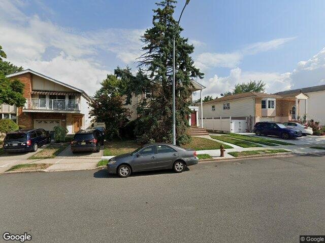
Description: 995 Westwood Ave, Staten Island, NY 10314 is a Multi Family Home built in 1975. This property currently has an estimated value of $1,194,800. According to the Staten Island public records, the property at 995 Westwood Ave, Staten Island, NY 10314 has approximately 2,204 square feet, with a lot size of 5,304 square feet. Nearby schools include Ps 30 Westerleigh, Ps 54 Charles W Leng, Ps 60 Alice Austen and Staten Island School Of Civic Leadership.
2,204 sqft
5,304 lot size
Year Built: 1975
Pre-foreclosure
995 Westwood Ave, Staten Island, NY 10314
Last Updated: February 28, 2024
1
Multi Family Home
Estimated Market Value EMV $ 1,194,800
995 Westwood Ave
bool(false)

bool(true)

bool(true)

int(0)
Estimated Market Value EMV $ 1,194,800
Foreclosure History
for 995 Westwood Ave
for 995 Westwood Ave
995 Westwood Ave, Staten Island, NY 10314 is a Multi Family Home built in 1975. This property currently has an estimated value of $1,194,800. According to the Staten Island public records, the property at 995 Westwood Ave, Staten Island, NY 10314 has approximately 2,204 square feet, with a lot size of 5,304 square feet. Nearby schools include Ps 30 Westerleigh, Ps 54 Charles W Leng, Ps 60 Alice Austen and Staten Island School Of Civic Leadership.
Property features
Year Built:
Year Built:
1975
1975
Zoning:
Zoning:
R3-1
R3-1
Living Area:
Living Area:
2204
2204
Building Class:
B2
Two Family Dwellings: Frame
Floors on Main Building:
2
Building Dimensions:
26'
Actual Square Footage:
2,204
Calculated Square Footage:
2,392
Residential Floor Area:
2,204
Basement:
Below grade full basement
Address:
995 WESTWOOD AVENUE
Borough:
Staten Island (5)
BIN
Name 995 WESTWOOD AVENUE
Land Use:
01
One & Two Family Buildings
Calculated Lot Perimeter:
300.13 ft
Zoning Districts:
R3-1
Lower-density residence district
Max Residential FAR:
0.50
Max Residential Sqft:
2,652
Buildable Residential Sqft:
448
Residential Area Distribution:
Assessed Land Value:
$13,440
Assessed Total Value:
$52,380
Last Recording Date:
Jan 8, 2024
Property Assessment Data:
Tax Class:
1
One- to three-unit residential properties
Taxable Assessed Value:
$45,236
Estimated Market Value by NYC DOF :
$873,000
Community District (CD):
502
City Council District:
50
Document DateDocument Type Unit Amount
Year
Taxes
Land
Additions
Total Assessment
2022
$6,420
$13,440
$34,200
$47,640
2021
$6,804
$13,440
$36,780
$50,220
2020
$11,734
$13,440
$42,060
$55,500
2019
$11,998
$13,440
$42,180
$55,620
2018
$5,776
$10,707
$24,857
$35,564
2017
$5,605
$10,798
$22,754
$33,552
2016
$2,440
$11,761
$21,791
$33,552
2015
$2,355
$10,811
$22,488
$33,299
2014
$1,909
$11,106
$18,531
$29,637
2014
$2,140
$10,343
$21,072
$31,415
2012
$1,732
$19,260
$8,700
$27,960
2010
$1,779
$19,260
$9,780
$29,040
2009
$1,714
$19,260
$10,560
$29,820
2007
$1,533
$4,806
$22,150
$26,956
Address
Price
Built
Beds
Baths
Sqft
Lot Size
Distance
707 Harris Ave
Staten Island, NY 10314MF
$900,000
12/28/2023
1970
3
2
2,208
+4difference
4,089
0.49 mi
23 Jaffe St
Staten Island, NY 10314MF
$930,000
02/05/2024
1970
3
3
2,268
+64
4,760
0.97 mi
890 Westwood Ave
Staten Island, NY 10314MF
$820,000
04/18/2024
1970
5
5
2,275
+71
4,000
0.21 mi
709 Collfield Ave
Staten Island, NY 10314MF
$828,000
02/02/2024
1970
4
2
2,100
-104
4,386
0.08 mi
44 Harvey Ave
Staten Island, NY 10314MF
$985,000
11/22/2023
1965
5
4
2,096
-108
4,600
0.57 mi
742 Willowbrook Rd
Staten Island, NY 10314MF
$1,300,000
12/05/2023
1992
11
8
3,660
+1,456
8,287
0.16 mi
94 Woodward Ave
Staten Island, NY 10314MF
$870,000
03/01/2024
1955
4
2
1,456
-748
4,400
0.22 mi
233 Martin Ave
Staten Island, NY 10314MF
$875,000
11/15/2023
1970
4
2
2,724
+520
4,200
0.30 mi
497 Willowbrook Rd
Staten Island, NY 10314MF
$935,000
04/22/2024
2005
4
3
2,050
-154
3,833
0.40 mi
31 Denton Pl
Staten Island, NY 10314MF
$875,000
02/21/2024
1985
5
2
2,722
+518
4,000
0.42 mi
Address
Price
Built
Beds
Baths
Sqft
Lot Size
Distance
306 Westcott Blvd
Staten Island, NY 10314MF
$1,300,000
44 days ago
2005
2
1
2,200
-4difference
4,000
1.04 mi
89 Copley St
Staten Island, NY 10314MF
$1,079,000
50 days ago
1970
3
3
2,188
-16
4,200
1.38 mi
102 Coale Ave
Staten Island, NY 10314MF
$898,000
4 days ago
1965
3
1
2,184
-20
4,299
1.00 mi
128 Queen St
Staten Island, NY 10314MF
$1,280,000
13 days ago
1970
5
3
2,224
+20
4,655
1.06 mi
128 Queen St
Staten Island, NY 10314MF
$1,280,000
13 days ago
1970
5
3
2,224
+20
4,655
1.06 mi
199 Lewiston St
Staten Island, NY 10314MF
$929,000
6 days ago
1975
4
4
2,288
+84
3,200
1.60 mi
199 Lewiston St
Staten Island, NY 10314MF
$929,000
6 days ago
1975
4
4
2,288
+84
3,200
1.60 mi
101 Gary Ct
Staten Island, NY 10314MF
$950,000
52 days ago
1975
5
3
2,112
-92
2,449
0.85 mi
101 Gary Ct
Staten Island, NY 10314MF
$950,000
52 days ago
1975
5
3
2,112
-92
2,449
0.85 mi
301 Regis Dr
Staten Island, NY 10314MF
$899,000
101 days ago
1983
5
4
2,300
+96
4,158
1.48 mi
Estimated values are not a substitute for professional expertise. Contact your RE agent for a market assessment.
School Name
Rating
Grades
Parent Rating
Distance
Ps 30 Westerleigh
, Staten Island , NY 10314
8 / 10
K−5
1.05 mi
Mesivta Kesser Yisroel Of Willowbrook
, Staten Island , NY 10314
—
9−12
0.12 mi
Yeshiva Yesodei Hachaim
, Staten Island , NY 10314
—
9−12
—
0.36 mi
Ps 54 Charles W Leng
, Staten Island , NY 10314
8 / 10
K−5
0.44 mi
Jewish Foundation School
, Staten Island , NY 10314
—
1−8
0.64 mi
Is 72 Rocco Laurie
, Staten Island , NY 10314
7 / 10
6−8
1.18 mi
Gaynor Mccown Expeditionary Learning School
, Staten Island , NY 10314
6 / 10
9−12
1.82 mi
Is 51 Edwin Markham
, Staten Island , NY 10302
4 / 10
6−8
1.17 mi
Ps 60 Alice Austen
, Staten Island , NY 10314
4 / 10
K−5
0.95 mi
Staten Island School Of Civic Leadership
, Staten Island , NY 10314
6 / 10
K−8
1.42 mi
FEMA Zone (Est.)
X (unshaded)
Flood insurance:
Recommended
Flood risks are increasing as sea levels rise and weather patterns change.
This property has a
Minimal Flood Factor
.
Please Log In
Please wait... If this message is not eventually replaced by the proper contents of the document, your PDF viewer may not be able to display this type of document.
You can upgrade to the latest version of Adobe Reader for Windows®, Mac, or Linux® by visiting
https://get.adobe.com/reader/ this link .
For more assistance with Adobe Reader visit
http://get.adobe.com/reader/ this link .
You can download this PDF-document from
here .